One Billion Square Kilometers of Earth Imagery
DigitalGlobe‘s content library now contains more than one billion square kilometers of earth imagery, 33% of which is less than one year old. DigitalGlobe's WorldView-1, QuickBird and recently launched WorldView-2 satellites combine to form the industry's largest satellite constellation.
These three satellites, together with DigitalGlobe's aerial network, enable the company to offer the highest collection capacity of high-resolution earth imagery to customers around the world, adding roughly 1.5 million square kilometers of imagery every day or three times the Earth's landmass annually. The result is DigitalGlobe's highly complete ImageLibrary, containing imagery used to inform critical decisions across a range of industries.
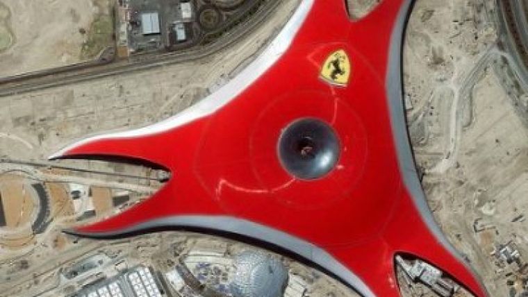
Image: This satellite image is of Ferrari World, also known as Ferrari Experience, an upcoming theme park on Yas Island in Abu Dhabi designed by Benoy Architects. (Photo Courtesy of: DigitalGlobe).

Value staying current with geomatics?
Stay on the map with our expertly curated newsletters.
We provide educational insights, industry updates, and inspiring stories to help you learn, grow, and reach your full potential in your field. Don't miss out - subscribe today and ensure you're always informed, educated, and inspired.
Choose your newsletter(s)


