Paving the Way for Self-driving Cars
The Impressive Contribution of Geomatics to Autonomous Driving
Since Karl Benz was granted a patent for his first internal combustion engine in 1879, the automotive industry has changed substantially. Or has it? The main principle remains the same: cars still have four wheels, a petrol- or diesel-powered engine – electric cars are still underrepresented and so far there are just a few hydrogen cars publicly available in select markets – and they still need to be driven by a human being. However, a major change is just around the corner: self-driving vehicles. And they won’t get far without geomatics technologies, claims Wim van Wegen, content manager of 'GIM International'.
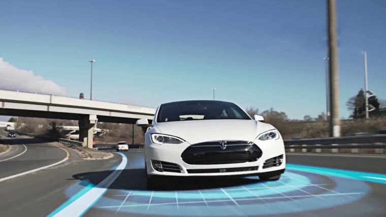
Not only car manufacturers such as Ford, Volvo, Tesla (Figure 1) and Mercedes-Benz (Figure 2), but also the likes of Google and Uber have been testing autonomous vehicles over the past few years. Volvo recently announced it is looking for drivers who are interested in participating in its self-driving cars trial, reportedly the largest conducted by the automobile industry so far. Operating the car should be as easy as using a smartphone, the Swedish carmaker states. Great strides have been made in the development of the next-generation car, but what is the technology behind it? This article zooms in on the key role geomatics plays in autonomous driving.
GNSS
Self-driving cars can navigate on their own, which already implies that geomatics is involved. Global navigation satellite system (GNSS) technology provides the accuracy that a vehicle requires to be self-driving. A high-precision and reliable localisation solution is fundamental. Just imagine, for example, what could happen if poor localisation positions the car on the wrong side of the road. Therefore, the availability of accurate and reliable GNSS technology is a major challenge to the advancement of autonomous driving. Only the most sophisticated GNSS receivers are suitable for use in self-driving cars. Those receivers rely on multiple frequencies and use multiple constellations. GNSS positioning is combined with an inertial navigation system (INS), creating a powerful system that compensates for the inherent weaknesses that occur when just one system is used. Additionally, anti-jam technology is used to provide the required positioning and sensor integration.
One of the companies known among geomatics professionals focusing on autonomous cars is NovAtel. The Canada-based GNSS specialist states that its technology is capable of providing decimetre-level accuracy to ensure a vehicle stays in its lane and/or at a safe distance from other vehicles. NovAtel aims to develop solutions that make driverless cars a common sight on our roads, providing the autonomous driving positioning reference. The Canadians therefore have established a special engineering team – the Safety Critical Systems Group – dedicated to developing functionally safe GNSS positioning technology for fully autonomous applications.
Optical Cameras
Several camera technologies are being applied in the self-driving car industry, each with their own advocates. For example, Tesla uses cameras as a primary sensor and has equipped its cars with eight monocular cameras. Stereo cameras, on the other hand, give the car depth of field that can be compared to human vision. Stereo cameras also offer the advantage of being cheap to produce while providing high-quality measurements in real time. However, some claim that fisheye cameras are an even better alternative, as these are capable of covering a wider field of view as well as of detecting obstacles in the very near vicinity of the car that are often not seen by a binocular stereo camera set-up ([1] Christian Häne et al).
Radar
On-board radar technology increases the safety of passengers, a fundamental issue in autonomous driving. Radar sensors are mounted on the car’s front and rear bumpers, giving the car awareness of what is in front of and behind it. The car will maintain a safe distance (two seconds) from the car ahead. When equipped with radar technology, the car automatically speeds up or slows down depending on the behaviour of other vehicles. In fact, radar observes the (changing) distances between the car and other vehicles. The software interprets the data and sends a signal that the car needs to accelerate or decelerate.
A recent development in the field of radar technology is vehicle-to-everything (V2X) radar. This combines vehicle-to-vehicle communication and vehicle-to-infrastructure technology, while operating on a single antenna. Radar has a big advantage compared to other technologies: it can cope with weather conditions such as fog, snow and heavy rain. V2X is able to instantly detect vehicle speeds, thanks to Doppler measurements, ands 360-degree sensing from a single antenna. These capabilities make V2X radar an important step in developing new sensors for autonomous vehicles.
Lidar
In the automotive industry, Lidar is usually applied as a spinning cylinder mounted on the vehicle’s roof. Laser pulses bounce off the surrounding objects, the time of flight is measured and, thanks to real-time processing of the Lidar data from the 360-degree sensors, the car ‘knows’ exactly how far it is away from other objects. As Lidar functions as the eye of driverless cars, it is no surprise that most self-driving car solutions use Lidar as the main sensor. Lidar is essential for emergency braking, pedestrian detection and collision avoidance.
In August 2016 Velodyne LiDAR, a global leader in Lidar technology, announced that it had received a combined USD150 million investment from co-investors Ford and China’s leading search engine company, Baidu. The investment will allow Velodyne to rapidly expand the design and production of high-performance, cost-effective automotive Lidar sensors (Figure 4). This step paves the way for mass adoption in autonomous vehicles and so-called Advanced Driver Assistance System (ADAS) applications and will thus accelerate the critical, transformative benefits they provide. Lidar technology has been recognised by global automotive companies as a critical enabler in the development of fully autonomous vehicles. Meanwhile, in December 2016, Magna – a leading manufacturer of auto parts – and Innovize revealed that they are partnering to deliver Lidar remote sensing solutions for the implementation of autonomous driving features and full autonomy in future vehicles. These are just two examples of the automotive industry investing in Lidar, and several well-known carmakers have also shifted their focus onto Lidar. Most self-driving concept cars rely on radar and Lidar to cross-validate what they are seeing and to predict motion.
Most self-driving cars rely on Lidar, but Tesla is an exception. So far, the owner of the company, the eccentric billionaire Elon Musk, is sticking to conventional radar combined with ultrasonic sensors. Musk has repeatedly dismissed the need for Lidar, stating that it makes no sense in the context of driverless cars. However, in view of the indisputable fact that the cost of Lidar technology will fall, it is not entirely unlikely that Teslas will also be equipped with Lidar sooner or later.
Artificial Intelligence
Ford is not only focusing heavily on Lidar technology. In February 2017, the firm declared it will be investing USD1 billion over the next five years in Argo AI, an artificial intelligence company – interestingly enough founded by former Google and Uber leaders. The idea behind this massive investment is that Argo AI’s robotics experience and artificial intelligence software is essential to further advance driverless cars. The key objective of this cooperation is a new software platform for Ford’s fully autonomous vehicle due to be launched in 2021.
3D Maps
The advancement of autonomous vehicles is a driving force behind the collection of point clouds around the world. Maps for self-driving cars need to provide more information at a higher fidelity and accuracy, comprising features such as lane markings and roadside barriers. High-definition (HD) map datasets deliver high-precision intelligence on road features, e.g. painted lines, signs, 3D building models, signals, stop signs and parking spaces. So-called self-healing mapping systems provide a state-of-the-art solution for autonomous cars. They solve the problem of out-of-date navigation data since they give cars the intelligence to update their own maps. Autonomous vehicles will be able to acquire and process data and convert it into useful information while on the road. In addition, the cars will be connected with the cloud in order make the right decisions about where they are going, including choosing the optimal route.
A mapping system for self-driving cars, designed to help carmakers, map companies and start-ups to rapidly create HD maps and keep them updated, is being offered by companies such as TomTom, HERE, Nvidia (Figure 6) and Sanborn. An interesting project is underway in Japan, where a consortium of car manufacturers is taking part in the Dynamic Map Planning initiative, initially set up by Mitsubishi Electric. Nine carmakers are teaming up with the mapmakers from Zenrin. The association will create a digital chart of the nation’s key expressways by driving specially equipped vehicles over them. Japan aims to have autonomous cars on its roads on a considerable scale by the 2020 Tokyo Summer Olympics.
Fundamental Factors
A driverless vehicle needs to be able to understand in real time what is happening around it, precisely locate itself on an HD map, and plan a safe path forward. The world’s most advanced self-driving car platforms combine deep learning, sensor fusion and surround vision for an optimal driving experience. GNSS, ranging and 3D mapping systems (in particular Lidar), and artificial intelligence are making this possible. Therefore, they are all fundamental factors in the future success of the autonomous car as a game changer in transportation, as Lidar has already proven to be in the world of autonomous vehicles. What perhaps counts against Lidar is its price tag, especially compared with technologies such as cameras, GPS-like data or radar, but thanks to technical innovations this obstacle is gradually being eroded. As a report by Market Research Future indicates, the global autonomous vehicles market is expected to reach a value of USD65.3 billion by 2027. Hence, the best advice to the geomatics sector is: fasten your seatbelt and enjoy the ride!
Acknowledgement
Thanks to Sabine de Milliano for reviewing the article and her valuable suggestions for improvements.
Further reading
- [1] Christian Häne, Torsten Sattler, Marc Pollefeys: Obstacle Detection for Self-Driving Cars Using Only Monocular Cameras and Wheel Odometry
- Driving towards the Autonomous Vehicle: European GNSS Agency (gsc-europa.eu)
- Mathias Lemmens: Photon Lidar, a Promising Advance in Mapping Applications; GIM International
- Steve Crowe: How AI is Making Self-Driving Cars Smarter; Robotics Trends
- John Ristevski: Building a Global 3D Routing Map, GIM International
Biography of the author
Wim van Wegen is content manager of GIM International. In his role, he is responsible for the print and online publications of one of the world’s leading geomatics trade media brands. He is also a contributor of columns and feature articles, and often interviews renowned experts in the geospatial industry. Van Wegen has a bachelor degree in European studies from the NHL University of Applied Sciences in Leeuwarden, The Netherlands.

Value staying current with geomatics?
Stay on the map with our expertly curated newsletters.
We provide educational insights, industry updates, and inspiring stories to help you learn, grow, and reach your full potential in your field. Don't miss out - subscribe today and ensure you're always informed, educated, and inspired.
Choose your newsletter(s)


