Pipe Modelling from Point Cloud Data
Elysium, an emerging Japan-based provider in the point cloud data industry, has released a new version of InfiPoints. Version 2.0 highlights enhancements such as pipe modelling and video generation from point cloud data consisting of billions of points. The company has recently been expanding its portfolio from CAD data translation and processing to point cloud rendering technologies.
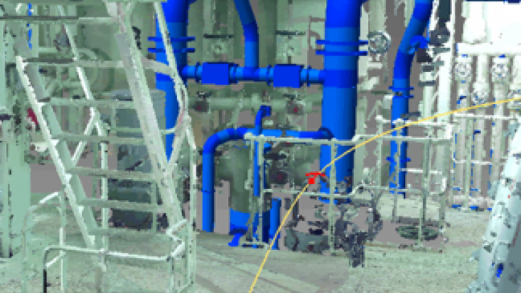
Pipe modelling from point cloud data is one of the key features and enhancements of InfiPoints that provides a competitive advantage for both time and accuracy. Without this capability, it is very time consuming to model piping elements from point cloud data as geometry must be defined piece by piece.
InfiPoints 2.0 offers automatic extraction of cylinders while complementing areas where pipes may not be extracted due to low density of points in original point cloud data, which is common when pipes may be partially hidden by other objects. Piping elements can also be replaced with standard elements, such as straight pipes, elbows, flanges and tee pipes.
With Elysium's CAD interoperability background and experience, another differentiator is the flexibility of exporting various CAD formats, including IGES, STEP, CATIA V5, NX, SolidWorks, Pro/E, Parasolid and more. 3D isometric drawings can be exported as DWG or DXF.
Fly-through videos
Another key technology is the ability to create "fly-through" videos with high resolution of the point cloud data. Video operation is simple — users specify the desired viewpoints in order, and then check the view path in a display window. Users can include created or imported CAD data for display along with the point cloud data. This is ideal for effectively communicating planning concepts or utilisation of a particular environment — whether it be an automotive factory, construction site or shipyard.
Effective with Version 2.0, commuter licensing, or license borrowing, is supported by Elysium's licensing. This allows users to temporarily use licenses on their laptop while on-the-go at different locations or perhaps while presenting at off-site meetings.
While most plants and buildings typically have a 2D drawing that defines their coordinates of origin and standard directions, point cloud data are defined by different standards based on the centre of each scan location. With InfiPoints 2.0 users can align the point cloud data to conform to the 2D drawing, so that an accurate comparison can be conducted between the point cloud and a 3D model or a 2D drawing from a CAD system.

Value staying current with geomatics?
Stay on the map with our expertly curated newsletters.
We provide educational insights, industry updates, and inspiring stories to help you learn, grow, and reach your full potential in your field. Don't miss out - subscribe today and ensure you're always informed, educated, and inspired.
Choose your newsletter(s)


