PolyExplore Unveils High-Precision UAV Lidar Mapping System
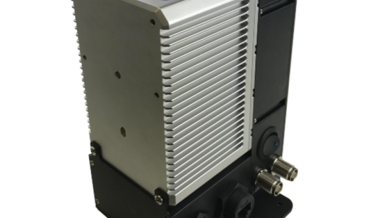
PolyExplore has launched the Polyscanner LS1, a high-precision Lidar mapping system designed for UAVs and other aerial platforms. Based around advanced solid-state Lidar technology, the Polyscanner LS1 uses an innovative scanning pattern and focused field of view (FOV) to create a dense point cloud with a detection range of over 200 metres.
This latest addition to the Polyscanner family of aerial mapping platforms incorporates PolyExplore’s Polynav 2000 precision GNSS-aided INS (inertial navigation system) technology, featuring a dual-frequency, dual-antenna, quad-constellation PPK/RTK capable receiver with centimeter-level accuracy and a tactical grade IMU. Sensor fusion post-processing software is also included as part of the package, and drone adaptors with custom vibration dampers and high-performance dual antennas are available on request.
The Polyscanner LS1 is factory-calibrated, eliminating the need for user calibration. The high-precision system delivers precision geo– and time-annotated point cloud models, with – according to PolyExplore – results comparable to more expensive conventional systems.
The compact system, weighing in at less than 1.3kg and measuring 160mm x 120mm x 107mm, can be fitted to a variety of UAV platforms and is designed for a range of mapping and surveying applications, such as infrastructure, forestry, asset management and environmental erosion monitoring.

Value staying current with geomatics?
Stay on the map with our expertly curated newsletters.
We provide educational insights, industry updates, and inspiring stories to help you learn, grow, and reach your full potential in your field. Don't miss out - subscribe today and ensure you're always informed, educated, and inspired.
Choose your newsletter(s)


