Pre-register for ISPRS Geospatial Week 2017 in China
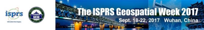
The biennial Geospatial Week 2017 (GSW2017), hosted by the International Society for Photogrammetry and Remote Sensing (ISPRS) and Wuhan University, will be held in Wuhan, China, from 18-22 September 2017. The event, which is co-organised by the State Key Laboratory of Information Engineering in Surveying, Mapping and Remote Sensing, is taking place at the Wuhan East Lake International Convention Center, and is set to attract scholars and practitioners from more than 50 countries and regions. Pre-registration is open until 15 July 2017.
ISPRS is known as ‘the Pulitzer in photographic measurement’ and there is always great competition between member states to win the right to host the biennial GSW event. The Wuhan University team representing China experienced many ups and downs, but it is finally going to happen in Wuhan. There is a very close relationship between ISPRS and China. Wuhan University team leader and academician Deren Li has affectionate memories: “My mentor Zhizhuo Wang participated in the 5th ISPRS congress in Rome. Our Chinese counterparts have learned a lot from ISPRS in the past and this time the GSW is the contribution that we should make to ISPRS.”
In 2008, the ISPRS general meeting was held in China, and Professor Jun Chen from Wuhan University also served as chairman of ISPRS (2012-2016). Academician Deren Li said that China has recently been promoting high-resolution Earth observation and Beidou navigation system, so GSW is a very rare opportunity to exchange knowledge and show applications. The experts and scholars travelling to Wuhan for GSW17 will come from more than 50 countries and regions.
GIS-SmartCity 2017: 2017 International Geospatial Information Workshop on Smart City
A core aspect of the GSW is its comprehensive and forward-looking thematic workshops. This year’s conference will focus on the theme of ‘Geospatial For Smart City’, with ten seminars and peripheral activities.
WebMGS2017: The 5th International Workshop on Web Mapping, Geoprocessing and Services
WebMGS is an important event in the field of web-based GIS, which emphasises a diverse range of topics related to new web-based developments of geospatial theories, technologies and solutions. Current and state-of-the-art advances in web-based mapping, geoprocessing, geospatial information services and applications, particularly in dealing with big geospatial data, will be exchanged and discussed in the workshop. The WebMGS workshop series commenced in Como, Italy, in 2010 and was followed by subsequent workshops in Vancouver, Canada, in 2011, Xuzhou, China, in 2013 and Cagliari, Italy, in 2015.
The workshop will be organized by ISPRS WG IV / 4, WG III / 8 and WG V / 4.
ISSDQ 2017: The 10th International Symposium on Spatial Data Quality
The ISSDQ workshop is an important activity in the field of spatial data quality. It has been successfully held nine times every two years since 1999. ISSDQ 2017 will address some of the new challenges in the field of spatial data quality, and discuss standards and the latest technological developments to face the quality challenges posed by spatial big data.
Indoor 3D 2017: ISPRS Workshop on Indoor 3D 2017
With the rising urban population and the increasing complexity of cities as conglomerates of enclosed spaces, there is a growing demand for spatial and semantic information of indoor environments. Navigational assistance for disabled and elderly people, route planning for emergency management, smart facility maintenance, disaster monitoring and prevention, gaming and tourism are just several of the direct applications of indoor spatial information.
To explore such applications, Indoor 3D will bring together researchers and practitioners from academia and industry involved in indoor mapping, positioning, navigation, 3D modelling, location-based services (LBS) and mobility to exchange the latest research and development results in the area of indoor spatial information.
SARCon 2017: Advances in SAR: Constellations, Signal Processing and Applications
In recent years, synthetic aperture radar (SAR) satellite constellations have been playing a positive role as a means of civilian remote sensing. The present SAR constellations offer high-quality SAR data, which can be used for a variety of applications, but meanwhile posing a challenge to the appropriate data processing methods.
In the future, geostationary SAR satellites or fast revisiting within the target time will also be important concepts for SAR development. These concepts have already inspired new methodologies and innovative ideas and contributed to some new applications.
LS2017: Laser Scanning 2017
Laser Scanning 2017 is the latest of a series of ten ISPRS workshops covering various aspects of space-borne, airborne, mobile and terrestrial laser scanning in both indoor and outdoor environments. The workshop aims at bringing together experts who specialise in processing and using point cloud data acquired from laser scanners and other active 3D imaging systems, such as wide-angle cameras. Conference topics include all aspects related to sensor calibration, data acquisition and data processing including notably registration, feature extraction, object detection, 3D modelling and change analysis.
IWIDF2017: Image and Data Fusion
With increasing amounts of data collected from satellite, airborne and ground-based imaging systems, image and data fusion techniques are gaining more and more importance. Through the integration of multi-sensor, multi-temporal, multi-resolution and multi-platform image data, together with geospatial data, GIS and other statistical datasets, more accurate information can be obtained to improve operational efficiency. Discussion and communication will cover more than 10 topics such as information extraction, image analysis fusion, high performance computing technology used in remote sensing data fusion.
PhotoGA 2017: Photogrammetric 3D Reconstruction for Geo-Applications 2017
The seminar will attract experts from all over the world in photogrammetry, remote sensing and computer vision from both academia and industry. It is designed for researchers and practitioners in the fields of image-based 3D reconstruction including aerial and/or space sensor calibration and orientation, multi-source data fusion, 3D data acquisition and surface reconstruction, UAVs for 3D mapping, multi-view geometry and image sequence analysis for platforms ranging from low-cost UAVs to professional airborne and space-borne sensors.
ICSDM2017: The Third International Conference on Spatial Data Mining and Geographical Knowledge Services
ICSDM aims to discuss spatiotemporal big data analysis, trajectory mining, stream data mining, night-time light remote sensing data mining and geographical knowledge services, time-space process modelling and spatial decision support, and provide researchers and practitioners with the opportunity to exchange ideas, share the latest ideas and achievements, and promote international cooperation.
CHGCS 2017: Cryosphere and Hydrosphere for Global Change Studies
Earth’s climate is changing, and multiple lines of evidence suggest significant warming in the cryosphere, the oceans and the atmosphere. The increasing global surface temperature, the rising global sea level, the melting ice and changes in the pattern of precipitation are bringing intense rainfall and floods to some areas and devastating droughts to other areas. Satellite remote sensing and other aeronautical measurements will undoubtedly promote our understanding of the dynamics and impacts on global climate system. This international workshop aims to present the state-of-the-art advances in remote sensing research with cryospheric and hydrological applications.

Value staying current with geomatics?
Stay on the map with our expertly curated newsletters.
We provide educational insights, industry updates, and inspiring stories to help you learn, grow, and reach your full potential in your field. Don't miss out - subscribe today and ensure you're always informed, educated, and inspired.
Choose your newsletter(s)


