
Providing Reality Your Way in the Geosystems Track at HxGN LIVE
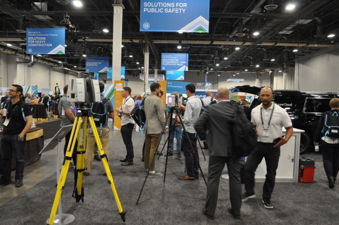
More than 3,000 professionals from the technology community came together to discover game-changing solutions, receive unprecedented access to hundreds of technical and educational workshops, and to collaborate with leadership, industry experts and peers at the HxGN Live 2018 event which held its annual four-day international digital solutions conference from 12 to 15 June at The Venetian in Las Vegas.
In the Geosystems Track, attendees were challenged to discover their own digital realities throughout the event, and they delivered at every turn.
The Reality of Training
During the first day, attendees participated in hands-on training that provided expert instructions in laser scanning. Attendees were even able to earn continuing education units (CEU). Throughout the rest of the week, personalised sessions were provided in an array of geospatial industries including:
- Surveying and infrastructure
- Building construction
- Heavy construction
- Public safety
- Transportation
- Utilities and communications
- Plant
- Digital cities
- High definition surveying (HDS)
The Reality of Thought Leadership
There were three main keynotes this year in the Geosystems Track:
Your Reality. Your way: Jürgen Dold, Hexagon’s Geosystems Division President, explored the main concept of the Geosystems Track. A pervasive and rapid shift in the world’s digital landscape is disrupting industry dynamics, economic fundamentals, and what it means to compete. Reality is the currency of this new economy. The road to digital transformation requires a 'digital first' approach – one that is data driven and unique to you. To sustain a competitive advantage, and to meet your greatest potential, a smart digital reality is imperative – and one that is relevant, accessible, and in whatever format you need.

BLK – The Story Continues: Hexagon’s Geosystems Division CTO Burkhard Boeckem explained the story behind the evolution and simplicity of the BLK line. He shared the latest developments and R&D that is bringing exclusive innovation to inclusive audiences, further democratising the technology.
Digitalising Industries: Geosystems’ segment managers Andrew Hurley, Matt Wheelis and Chuck Coiner explored trends, best practices, and future outlooks across the Surveying and Infrastructure, Building Construction, and Public Safety industries worldwide. When an organisation digitises, it should become more efficient in how it produces, shares, and evaluates data as it will undergo a transformation to become a more connected ecosystem. As our world changes, from growing populations and increased urbanisation, to creating smarter cities, the need for digitalisation grows across industries. Surveyors can now capture entire sites quicker in 3D while attracting the next generation to the classic profession with modern immersive applications. Construction professionals can become more productive, even in the current environment of constrained workforces and rising demands for services, with information to easily plan, execute, and manage any project. Public safety officials can help keep citizens safer with pre-event planning and post-disaster recovery aided by the latest technologies.
The Reality of Innovation
Geosystems released five new innovations during the conference:
RTC360: The Leica RTC360 is the world’s first 3D laser scanner with automatic in-field pre-registration. The RTC360 combines high-performance laser scanning, edge computing, and mobile app technologies to pre-register captured scans quickly and accurately. With the push of a button, two million points per second of High Dynamic Range (HDR) imagery can be captured to create a full-dome scan in under two minutes. Laser scanner movements between setup positions are automatically tracked by a Visual Inertial System (VIS) while scans are combined and pre-registered on a mobile device, where they can be viewed and augmented with information tags – saving precious time and speeding up decision-making right from the field.
BLK3D: The Leica BLK3D is the continuation of the popular BLK line. The world’s first compact 3D handheld imager improves productivity by enabling immediate and precise 3D measurements from any image it captures. By combining measurement sensors, software, and on-device edge data processing capabilities, the BLK3D enables in-picture measurements with professional-grade accuracy. Every image captured is a complete and precise 3D record. Its edge capabilities eliminate the need for network connections and/or cloud services, ensuring professionals can make faster decisions within their daily workflow – whether creating floor plans and estimating building installations or documenting construction progress and creating as-built facility documentation.
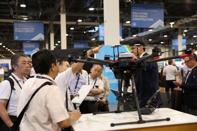
Aibot: The latest Unmanned Aerial Vehicle (UAV) system based on DJI’s aerial platform, the M600 Pro, rapidly and autonomously enables digitising of critical infrastructure. The Leica Aibot allows users to get a complete data set in less time with a user-friendly and innovative interface, opening up business opportunities while spending less time, lowering costs and being less effort than traditional methods. Leica Infinity supports the UAV workflows for point cloud, digital surface model and orthophoto generation enabling surveyors to easily process and visualise aerial data to maximise productivity and speed up data delivery. Supporting users to share data to Cyclone and Cloudworx, the integration of the UAV point cloud with terrestrial scan data enables users to make the most informed decisions. This complete set of data results in higher project efficiency.
iCR70 and iCR80: The intuitive iCON construction total stations increase efficiency on any building construction site by automatically identifying the prism and automatically relocking to it, should the line of sight be lost, delivering the most reliable, simple, and automated setup routine for construction layout. The iCON layout solution, consisting of the new iCON construction total stations, the Leica iCON CC80 field tablet and an enhanced version of the iCON build field software, is aligned with modern Building Information Modelling (BIM) processes and provides a simplified and seamless dataflow of fully rendered 3D design models, between the office and field and vice versa.
MC1 and MCP80: With the new all-in-one machine control platform, Leica Geosystems delivers an intelligent and intuitive hardware and software combination for the heavy construction industry. The MCP80 panel displays information about the work in process and automatically positions the tools, such as bucket, blade or drill bit to dig, grade or drill. Interchangeable between several heavy construction machines, the MCP80 control unit integrates into the common software platform, Leica MC1.
The Reality of Fun
Geosystems joined with Mining to offer attendees a night out at the games. Participants wore their favourite sports team’s jerseys to Lagasse’s Stadium and enjoyed sporting events provided on more than 100 screens. They connected with colleagues over cold brews and cocktails with classic game day fare with a twist by renowned chef Emeril Lagasse.
The Reality of Reality
Whether you’re a surveyor capturing points instantly in a digital format, a construction professional bringing 2D blueprints into a 3D environment, a public safety professional permanently preserving a scene in an exact digital representation, or any other professional looking to create your own digital reality for improved operations, HxGN Live in the Geosystems Track is the place to be every year.
The conference also provides an opportunity for everyone to discover the potential of Hexagon solutions – for users to learn how to enable their existing products to deliver the highest ROI, as well as an opportunity for new customers to see how advanced visualisation and analytics can impact their industry.
Those who weren’t able to join HxGN Live this year, can check out https://hxgnspotlight.com for the highlights. HxGN Live 2019 will take place again in Las Vegas from 11-14 June.

Value staying current with geomatics?
Stay on the map with our expertly curated newsletters.
We provide educational insights, industry updates, and inspiring stories to help you learn, grow, and reach your full potential in your field. Don't miss out - subscribe today and ensure you're always informed, educated, and inspired.
Choose your newsletter(s)


