Q&A: The Quickly Evolving UAS Mapping Market
GIM International meets with senseFly CEO Gilles Labossière
Drones have become a standard tool for mapping and surveying. Read what Gilles Labossière, CEO of senseFly, has to say about the market trends, technical developments and challenges affecting geospatial professionals.
Even in turbulent times, the outlook for the unmanned aerial system (UAS) mapping market is full of promises. Now that the unmanned aerial vehicle (UAV or 'drone') market has reached its maturity, education and training will be key to ensuring more widespread adoption and optimized drone usage. Here, senseFly’s CEO Gilles Labossière shares his views on the latest trends in the market, new technical developments and further changes and challenges geospatial professionals have to take into account now that UAVs have become a standard tool for mapping and surveying.
How would you describe the current market circumstances for UAVs for mapping and surveying purposes?
Following a 40% quarter-on-quarter increase revenue in Q1, we experienced a drop in Q2. These circumstances aren’t unique to senseFly; the commercial drone industry as a whole experienced a similar impact. However, the global drone market for mapping and surveying is strong and is continuing to grow despite the many challenge brought about the by the COVID-19 pandemic. For us, sales have been steadily rising since May and we expect to recover to Q1 levels by the end of Q3.
What are the key markets and products for senseFly as of today?
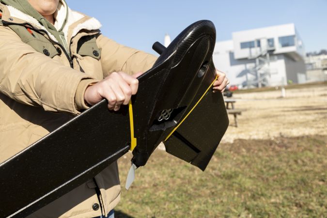
Our flagship product is the senseFly eBee X, which is the result of more than 10 years of experience developing best-in-class fixed-wing drone solutions for geospatial professionals. The eBee X is the foundation of our business and our most versatile, safe and robust drone and we’re continuing to optimize this unique technology to ensure that it meets the needs and challenges of the surveyors and engineers who use it every day for years to come.
Which specific services are you offering to mapping and surveying professionals?
Our focus at senseFly is offering our customers the enhanced range and coverage they’re looking for. With 50% of users saying they purchased the eBee X due to its long-range abilities, it’s clear that this is a key priority area for industry professionals and, in turn, for us. In addition, our global network of experts and more than 90 distribution partners ensures we can provide technical support at a local level so our customers know they can rely on us whenever they may need.
When considering the UAV fleet size of a company, which factors must be taken into consideration?
The main factors to consider are whether there is a thorough understanding of the technology and the benefits it offers from key stakeholders, as well as how the data that is collected by the drone will be used to maximum effect and incorporated into the existing data management system. The size of fleet required differs from company to company, but in our experience we find that customers have better success integrating drone fleets if they start small. Most of our customers start with a fleet of five drones in their first year, increasing to 10 in their second year and 30 in their third year. Some of our more mature customers now have fleets of between 50 and 100 drones.
No UAV without a payload – what are key trends (cameras, sensors)?
The payload that is required varies between projects; what is more important is to ensure whatever payload is used is supported by an excellent quality: weight ratio – especially with the upcoming European regulations that mean drones over 2kg will face severely limited flight restrictions. As senseFly, we’ve developed high-quality and lightweight solutions that allow a maximum flight time of 90 minutes, and a weight of less than 1.56 kilos, regardless of payload.
How do you see BVLOS applications evolving over the next years?
We see BVLOS and other advance drone operations continuing to progress in the years to come, especially as greater rules and regulations are established with different civil aviation authorities across the world. Surveying and mapping professionals are increasingly looking for technologies that will enable them to conduct long-range operations, which BVLOS can solve. The senseFly eBee X has already been used for BVLOS flights in the US, Canada and Brazil as it is light and safe to use, and we’re closely working with key local organizations to ensure it meets regulations and open up BVLOS as an option more globally.
What are the main challenges that need to be addressed for a more widespread adoption of UAVs?
As with any disruptive technology, it’s important to understand how drones function, what the benefits and regulations are, as well as how to operate them safely. With the market now reaching a new stage of maturity, education and training will be key to ensuring more widespread adoption and optimized drone usage. At senseFly, we have a number of initiatives to help support adoption, including a technical training program and local maintenance facilities – both of which aim to make using our drones as easy an experience as possible.
senseFly is also cooperating with other companies. What are the most notable examples?
We are proud to cooperate with some of the best companies around the world, such as Trimble, Microsoft, Autodesk and Pix4D. We also have educational and humanitarian partnerships with the World Bank, Princeton University and non-profit organizations such as Drone Adventures. Our aim is to provide agnostic solutions that can be used by any of our partners and customers.
The evolution of 5G is set to bring many new opportunities for the UAV industry. What is senseFly’s approach towards 5G?
The adoption of 5G technology will mean better network coverage and IoT module availability for drone integration. This in turn can optimize drone connection and provide the necessary bandwidth for real-time download of the rich data acquired during flight, so that data is processed even faster. While the technology hasn’t been fully rolled out globally yet, especially in rural areas, we’re seeing a correlation with the upcoming EU drone regulations, as it will allow surveyors to fly drones over urban areas, where 5G coverage will be available first.
Do you foresee any further changes in UAS mapping in the foreseeable future?
The UAS mapping market is quickly evolving and has now reached a stage of maturity where users are looking to optimize their knowledge of drone technology. Increasing numbers of businesses now understand the value of the data captured by drones, which will drive the adoption of BVLOS and other advanced operations. The other big change is the new EU legislation coming into effect in 2021, which demonstrate a shift in the acceptance of drones from an unknown to a widely-used piece of equipment that needs to be better regulated. Although it will make some technology obsolete, it presents an opportunity for the industry as we work towards developing more advanced drones capable of carrying out increasingly complex missions.
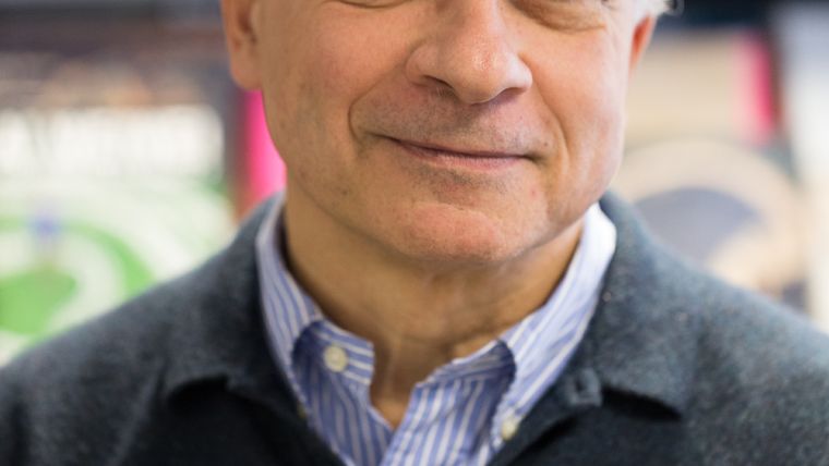
Gilles Labossière is the CEO of senseFly, responsible for driving the organization’s global commercial and product strategy. He has been a part of the Parrot Group since 2008, previously serving as Chief Financial and Administrative Officer, as COO and Executive Director of Parrot Drones and as Executive Director of MicaSense.


Value staying current with geomatics?
Stay on the map with our expertly curated newsletters.
We provide educational insights, industry updates, and inspiring stories to help you learn, grow, and reach your full potential in your field. Don't miss out - subscribe today and ensure you're always informed, educated, and inspired.
Choose your newsletter(s)


