Real-time Mapping of Illegal Amazon Deforestation
Remote sensing solutions provider DMC International Imaging Ltd (DMCii, UK) has signed a contract with Brazil’s National Institute for Space Research (INPE) to deliver near-real-time satellite imagery to monitor forest-clearing in the Amazon rainforest and target illegal logging as it happens.
INPE is experienced in the use of satellite imagery to monitor deforestation, providing information central to Brazil’s war on deforestation that has cut deforestation rates by 78% since 2004. The space agency’s DETER service uses regular satellite images to detect forest clearance as it happens rather than surveying the damage afterwards, guiding Brazil’s enforcement officers to provide effective forest clearing control. However in recent years, the authorities have discovered that illegal loggers are clearing smaller areas to evade detection by the 250metre-pixel MODIS data that is currently in use.
The new GBP2.1m contract signed with DMCii will enable INPE to downlink higher resolution 22-metre resolution data directly from the UK-DMC2 satellite to its ground station at Cuiaba, Brazil. With approximately 130 times as many pixels per hectare as the MODIS images currently in use, the data will detect these smaller clearings and provide more detailed maps. The UK-DMC2 satellite will image the entire Amazon basin every two weeks, so that the authorities are alerted as soon as possible after logging is detected. In an agreement, the data covering Brazil will be made freely available on open licence through the INPE website so the general public can follow progress against deforestation.
Dr. Gilberto Camara, Director General of INPE said that it became urgent to increase the supply of satellite imagery to operate the forest monitoring system, and DMC data provides a very cost-effective tool. The 650km wide swath DMC imagery provides a frequency of coverage and level of detail which enhances the ability of the DETER system to identify deforestation at an early stage. I am particularly pleased that DMCii has agreed to an open licence so that INPE can make the data freely available through its website, an innovation which has enhanced public monitoring of forest management in Brazil.
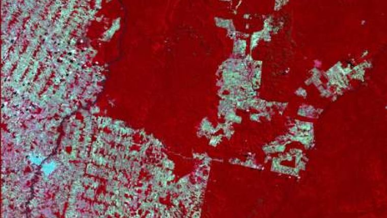
Image: clearing of forests in Rondonia.

Value staying current with geomatics?
Stay on the map with our expertly curated newsletters.
We provide educational insights, industry updates, and inspiring stories to help you learn, grow, and reach your full potential in your field. Don't miss out - subscribe today and ensure you're always informed, educated, and inspired.
Choose your newsletter(s)


