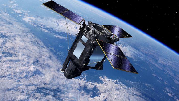
SEOSAT-Ingenio Moves a Step Closer to Launch
The Spanish high-resolution land imaging mission, known as SEOSAT-Ingenio, will soon be shipped from Airbus in Madrid to Europe’s Spaceport in French Guiana, where it will be prepared for launch later this year on a Vega rocket, according to an announcement by ESA.
The Earth-observing satellite carries a state-of-the-art dual camera that can image Earth’s land with a resolution of 2.5m. The mission will benefit society through numerous disciplines such as cartography, agriculture, forestry, urban development and water management.
With its capability to look sideways, it can access any point on Earth within three days, and will be used to help map natural disasters such as floods, wildfires and earthquakes – as well as help with one of humankind’s biggest challenges: understanding and responding to climate change. While SEOSAT–Ingenio is a Spanish national mission, it is the result of an international collaborative effort. The mission is funded by Spain’s Centre for the Development of Industrial Technology (CDTI) of the Ministry of Science and Innovation, but developed by ESA in the context of the European Earth Observation Architecture.

Value staying current with geomatics?
Stay on the map with our expertly curated newsletters.
We provide educational insights, industry updates, and inspiring stories to help you learn, grow, and reach your full potential in your field. Don't miss out - subscribe today and ensure you're always informed, educated, and inspired.
Choose your newsletter(s)


