SimActive Releases Version 8.2 for Processing of Multispectral Imagery
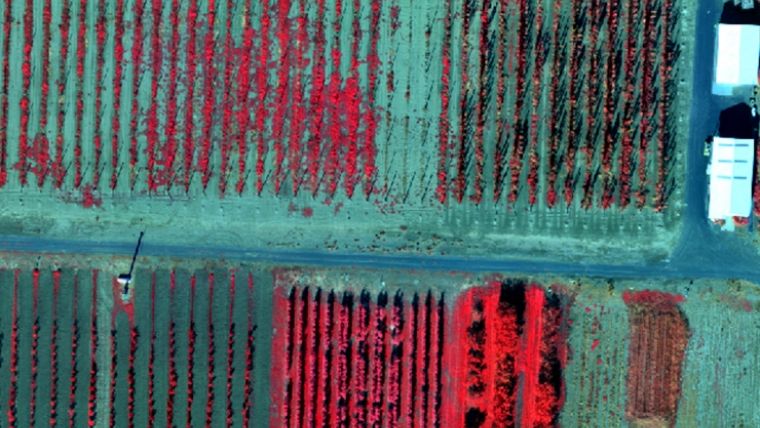
SimActive, one of the leading developers of photogrammetry software, has released Correlator3D version 8.2 with advanced processing capabilities of multispectral imagery. Supported sensors include the MicaSense RedEdge/Altum and the Parrot Sequoia. The new version allows automatic registration of multispectral as well as infrared images. The resulting fused data can be used in the software to produce digital surface models (DSMs) and digital terrain models (DTMs) and to generate multiband orthomosaics with perfect co-registration.
“There is a growing need for multispectral sensors in agricultural applications such as crop management”, said Louis Simard, CTO at SimActive. “The new version allows our users to profit from the multiple bands available, seamlessly.”
SimActive is the developer of Correlator3D software, a patented end-to-end photogrammetry solution for the generation of high-quality geospatial data from satellite and aerial imagery, including UAVs. Correlator3D performs aerial triangulation (AT) and produces dense digital surface models (DSM), digital terrain models (DTM), point clouds, orthomosaics, 3D models and vectorized 3D features.

Value staying current with geomatics?
Stay on the map with our expertly curated newsletters.
We provide educational insights, industry updates, and inspiring stories to help you learn, grow, and reach your full potential in your field. Don't miss out - subscribe today and ensure you're always informed, educated, and inspired.
Choose your newsletter(s)


