Simultaneous Survey Across Fifty States
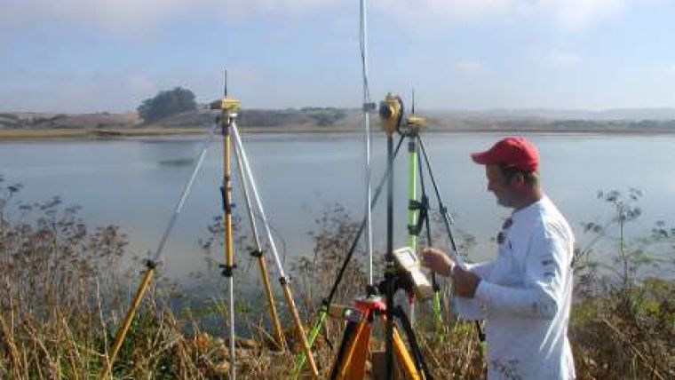
Hundreds of surveyors from all around the United States joined NOAA's National Geodetic Survey on Saturday 19th March at exactly 1PM EDT. It was the first ever 'Surveying USA Day', a kick-off event commemorating Surveyor's Week, coordinated by the National Society of Professional Surveyors. Professional, government and independent surveyors collected global positioning system (GPS) data simultaneously using various methods including handheld GPS devices and more sophisticated surveying equipment.
As a result, NOAA is expecting a large influx of data submitted to its Online Positioning User Service (OPUS), new database tool that allows surveyors, engineers, and other users to share their survey results.
OPUS serves as a direct conduit to the NOAA's National Spatial Reference System (NSRS), the coordinate system maintained by NOAA that defines latitude, longitude, height, scale, gravity, and orientation throughout the United States. The system is designed to meet US economic, social, and environmental needs. The NSRS provides the foundation for mapping and charting; state boundaries; transportation, communication, and land-records systems; and numerous scientific and engineering applications and provides more than USD2.4 billion in estimated annual benefits to the US economy.
Juliana Blackwell, director of NOAA's National Geodetic Survey, said that the nation was built on the foundational work of surveyors. Every piece of infrastructure from roads to buildings, airports, levees and pipelines needs accurate positioning data. "The work of geographers, cartographers and engineers all rely on having accurate positional data provided by surveyors."
For over 200 years, NGS and its predecessor agencies have collaborated with public and private organisations to establish reference stations at precisely-determined locations. Traditionally, these locations have been identified by setting a survey mark, usually a brass, bronze or aluminum disk. Locations might also be identified by a deep-driven rod or a prominent object, such as a water tower or church spire. This collection of more than 1,500,000 points-plus more than 1,650 Continuously Operating Reference Stations that provide GPS data-are coordinated and monitored by NGS to form the NSRS.

Value staying current with geomatics?
Stay on the map with our expertly curated newsletters.
We provide educational insights, industry updates, and inspiring stories to help you learn, grow, and reach your full potential in your field. Don't miss out - subscribe today and ensure you're always informed, educated, and inspired.
Choose your newsletter(s)


