Small Unmanned Aerial Systems for High-throughput Phenotyping
Phenotyping is an important agricultural approach that combines methodologies and protocols to quantify plant growth, structure and composition at different scales of organisation, from organs to canopies. Traditional phenotyping is based on destructive, labour-intensive and time-consuming approaches. Therefore, novel phenotyping techniques are essential to tackle the global challenge of ensuring crop yield for food and fuel generation while using fewer resources and reducing the environmental impact. In this regard, small unmanned aerial systems (sUASs) are rapidly gaining momentum as one of the best approaches for high-throughput plant phenotyping.
The world faces a global challenge of ensuring crop yield for food and fuel generation while using fewer resources and reducing the environmental impact (e.g., diminishing agricultural land, efficient use of nitrogen fertilisers, and correlating genotype and phenotype traits for advancing crop yield). Traditional phenotyping is based on destructive, labour-intensive and time-consuming approaches that are mainly conducted in a controlled environment with limited coverage such as greenhouses. Such limitations are the cause of phenotyping being the bottleneck of advancing crop yield while reducing the impact of agricultural practices on the environment (e.g. reducing the use of nitrogen-based fertilisers). Therefore, novel phenotyping techniques are critical to alleviate the above-mentioned challenges. In this regard, directly georeferenced passive and active imaging sensors operating in different portions of the electromagnetic spectrum could be utilised for innovative high-throughput phenotyping, which is non-destructive and non-invasive while being capable of providing abundant and diversified information. Mobile sensor systems onboard tractors, tethered balloons, manned aircraft, and unmanned aerial systems (UASs) are becoming popular thanks to their potential for collecting data that is conducive to automated phenotyping. Among the above-mentioned mobile platforms, small unmanned aerial systems (sUASs) are rapidly gaining momentum as one of the best approaches for high-throughput plant phenotyping. The ability of sUASs to fly lower compared with manned aerial systems allows them to collect geospatial data at high resolution while covering larger areas than wheel-based systems. The low cost of consumer-grade sUASs is another advantage that makes them more appealing.
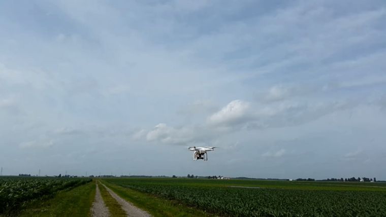
Utilising sUASs, which are equipped with directly georeferenced imaging sensors, for precision agriculture in general and high-throughput phenotyping in particular is an important application that is gaining significant attention from researchers in the mapping and plant science fields. As can be seen in Figure 1, a low-cost sUAS can be used for image acquisition according to a preset flight plan. Acquired images can then be manipulated for the generation of important products such as orthophotos and height maps (Figures 2 and 3). However, RGB-based images are not sufficient for the derivation of all the necessary phenotype traits for advancing crop yield, such as plant stress level, leaf pigment analysis, leaf area index and plant structure. Therefore, in addition to RGB cameras, sUASs should be also equipped with hyperspectral and laser scanning systems. However, the limited endurance and payload constraints are key challenges when dealing with consumer-grade sUASs. In order for sUASs to be utilised for high-throughput phenotyping while considering the desired sensors as well as the imposed payload and cost constraints, members of the professional and research community are faced with the following challenges:
- Improving the geometric fidelity of remotely sensed data from sUASs using consumer-grade imaging and direct georeferencing sensors.
- Integration of multi-sensory data captured by imaging systems operating in different portions of the electromagnetic spectrum to derive higher-quality geometric and spectral plant traits.
- Reducing the level of required technical expertise to operate and process the acquired data through the development of robust data processing algorithms with built-in quality assurance and quality control protocols.
Acknowledgement
The information, data or work presented here was funded in part by the Advanced Research Projects Agency-Energy (ARPA-E), U.S. Department of Energy, under Award Number DE-AR0000593. The views and opinions of the author expressed herein do not necessarily state or reflect those of the United States Government or any agency thereof.
Ayman Habib, Lyles School of Civil Engineering, Purdue University, USA

Value staying current with geomatics?
Stay on the map with our expertly curated newsletters.
We provide educational insights, industry updates, and inspiring stories to help you learn, grow, and reach your full potential in your field. Don't miss out - subscribe today and ensure you're always informed, educated, and inspired.
Choose your newsletter(s)


