Survey Value Takes off with UAV
Landpro, New Zealand, has been using a UAV to deliver better survey value to mining, quarry and land development clients in Australia and New Zealand. The company acquired a Topodrone-100 in 2014. The gyro-stabilised mount was a key reason for the purchase, along with accuracy and regional product support.
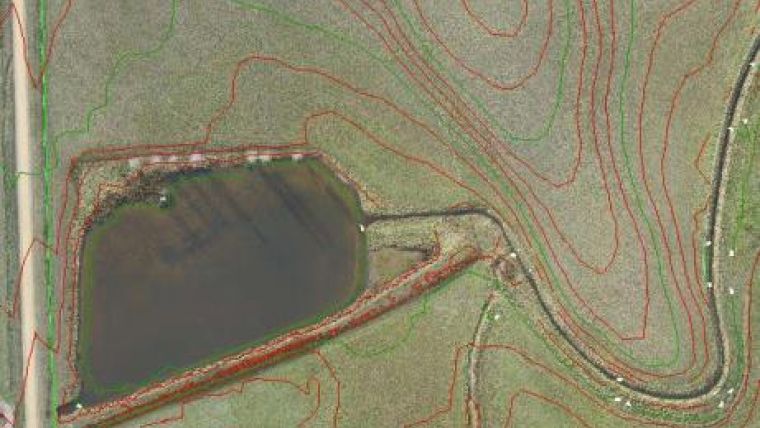
Topodrone-100 results are reliable and repeatable. Comparison to previous surfaces clearly demonstrates a data accuracy better than 50 mm for mining projects. Mission planning and strategically placed control points are key to obtaining highly accurate results, said Mike Borthwick, director technical services of Landpro.
Mine deliverables
Landpro conducts UAV surveys to collect data for modelling and volumetrics to reconcile end of month payments. Batter angles and haul road gradients are also checked. Collecting waste dump or engineered landfill data at the same time is a bonus. Ground teams would only survey these on demand for monthly progress data.
A typical UAV survey project with 3 to 4 flights of 30 minutes duration involves up to 4 hours on site. About 300 photographs are generated per flight. Ortho-rectified high resolution images are created along with point clouds of up to 100 million survey points. Data is reduced to 5 million points for a digital surface model. Filtered data is validated against full datasets to ensure accuracy is maintained.
Deliverables include a filtered point cloud, surface model, low resolution aerial image and large scale plots of aerial data and contours. Volumes of mined areas, waste dumps and stockpiles are provided. Video fly-throughs are always appreciated. High resolution aerial imagery file sizes can be 150 gb, which limits use by some clients.
An issue with UAV mine survey is finding launch and landing sites, said Borthwick. You can launch from anywhere, but smooth landing terrain is scarce. Landpro’s investment in skilled pilots provides surety and reduces overall flight time.
Safe and efficient
UAV survey is far more efficient than ground survey. UAV data is processed overnight depending on project size and computing power. Only 8 to 10 hours of this is hands on, comparing favourably with 16 to 20 hours for traditional methods.
Output such as aerial imagery is useful for mine planning, providing clear reference points for mine staff and contractors. The site survey dataset is far more detailed than traditional methods, and includes areas that could not otherwise be surveyed due to access or work health and safety limitations.
No one tool can cover the range of applications required on a mine site. Using the right tool for the job improves productivity. For example, the UAV keeps surveyors off the high walls and slip areas, while still accurately acquiring the required survey data. There is no other way to get this without a person entering the area. On the other hand, the UAV cannot acquire data in thick vegetation, hence data capture needs to be undertaken by total station or expensive Lidar survey, Mike Borthwick explained.
Applications for the Topodrone-100 are near endless. To date we have conducted surveys for mining volumetrics, irrigation design projects, large scale earthworks projects, noise modelling, dam design and catchment mapping, and vegetation mapping including pest weed mapping, Borthwick added.
Skilled staff
As demand increases, it brings challenges around human and computing power. The UAV can acquire more data in 1 week in good flying conditions than they can process on 2 large PCs in a fortnight. Landpro would like to add a second UAV, but in the current market it is not easy to find skilled staff capable of operating the aircraft and processing the data, Borthwick said.
According to Borthwick, Landpro’s Topodrone-100 UAV provides more accurate data than GPS surveys. Aerial images are a bonus, at a fraction of the cost of Lidar. Most importantly, it allows them to produce data to suit client needs.
Landpro’s clients want the best data in the safest way. Getting highly accurate data without placing people into dangerous areas ticks all the boxes. This data enables easy production of work and rehabilitation plans to satisfy all regulatory requirements, Borthwick concluded.
With the UAV, Landpro can now save significant time on large scale topographic surveys, avoiding risk to ground crews.
Source: Maptek.

Value staying current with geomatics?
Stay on the map with our expertly curated newsletters.
We provide educational insights, industry updates, and inspiring stories to help you learn, grow, and reach your full potential in your field. Don't miss out - subscribe today and ensure you're always informed, educated, and inspired.
Choose your newsletter(s)


