Surveying and Positioning Systems
North Group
The world of surveying and positioning is experiencing an amazing transformation that began just recently, and goes hand in hand with the superior push in technology democratisation due to the popularity of consumer and professional hand devices. Almost any phone is now more powerful than our first desktop computers and satellite positioning seems to be permeating into everything from locating friends to autopilot planes and cars.
North Group has experienced this change in technology since its first totally automated truck fleet management system was put to work in 2000 in Europe, USA and Mexico. The hardware and communications involved in processing advanced positioning and data management has only decreased in costs while there has been an exponential increase in capabilities.
| NXR total station. |
The development of surveying and positioning systems by North was a natural evolvement of its industrial and government customers that required higher accuracy and integrated usability. In 2001, this led to its very first instrument, called the Dataflow, which could perform analysis on the fly - 10 real-time water quality parameters while doing bathymetric work, and was used on offshore oil operations and high-volume dredging. The same high-end technology is used in their surveyor-type North Naviger D echo sounder that delivers double frequency readings up to 900m within a portable OS based unit.
New Markets
While North Group’s core business was surveying, they began serving mostly non-surveying markets, and it quickly became clear that their instruments and systems should always be simple to use by anyone, regardless of the field work profile, and open enough to be modified in accordance with the customer’s specific needs. The product line continued to grow in this direction, currently serving a strong base of geologists, electric engineers, miners, biologists, railway operators, risk managers, archaeologists, speleologists, machine operators, logistic and port managers, cadastral administrators, construction contractors, and, of course, land surveyors.
The highly capable R&D personnel of the company began developing instruments and systems as third party consultants for renowned European and Asian surveying instrument manufacturers, working on total stations, handheld GNSS, RTK receivers, CORS systems, surveying echo sounders, and controlling software. This trend and experience resulted in the start of the North Surveying line in 2010, aimed directly at end-users, rather than corporations, thus offering high-level instruments to markets looking for the best cost versus benefit relation while integrating smart and easy to use solutions that are welcomed at every level.
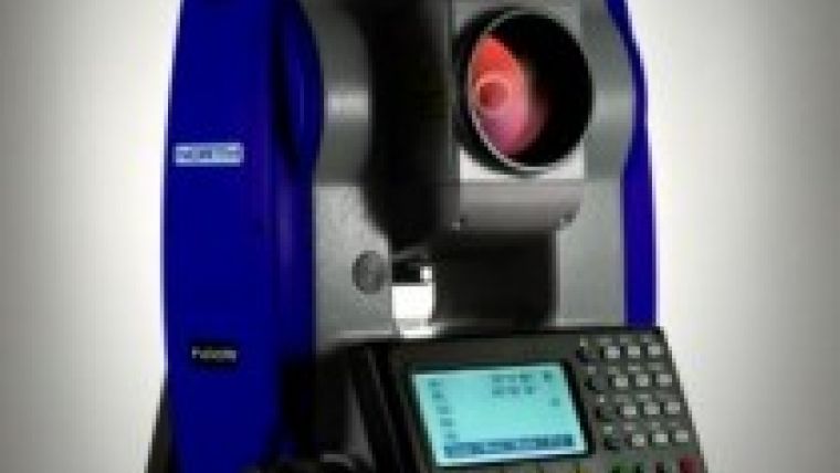
For example, the NXR is the only mechanical total station in the market capable of realising laser scanning, and is so simple that any surveyor can operate it, while doing regular stake out work, running a point cloud in a snap, actually transmitting the data wirelessly in real-time using the user´s Android phone to then forward it by “Share” to the office email and continue working in the field; all in all, a time saver that does not add to the price tag.
User Friendly
North´s CORS system is also simple and powerful. The user simply needs to plug the Base receiver to the internet and our cloud service takes care of the rest, even showing the location of the receivers on Google Maps. No need for fixed IPs, expensive and hard to configure software, or dedicated servers to operate.
Another example of simplicity, although some details cannot be currently released, is the new system upgradable GNSS RTK line, to be introduced in 2013. The design is rugged enough for military and machine control applications while also being light and integrated enough as a full day
| Naviger D echo sounder. |
portable rover. Some of its details such as its IP68 rating, double battery life, standard data communication protocols, full array of preconfigurations, the largest screen of its type, and on board transmitting UHF radio with 40W of transmission on the basic set, clearly sets it apart from others in its price range. Based on customer demand, the receiver was designed entirely with no rubber or membrane buttons that can weather away and break, no battery boxes and nothing that can compromise the operation of the receivers.
The new receiver line, like most instruments and components of the North product line, has been designed and manufactured entirely in Barcelona, Spain, and field tested in sub-zero temperatures in Europe and in the sun-baking 60°C saline weather of North's Mexican office. From desert to mountain, rainforest to open ocean, as rugged as a surveyor, North delivers results.
Flexibility
To be able to deliver technology of the highest level while remaining affordable to the loyal base of customers, North Group began working on the development of core technology two years ago, introducing three critical components on the full line of receivers this year. Firstly, the custom designed four-element GNSS antenna, created by partnering with aerospace suppliers for maximum accuracy and multipath rejection; this antenna is specifically designed to match the fine tuning of the patented algorithms of the new Stealth GNSS receiver board, that boost 330 channels receiving in full spectrum Landstar-GPS, GLONASS and the newly available Compass/Beidou systems. In addition, its scalability makes it flexible enough to cover any application and budget while sporting top-notch technology. The Stealth receiver is not available for OEM applications, being exclusively available within North branded instruments or custom applications.
| Stealth GNSS receiver board. |
Another newly introduced core technology is the UHF radio-modem module, with a selection range of 0.5, 2, 25 and up to 40W power steps for maximum field data transmission flexibility and matching communication protocols that enables seamless connection with other receiver radio brands. North believes that closed proprietary formats make the technology acquisition for the end-user difficult, so, where possible, it enforces the adoption of common standards like NMEA, RINEX and RTCM as base for its systems.
North Group's strategy of expansion into the end-user markets will include the impulse of the North brand, through the North Surveying division, and the allocation of sales and support points for the EMEA market during 2013 using as entry point the introduction of the totally redesigned 2013 product line, with strong support of the well-received North and strategic partner’s instrumental software, that is developed under their Continuous Improvement policy.

Value staying current with geomatics?
Stay on the map with our expertly curated newsletters.
We provide educational insights, industry updates, and inspiring stories to help you learn, grow, and reach your full potential in your field. Don't miss out - subscribe today and ensure you're always informed, educated, and inspired.
Choose your newsletter(s)


