Surveying for Belvedere Waste Project
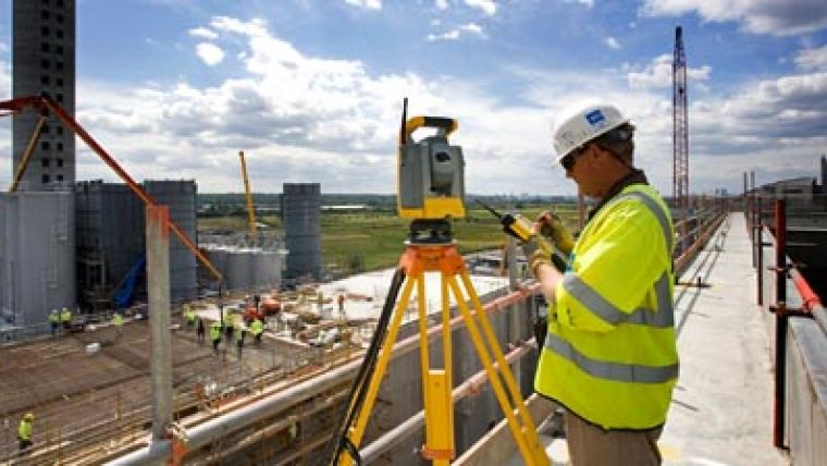
Maidenhead-based civil engineers, Costain, have purchased a combination of Trimble R8 GNSS receivers and Trimble S6 robotic total stations for use on the Riverside Resource Recovery Facility currently under construction at Belvedere in South-East London. These instruments will help Costain to deliver the main buildings, jetties, roads and offices for the GBP350 million project which is being developed by Cory Environmental and built by Swiss plant construction company Von Roll Inova.
The Trimble solution means streamlined data handling and less time in the office. Key to this is the ability to switch between optical and GPS instruments with a common user interface. Having a single software aplication for all the survey work immediately reduces the learning curve for the engineers which is the first step in cutting out errors and rework.
The Survey Controller allows ‘drag and drop' copying of csv and dxf files from PC to logger, to a drop-down menu with pictures for predefined prism types. This feature means that one out of three or four targets to work with, all at different heights, can be selected with a tap on the controller. The colour map display facilitates checking and viewing a point in real time before it is stored, adding attribute information to points, editing elevations, zooming in and out of the map to check gridlines.
The R8 is being used for multiple tasks including topo and verification surveys, barge positioning and checking the height of quay walls along the Medway Estuary to enable successful loading and unloading from barges.
The S6 robotic total stations allow to work within tight tolerances. The engineers set out with Nikon total stations, to be checked with the S6's. They always tie up within a couple of mm, giving confidence whether the builders carrying out as-builts of piles or reflectorless monitoring of river bed levels for the Environment Agency. A 360 degree prism ensures that the S6 has been able to track with mm accuracy from every angle. The reflectorless range, often in excess of 150m, means that the engineers can carry out work from the safety of dry land rather than a rocking barge.

Value staying current with geomatics?
Stay on the map with our expertly curated newsletters.
We provide educational insights, industry updates, and inspiring stories to help you learn, grow, and reach your full potential in your field. Don't miss out - subscribe today and ensure you're always informed, educated, and inspired.
Choose your newsletter(s)


