Surveying the World of Tomorrow
From Digitalisation to Augmented Reality
From 29 May to 2 June Helsinki, Finland – also known as a ‘pearl of the Baltic Sea’ – was the centre of the global surveyors’ community during the FIG Working Week 2017. All participants were warmly welcomed by FIG colleagues in Finland. The programme was exciting and future-oriented.
By Christiaan Lemmen, Louise Friis-Hansen and Eva-Maria Unger, International Federation of Surveyors (FIG)
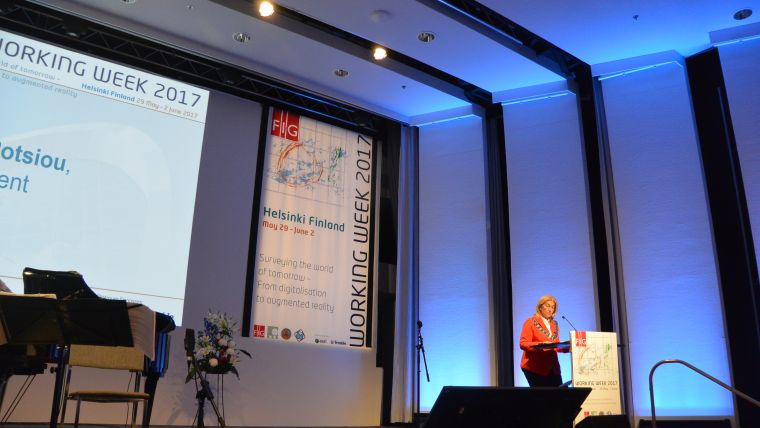
FIG Honorary President Juha Talvitie, who was president of FIG in 1990 (the last time the FIG Working Week was held in Helsinki) gave a short and inspiring welcome address greeting all the younger surveyors and also those who had attended in 1990. FIG President Potsiou began her opening address by stating: “Finland is a top performer in numerous metrics of national performance, including education, economic competitiveness, civil liberties, quality of life and human development, and our Finnish colleagues, top professionals, have chosen an appropriate theme for this Working Week for the times in which we are living.”
Change
President Potsiou further stated that change continues, as it always has and always will, inexorably. Change in the surveyor’s world is not limited to technological invention. Systems and processes are just as growth-oriented as the hardware that we use. The formation of FIG in 1878 was the beginning of the globalisation of our profession. First it was the organisation representing surveying associations of a mere seven western European countries; today it represents over one hundred. Nowadays, modern globalisation is being questioned for its fairness and efficiency yet we feel its effects on our profession.
Sibelius
Finlandia, by Jean Sibelius, symbolically accompanied by breathtaking photos of the Northern Lights and the subsequent sunrise, was an emotional conclusion to the Opening Ceremony. The sun then also rose over the Working Week with its myriad of activities, sessions, meetings and networking possibilities plus a lively exhibition showcasing new technology and equipment and stimulating new thinking.
The presentation by Ed Parsons, geospatial technologist and tech evangelist at Google, was of the highest level. He explained how, from the perspective of users and consumers, the benefit of geofunctionality is in the details: ‘avoid the traffic, ‘get me home’ and ‘eat out’ are well-known examples, as is ‘never lost’. He stated that a new generation of digital natives is on its way, who will combine big data to egocentric scales. There will be more and more simultaneous localisation and mapping – thus creating digital reality.
Keynotes
All keynotes were a source of inspiration and very much in alignment with the theme of the Working Week: ‘Surveying the World of Tomorrow’. Arvo Kokkonen from National Land Survey Finland questioned whether the surveying sector is changing quickly enough. He concluded by predicting a future with “many players in the field” as land information will become increasingly recognised as part of the basic infrastructure. Greg Bentley from Bentley Systems gave a fascinating keynote on ‘Going digital: reality modelling advances surveying, and engineering’. According to Greg, reality modelling is going mainstream and ‘conceptioneering’, ‘constructioneering’, ‘inspectioneering’ and ‘productioneering’ are all underway. Oumar Sylla from Global Land Tool Network highlighted in his keynote the relevance of land information as a key ingredient for achieving the Sustainable Development Goals. Tenure security for all is one of the goals in which surveyors worldwide play a vital part. Robert Guinnes, Finland, shared details of future trends in pervasive positioning, saying that accuracy, availability and reliability of GNSS will increase. Yola Georgiadou from ITC, Twente University, made a brilliant contribution on geoethics. Jolyne Sanyak from Landesa presented on ‘How can we favour secure land rights for the digitalised world we want?’. She explored innovative and more affordable technology and how to democratise data gathering. Markku Poutanen went back to the roots with a very interesting overview of the future of reference frames. Fredrik Zetterquist wondered whether we are embracing the global transformative forces, with a showcase of cadastral procedures conducted by citizens.
Point Clouds
The most provocative keynote came from Juha Hyyppä, the director of remote sensing and photogrammetry at the Finnish Geospatial Research Institute, with his presentation titled ‘Disruptive technologies threatening national mapping and cadastral agencies’ centralised mapping’. He said that, over the next two decades, new mobile laser scanning systems will make laser scanning ubiquitous. Even autonomous robots using point-cloud-generating perception sensors may be added to the ecosystem during this time frame. Juha is convinced that during the 2020s and 2030s, a great number of laser scanners will become omnipresent in everyday life. Mobile laser scanning is also one of the main techniques to create local virtual reality. Physical and virtual worlds will be merged. His illustrated his presentation with many examples of where cadastre is missing, even if the use of imagery is promoted in that area. He proposed action items including a national topographic database with high-quality point clouds and images. “Change or die” was his final message…
History Symposium
Prior to the FIG Working Week, the International Institution of History for Surveying and Measurement – one of the permanent institutions of FIG – hosted a one-day symposium. There were several contributions from the Nordic countries and also from Serbia, Canada, Croatia and Denmark. The Struve Geodetic Arc and the Enhancement from North Cape to Cape Agulhas in South Africa – the Longest Meridian on Earth were presented as highlights in geodesy. The contributions on the surveyors in the Roman Empire were fascinating. FIG Vice President Mikael Lilje brought along two books by Swede Martin Ekman on Celsius and 500 Years of Nordic Mapping.
BIM for Surveyors
Another pre-conference event was on BIM for surveyors, which attracted more than 50 professionals and academic engineers from 27 countries. Building information modelling (BIM) is the key for the implementation of digital models and processes for the construction industry. The workshop showed that surveyors play a crucial role in BIM design and implementation: managing project and asset data with proper coordinate reference systems, linking the construction project to GIS, measured surveys of the built environment using terrestrial laser scanners, setting out and machine guidance, linking virtual building models to land management, tendering and costs. Surveyors make BIM work properly.
Young Surveyors Network
The success of the FIG Young Surveyors Network (YSN) and its previous events has paved the way for yet another collaboration of young students and professionals; YSN organised its Fifth FIG Young Surveyors European Meeting and various sessions within the overarching FIG Working Week. Merging those two events allowed young surveyors from all over the world to participate in and experience the full range of FIG events and activities. The atmosphere was energetic, and the participants shared news and reports on their activities, research and work. The highlights were actively shared through the YSN social media channels, allowing young surveyors across the globe to join in and interact.
Programme
The FIG Working Week 2017 attracted about 1,400 participants from 90 countries worldwide. The programme included 400 papers presented in 57 sessions. There was a series of ‘inspirational sessions’ with short presentations and a focus on debate and discussion. The FIG Platinum Members – Trimble, Bentley Systems, Esri and Leica Geosystems – gave spectacular overviews of their services. The city of Helsinki, with its unique climate, beautiful evening lights and relaxed atmosphere, helped to make the event unforgettable. FIG thanks its Finnish colleagues for this experience!

Value staying current with geomatics?
Stay on the map with our expertly curated newsletters.
We provide educational insights, industry updates, and inspiring stories to help you learn, grow, and reach your full potential in your field. Don't miss out - subscribe today and ensure you're always informed, educated, and inspired.
Choose your newsletter(s)


