Swedish Lidar Project
New Nationwide Elevation Model
Airborne Lidar is being used to establish a new national elevation model of the entire territory of Sweden (450,000km2), one point per two m2. The project, spanning 2009 to 2013, is the responsibility of two internationally operating Scandinavian geospatial product service providers: Blom, headquartered in Oslo, Norway, and Denmark-based COWI. The authors discuss specifications, status and challenges posed by this large-scale, long-term project.
Appointed in June 2005 by the Swedish Government to assess the impact of global climate change on Swedish society, the ‘Commission on Climate and Vulnerability’ revealed its recommendations in 2007. Climate change will entail rising sea levels, heavier rainfall and higher temperatures. Estimating the risks and effects of flooding, landslides and other eventualities is hence vitally important. One of the Commission’s recommendations was to produce an updated, more accurate elevation model for the whole of Sweden, the fourth largest country in Europe. Such an elevation model also provides information on vegetation and objects, allowing inventory of both forest and other valuable resources, and numerous analyses. A brief description of Sweden’s geography and climate is given in the sidebar.
Specifications
Lantmäteriet (the Swedish mapping, cadastral and land registration authority) has divided Sweden into nine areas of production with various priorities, and about four hundred scanning areas, size 50x25km2, which have to be captured with the same type of scanner over the same time period and delivered as one block of height data. Flight lines should be parallel, with 20% overlap; in each scanning area three crossing flight lines should be flown and multiple laser pulse returns recorded. Further, the overlap between adjacent scanning areas should be at least 200m, maximum scanning angle not exceed 20 degrees, and point density of last echo should be at least 0.5 points per m2 in single flight lines. With respect to quality, the following requirements are specified: 20cm standard error in elevation at distinct surfaces and 60cm in planimetry, while terrestrial measurements and control features have to be used for geometric corrections and quality control.
Survey
In 2009 Lantmäteriet contracted Blom to carry out the airborne Lidar surveys in close operation with COWI; Blom acts as the single point of contact for Lantmäteriet. Data collection started in summer 2009 and is primarily done using Leica ALS50-II and ALS60, with complementary use of an Optech ALTM Gemini. As scanning pattern and other parameters of these systems differ, flying height and other survey parameters have to be adjusted accordingly. Flying height varies between 1,740 and 2,300m, flight speed between 145 and 155 knots, and pulse rate between 70 and 104kHz. Blom and COWI survey the scanning areas separately, but the overall goal is to optimise resources to survey as much as possible while weather conditions are optimal. Since both companies use the same version of the Leica scanner, flight plans can be easily exchanged. Terrestrial surveys for adjustment and control are carried out by COWI and subcontractors Sweco and Metria. All parties deliver the Lidar data to Blom’s Stockholm office, where it is further processed and undergoes a thorough quality check procedure prior to delivery to Lantmäteriet.
Status
Data collection is very dependent on rainfall, snowfall, cloudiness and other weather conditions. Winter 2009/2010 had extreme snowfall and scanning could not be performed in the south as planned; it seems the same snowfall conditions are prevailing during this winter of 2010/2011. Spring snowmelt deposits a massive amount of water on the ground, preventing data collection. April 2010 was also a bad month for data acquisition because of the ash cloud from the Icelandic volcano Eyjafjallajökull eruption, which caused further delays. The contractors managed to gather extra resources, and during autumn 2010 lost time could be compensated for and progress put back on track. A maximum of five systems have been operating simultaneously during periods of optimal weather conditions. So, by the end of 2010, within ten months of aerial activities beginning, 127 scanning areas were completed: 151,000 km2 (Figure 2). Checks using control and checkpoints revealed a Root Mean Square Error of better than 5cm in height and 25cm in planimetry.
Challenges
A major challenge is that companies which are also competitors in the global marketplace have to cooperate to make a success of such a large-scale, long-term project. One prerequisite is that all experience is openly shared and criticism expressed in a constructive and open-minded atmosphere. Key for success is that the professionals involved keep in mind the main goal of delivering the best quality to the client, given the specifications. Parties should be willing to marshal the highest professional expertise and invest in timely delivery of products, both in terms of human and financial resources. Such large-scale contracts involve parties having a mutual obligation to go for the best. Sharing and optimising resources and experience add high value, while the client benefits from having just one point of contact. One outcome of the good cooperation within the present project is that experience gained has been translated into adjustment of survey parameters in order to optimise data quality. For example, to meet the specification of a minimum of 0.5 point per m2 it was agreed to slightly modify specified flying altitude, pulse-rate frequency and flying speed, and the quality plan has been updated accordingly. This interactive process is valuable to both Lantmäteriet and the contractors. Another common focus is to complete the scanning areas with as few aerial surveys as possible. This may sound simple, but weather conditions mean proper decisions and pose a real challenge to operational crews.
Concluding Remarks
We focus here on airborne Lidar surveys in Sweden. In 2010 Blom and the National Land Survey of Finland signed a similar contract for Lidar data acquisition of the entire territory of Finland. Blom is performing this project too in cooperation with COWI.
Landscape
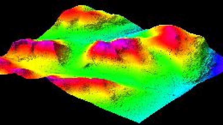
Scandinavia has several times in history been entirely covered by ice; the most recent ice age ended some 10,000 years ago. The weight and movement of the ice sheet polished and rounded rocks and hollowed out valleys and lakes. About 15% of Sweden’s landmass lies north of the Arctic Circle and topography varies greatly (Figure 1, top of this page); the highest point lies 2,100m above sea level. The country is sparsely populated and characterised by a long coastline and numerous lakes. Around 65% of the land is forested. The south is predominantly farmland. Going northwards, deciduous trees such as birch and aspen are gradually replaced by extensive coniferous forest, such as pine and spruce. The climate is mild; the south has an oceanic climate, the central part is humid continental, and the north subarctic. Length of day varies greatly; north of the Arctic Circle the sun never sets during part of summertime and never rises during part of winter.

Value staying current with geomatics?
Stay on the map with our expertly curated newsletters.
We provide educational insights, industry updates, and inspiring stories to help you learn, grow, and reach your full potential in your field. Don't miss out - subscribe today and ensure you're always informed, educated, and inspired.
Choose your newsletter(s)


