Tailor-made SDI Training
Reducing Disaster Risk in Indonesia
The National Spatial Data Infrastructure of Indonesia can potentially discover and map spatial and metadata managed by various national agencies and institutions and could be mobilised as a useful decision-support tool, helping agencies prepare and reduce the risks of urban disaster. A prerequisite is capacity building in the agencies involved. This article describes such, tailor-made training in the use of SDI for reducing disaster risk.
Many urban areas in Indonesia are disaster prone. Recently there has been the catastrophic tsunami in Aceh six years ago; and earthquakes in Yogyakarta four years ago, and last year in Padang. All have yielded lessons regarding the importance of capacity to deal with disaster risk, and alerted the nation to the need for improved disaster preparedness and resilience.
Be Prepared
Spatial data and information have proved essential in support of recovery and rehabilitation stages. But rather than focusing only on action during the post-disaster stage, institutions and agencies could put spatial data and information to valuable collaborative use in enhancing disaster preparedness. A National Spatial Data Infrastructure could provide efficient discovery and mapping of the spatial data managed by various agencies, enabling better support for pre-disaster activities; for example, risk analysis and action plans.
Indonesian NSDI
The Indonesian National Spatial Data Infrastructure (NSDI) entered a new phase with introduction of Presidential Regulation No. 85 in June 2007. This gave full mandate or development of an NSDI as an integrated and co-ordinated mechanism for providing and managing both national base data nd thematic data. The National Coordinating Agency for Survey & Mapping is responsible for evolving accessibility of geospatial data and metadata produced by various agencies and institutions. But while policy-level commitment and participation is considered most supportive, actual implementation of metadata and geospatial services is still lacking. This is clear from shortcomings in the national geoportal; users still cannot access much sector and thematic data.
Awareness
One reason for agencies and institutions contributing little to implementation of the national geoportal is that they remain unaware of how useful and supportive an NSDI can be in terms of their own function. Unfortunately, the potential for thematic use of the NSDI, including for disaster related activities, is not easily illustrated in its current status. Reasons for this include the fact that institutional arrangements for setting up infrastructure nodes have not been finalised, and that there are no proven applications. But a particular lack of capacity exists across agencies and institutions for making appropriate use of geospatial data infrastructure. This results in agencies and institutions initiating their own collection, accessing and dissemination efforts, rather than these being co-ordinated within the NSDI. Processing information regarding disaster preparedness and responses, such as analysing risks raised by the community, demands for infrastructure improvements and requests for aid, thus becomes difficult, if not impossible.
Tailor-made Training
Clearly, for better co-ordination and collaboration among institutions and agencies in support of national projects relating to urban disaster-risk reduction, an urgent need arises for capacity building. Decision-makers and staff must really comprehend the use and benefits of an NSDI. The case of an urban disaster-risk reduction programme was chosen as theme for training; such a programme requires collaboration among many agencies, including the Department of Civil Works, Agency for Meteorology and Geophysics, Land Office and Municipality Office. Specific attention was paid to the development of a use scenario utilising the National Geoportal as an integrated tool to support analysis and decision-making processes.
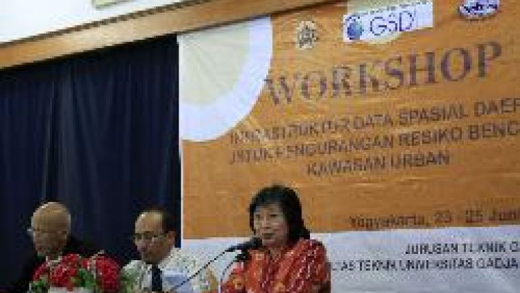
Training took place in Yogyakarta from 23rd to 25th June 2009, funded by the GSDI Association in co-operation with Universitas Gadjah Mada (UGM) and the National Coordinating Agency for Surveys and Mapping (BAKOSURTANAL). The course opened with a national workshop on use of the NSDI for Improved and Efficient Urban Disaster Reduction. Attending were staff from government agencies, plantation companies, NGOs that deal with disaster preparedness and response, and undergraduate and graduate students in Geomatics Engineering. During the training course thematic data and metadata were employed to show participants how the geoportal could be used as an interface to various data within the NSDI for successful and efficient access and analysis.
The training covered SDI fundamentals, disaster-risk reduction, urban spatial data analysis, and development of SDI-enabled participatory mapping. The modules are shown in Table 1 (below).
Step-by-step tutorials were given during practical exercises. For participatory mapping techniques, a manual approach using paper maps and a web approach using a map-based portal were introduced. Participants were taught how community members might spatially delineate and register local problems and vulnerabilities and afterwards combine this data with official NSDI layers. Also demonstrated during these sessions was the use of a low-cost interactive pen device for easy interaction with a projected wall display (see Figure 2).
Module | Delivery | Presenter/Facilitator |
Spatial Data Infrastructure Fundamentals | Lecture | National Coordinating Agency for Surveys and Mapping |
Technical Design of Spatial Data Infrastructure | Lecture & Demo | National Coordinating Agency for Surveys and Mapping |
Rehabilitation & reconstruction in Urban Disaster Management: a Lesson Learnt from Yogyakarta's Earthquake | Lecture | Institute for Research and Community Services, UGM |
The Role of national SDI for Community and Decision Makers in Disaster Risk Reduction Programmes | Lecture & Demo | Dept. of Geodetic Engineering, UGM |
Collaborative & Participatory GIS: Spatially-enabled Government | Lecture & Demo | Dept. of Geodetic Engineering, UGM & Dept of Geomatics, University of Melbourne |
Urban Disaster Risk Reduction & Spatial Analysis | Lecture & Practice | Centre for Natural Disaster, UGM |
Participatory Mapping & Risk Mitigation | Practice | Dept. of Geodetic Engineering, UGM |
Seismic Vulnerability Mapping and Risk Assessmentfor Urban Areas; a Lesson Learnt | Lecture & Demo | Asian Disaster Risk Preparedness centre, ADPC |
A Local SDI for Disaster Risk Reduction | Practice & Demo | Dept. of Geodetic Engineering and Faculty of Geography, UGM |
Way Forward
This course represented a first attempt at delivering application-oriented NSDI capacity building in Indonesia. The feedback from course participants indicated the usefulness and importance of the training, and the earthquakes in West Java and West Sumatra about three months after the training underlined its societal relevance. Because only seventeen of the expected thirty participants followed the course, similar training will be conducted again in the middle of this year. More advanced topics, including data standardisation and data quality, use and rights management, and management of the geoportal may be included in subsequent SDI training courses.
A thematic approach, and application-oriented NSDI capacity building for the geospatial community, is the way forward for raising awareness among those involved in the development of a National Spatial Data Infrastructure.
Acknowledgements
The author wishes to thank GSDI Association Committee for the grant that made possible tailor-made training in Indonesia. The author would also like to thank UGM and BAKOSURTANAL for their support.

Value staying current with geomatics?
Stay on the map with our expertly curated newsletters.
We provide educational insights, industry updates, and inspiring stories to help you learn, grow, and reach your full potential in your field. Don't miss out - subscribe today and ensure you're always informed, educated, and inspired.
Choose your newsletter(s)


