The Dynamic World of Open Source
FOSS4G 2016
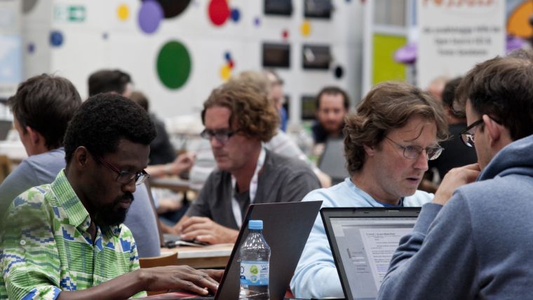
With no disrespect intended to the other geomatics conferences around (and there are many with high-quality and extremely relevant programmes), the FOSS4G (‘Free and Open Source Software for Geospatial’) conferences are different. FOSS4G 2016 (24-26 August) was held in the former plenary chamber of the German Bundestag in Bonn yet, despite this prestigious setting, the atmosphere was very laid-back. Participants dressed in shorts and FOSS4G T-shirts, a beer (or two) in the (late) afternoon, a sense of humour throughout the whole event and a very vibrant social programme (the ice-breaker at the wonderful BaseCamp Hostel Bonn and the Rhine cruise were instant hits!) summed up the vibe at FOSS4G.
(By Wim van Wegen, editorial manager, GIM International)
However, this was more than just a fun-packed event where everyone was having a jolly good time together. Open source is a movement within the geospatial sector that is full of exciting developments. People from all over the world had travelled to Bonn to become part of the worldwide FOSS4G community. Inspired by the location on the banks of the River Rhine, the organising committee had chosen ‘Building Bridges’ as this year’s conference theme – and many bridges were built during the conference, where networking opportunities were plenty and delegates from the traditional geosector interacted with members of the progressive open source community. New insights and knowledge were gained; it became crystal clear that open source geospatial software has a tremendous amount to offer in overcoming many challenges our world is facing.
The key topics of the FOSS4G 2016 event were open data, remote sensing for Earth observation, land information and disaster management. Open source geospatial software offers excellent solutions to many challenges and this was well reflected in the conference programme. There was a very inspiring topic talk on the theme of ‘Open Source Opportunities for Land Management’ – the first of its kind at a FOSS4G event but undoubtedly not the last! The session evidently demonstrated the immense potential open source solutions can offer to cadastral organisations. The diverse group of FOSS4G participants, ranging from consultants and land surveyors to programmers and developers, perfectly demonstrated what’s in it for everyone.
Although more and more government organisations are heading towards open source, one might wonder why the myriad possibilities of open source geospatial software with respect to a manifold of issues are still not on the radar of many authorities. Government bodies are involved in all kinds of relevant open source topics such as property rights, urban planning, food security, water & energy and climate change. Building bridges shouldn’t just be the theme of the 2016 edition of FOSS4G, but should also be part of the community’s core strategy. Any attempt to create awareness and heighten the visibility of the open geospatial community is worth the effort.
FOSS4G
FOSS4G is the annual global event of the Open Source Geospatial Foundation (OSGeo). The first edition was held in Lausanne, Switzerland, back in 2006. Although FOSS4G is widely recognised as the largest technical geospatial open source conference, the OSGeo community prefers to call it an ‘event’ because it is far more than just a conference. In addition to presentations and talks, a typical nine-day FOSS4G also includes code sprints, birds-of-a-feather sessions, workshops, topic talks and, of course, social events. FOSS4G 2017 will be held in Boston, Massachusetts, USA.
Interview with Arnulf Christl
The upcoming November issue of GIM International will contain an interview with Arnulf Christl, a high-profile member of the open geospatial community. Christl is a geospatial systems architect and founding and charter member of OSGeo. Editorial manager Wim van Wegen met up with him at the relaxed, open-minded and thought-provoking FOSS4G 2016 event in Bonn. The interview will provide plenty of insightful information from the open source geospatial community.
More on FOSS4G 2016:

Value staying current with geomatics?
Stay on the map with our expertly curated newsletters.
We provide educational insights, industry updates, and inspiring stories to help you learn, grow, and reach your full potential in your field. Don't miss out - subscribe today and ensure you're always informed, educated, and inspired.
Choose your newsletter(s)


