
The Story Behind Esri’s Acquisition of nFrames
Q&A with Richard Cooke, Director of Imagery, Esri
Richard Cooke, director of imagery at Esri, explains all about the company's acquisition of nFrames, the innovative Germany-based developer of software for 3D reconstruction from images.
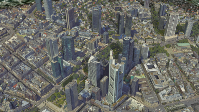
Esri recently made headlines in the geospatial industry when it announced the acquisition of nFrames, the innovative Germany-based developer of software for 3D reconstruction from images. To learn more about Esri’s recent takeover, we spoke to Richard Cooke, director of imagery at the world-leading company in GIS software.
What were Esri’s main considerations when acquiring nFrames, a relatively small photogrammetric company that is highly specialized in 3D modelling of imagery?
We are delighted to bring the nFrames staff and products into Esri, as this will enhance our existing 3D modelling and photogrammetric capabilities. The main consideration was to enhance our ability to help our customers perform highly accurate mapping and reality-capture workflows within the Esri platform by adding technology that allows for greater scale and produces very high-quality and accurate results.
Many companies are active in the field of photogrammetry and offer similar solutions as nFrames. How does nFrames offer Esri something extra?
In most cases, the data produced by photogrammetric processing needs to be used in a broader set of GIS and location workflows. So the simplest motivation is to give our customers who are creating or consuming 2D and 3D data a seamless workflow and user experience. We will accomplish this by integrating the nFrames technologies into the Esri platform. This will allow users to integrate high-resolution 3D content into their systems of record, but also to use all of our visualization tools to share the information with all of their stakeholders. Secondly, we believe that spatial analytics are becoming more multidimensional, so having the ability to create authoritative 2.5D and 3D data that can be used for analytics is essential to enhancing the spatial workflows of the future. This will also require that datasets can be built from the co-registration of data from collection platforms from nadir to oblique and, ultimately, street view.

nFrames is a spin-off of the University of Stuttgart, Germany. Were the possibilities of collaborating with that university a trigger in acquiring nFrames?
It is well known that the University of Stuttgart is a centre of excellence for photogrammetry, so the fact that nFrames rose out of this stellar institution gives their technology very strong credibility. We will definitely want to leverage their heritage from the university to continue our contribution to research in new approaches to maintain leadership in the areas of 3D reconstruction and photogrammetry. Esri has a strong history of working with universities and research institutions around the world on conservation and technology innovation in the disciplines most important to GIS users, and this will be important for us as we bring nFrames into the Esri family.
What is the profile of the current nFrames software user base, and does the acquisition fit into a larger Esri strategy to expand its product base?
The current nFrames customers embrace the product’s capabilities to utilize large aerial collections to create foundational 3D content for their projects. Current customers are executing workflows in the areas of mapping, survey, cadastre, change monitoring and infrastructure planning. We will maintain these focus areas, but we also plan to expand these capabilities into existing sectors Esri serves, such as architecture, engineering and construction (AEC), national governments, utilities, and natural resources, where we plan to use the nFrames capabilities to deliver foundation 3D content that integrates into existing customer workflows built on the Esri platform.
Since the introduction of semi-global matching, photogrammetry has made fascinating progress and enjoyed significant growth spurts. Which social and technological advancements will further stimulate photogrammetry over the next five years?
The next five years will see an expectation of 3D content within traditional GIS workflows such as mapping, planning, monitoring and sharing. We expect customers to build and maintain ‘digital twins’ as a key element to their operations. Authoritative 3D content is essential for these new workflows as well as the ability to perform analysis within a 3D world and share the results with multiple clients in 3D. Beyond that, we believe the ability to take our advanced analytics and artificial intelligence/machine learning (AI/ML) approaches and perform those on the high-resolution 3D meshes will drive even greater innovation in the photogrammetric techniques required to give users the best quality and accuracy for performing those analytics. For example, highly accurate feature extraction and attribution from the mesh as opposed to traditional approaches against 2D and 2.5D data sources.
nFrames’ SURE software also supports Lidar data. What role did this play in the acquisition?
Esri is excited to bring the SURE Lidar processing capabilities to complement our existing capabilities in ArcGIS. The importance of Lidar from perspective isn’t just about creating mesh from the point clouds, but we believe that the ability to create the most accurate 3D meshes requires a multi-modal approach. Photogrammetrically derived point clouds from aerial imagery combined with Lidar point clouds from mobile mapping systems will be a standard and required approach to creating the highest quality and most accurate 3D datasets.
What other imagery-related developments is Esri involved in?
From our recent investments, including the acquisition of nFrames, we hope the market will see Esri’s commitment to continuously enhancing its platform and tools for managing, processing, analysing and sharing location information from any source of remote sensing data. It starts with creating trusted and authoritative content, so nFrames is consistent with our commitment to bringing our users a world-class, comprehensive platform for remote sensing data and workflows. You will also see us transforming how people can use the platform and tools, as we will soon be launching a SaaS version of our imagery management and analytics platform in ArcGIS Online or in a virtual private cloud. Moreover, we are planning to integrate the nFrames capabilities into our Drone2Map and Site Scan for ArcGIS offerings to power our customers’ reality-capture workflows. And lastly, we will continue our focus on developing tools for multi-dimensional analytic-ready data (ARD) and AI/ML workflows for imagery and Lidar data to really empower our users to do their work better.
Acknowledgement
Thanks to Mathias Lemmens for his input in preparing the questions.

Value staying current with geomatics?
Stay on the map with our expertly curated newsletters.
We provide educational insights, industry updates, and inspiring stories to help you learn, grow, and reach your full potential in your field. Don't miss out - subscribe today and ensure you're always informed, educated, and inspired.
Choose your newsletter(s)


