Time for Point Cloud-based BIM Models?
Why base the terrain model in infrastructure projects on 'old' contour maps when you can get a fresh and more accurate representation of the terrain based on laser scanning? That's the question posed by Håkon Andresen, business developer at Blom, a European service provider of surveying, processing and modelling of geographic information.
This is a timely question since the laser scanning technology and modelling technology is fully available. In fact, most large-scale mapping projects in Scandinavia today produce point cloud models using laser scanning from aircraft. Yet, most often it is traditional contour maps that are still being used in infrastructure projects. Håkon Andresen believes it is high time that the infrastructure industry experiences the benefits of point cloud models. Especially in view of new object-based and open BIM technology from Vianova Systems that can import and process, so-called LAS data.
Accurate and useful
Not only are such terrain models more accurate and useful in infrastructure projects, they can also be used with great advantage in many other applications, said Andresen. For example in monitoring conditions for hydropower generation, forestry, utility networks, flood control and other climate monitoring.
Most people who are introduced to the laser scanning technology are surprised and impressed by the accuracy, especially the terrain representation you get in areas with dense vegetation.
In today's changing world the map is fresh-ware, Andresen continued. Laser scanning from airplanes and helicopters can be used before, during and after an infrastructure project. Both as a terrain model basis in the planning phase, as valuable construction support in the building phase, and as documentation of the final delivery, a so-called 'as-built' model.
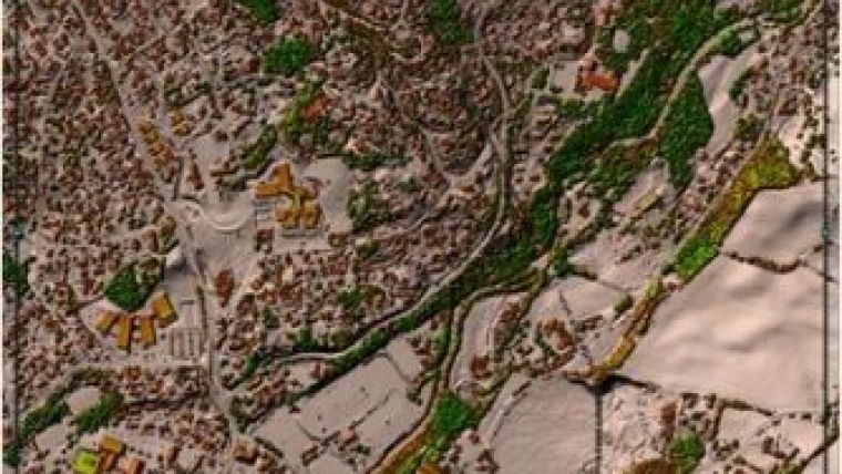
Not a new technology
![]() Laser scanning is by no means a new phenomenon. Blom started with laser scanning back in the mid 90s. Over the last decade laser scanning from aircraft has evolved to a de facto standard in mapping projects. Blom itself operates five planes and two helicopters serving the Nordic mapping market.
Laser scanning is by no means a new phenomenon. Blom started with laser scanning back in the mid 90s. Over the last decade laser scanning from aircraft has evolved to a de facto standard in mapping projects. Blom itself operates five planes and two helicopters serving the Nordic mapping market.
However, the adoption of laser data for design and engineering purposes has not been as fast as expected, admitted Andresen. New technology needs to be learned and find its place in established work processes. But not even the software tools have kept pace unfortunately.
Exchanging 3D point cloud data
Vianova Systems now can read LAS data directly into the new BIM solution for infrastructure, NovapointDCM and QuadriDCM. The LAS format is an international, standardised format for exchanging 3D point cloud data between systems. The format includes classes making it possible to distinguish vegetation, ground points and other object classes such as bridges, buildings, poles, masts, wires and so on. The objects may be further processed and refined in the terrain model, often in combination with other vectors or surveyed data.
LAS data are really just a dense 'cloud' of xyz points, often with a colour value attributed. The colour value can be acquired from pictures taken simultaneously as the laser scanning, or from other images of the area.
Potential
The accuracy and visualisation power of point clouds represents a great potential, said Håkon Andresen. In his opinion there is still too much contour data in use. Today you should not really need to create contour lines if you can read point clouds and have good routines for processing such data.
In order to gain advantage of this in infrastructure design modelling, point cloud functionality of course needs to be part of the software tool. The problem is that the model tools on the market originally were written for single point and vector data, not dense point clouds from laser scanning. Therefore, the tools need to be reprogrammed to handle the new requirements for large data volumes, memory management, 3D graphics and computational algorithms.
This is what Vianova exemplary has addressed and made possible with its new object-based BIM solution, said Andresen. Vianova sees a great potential in being able to read and process laser data in their solution, a BIM solution already in use in large design projects.
Accuracy and point density
Blom typically provides better than 5-10cm height accuracy in the terrain model. The accuracy and point density depends on the flying altitude, but even from 2000 metres the accuracy is about 10cm on flat and well-defined surfaces! From a helicopter flying 300-400 metres above ground the accuracy is 2-5cm with a density of 40-60 points per square metre. And this with correspondingly high resolution for images.
From a flying altitude of 2000 metres a plane can laser scan 1000-1500km2 per day. A typical terrain corridor for a road project can be completed in a few hours by helicopter. The scanning service is supposed to be very competitive.
It is easy to think that the more points you have, the better it is. But this is a trade-off. One can certainly get by with fewer points, in case the representation is good enough. You do not need the same number of points where the terrain is flat as where it is rugged.
Blom provides post-processing and 'thinning' of the data where there is less need for point density. For the sake of efficiency it is important not to deal with unnecessary data in the engineering process.
High point density: usability increases
However, with higher point density the usability increases of course. This is an assessment and decision you have to make. You can also edit and enhance the data set if you have other information to rely on. For example, it can be interesting to enrich the model by transforming parts of the point cloud data to usable individual objects – such as road elements, buildings, utility lines, structures, etc. This is something they do a lot of work on at Blom. The company is continuously improving routines for converting point cloud parts into independent objects that can be of additional use in the terrain model.
Errors and omissions
Experience from the construction industry tells that costs are significantly reduced and quality improved if you have a good model to design and build from, Andresen said. He referred to experience from several large infrastructure projects in Norway showing that overall project costs can be reduced by 5% using a joint collaboration BIM model. If the basic terrain model is imperfect, it goes without saying that it is difficult to accomplish a flawless design and construction process.
Other software tools on the market should follow Vianova's example in supporting point cloud data, because going forward you will definitely not see less, you will only see more and more laser data, postulated Andresen.
Natural part
But, as with any new technology, this also needs maturing. Still many people see a point cloud as a 'scary' dataset, experiences Blom. There are many good reasons why this is so. Blom has to work more closely together to do better going forward. It wants customers to be able to work with laser data the same way they currently work with aerial photos for example. As with other common data types it should be a natural part of the workflow. Vianova Systems has done a great job in making it possible to read laser data as an integral part of the work process, Håkon Andresen concluded.

Value staying current with geomatics?
Stay on the map with our expertly curated newsletters.
We provide educational insights, industry updates, and inspiring stories to help you learn, grow, and reach your full potential in your field. Don't miss out - subscribe today and ensure you're always informed, educated, and inspired.
Choose your newsletter(s)


