Total Stations: the Surveyor’s Workhorse
Features, Status and Trends
A total station is an angle measuring device, also known as a theodolite, integrated with an electronic distance measurement (EDM) unit. The integration provides the ability to measure horizontal and vertical angles as well as slope distances using the same device at the same time, which benefits the surveyor in terms of portability, convenience and speed. Today, total stations have a wide variety of capabilities and are extensively exploited in cadastral surveying, civil engineering and on construction sites. Read on for a synopsis of features, status and trends.
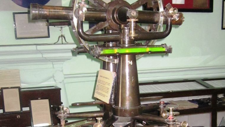
For many decades, and up until the 1960s, theodolites were the major surveying instruments for collecting geodata referenced in an Earth-fixed coordinate system. Figure 1 shows a theodolite used to measure the geodetic backbone of India in the 19th century, an endeavour which took many decades and to which the name of the Welshman George Everest (1790) is inextricably connected. Indeed, the highest mountain on Earth – Mount Everest with a height of 8,848m above sea level – is named after a land surveyor. George Everest was surveyor-general of India from 1830 to 1843. Figure 2 shows a modern surveyor in India in action using a total station to map a rural area which is scheduled for urbanisation.
From Theodolites to Total Stations
Theodolites measure angles, and the computation of coordinates also requires distances which in the past were measured with chains or measuring tapes. Without careful precautions, the chains and tapes produced inaccurate results. An important innovation that made distance measurements less cumbersome was electronic distance measurement (EDM). Developed around 1940, EDM became commercially available in the 1960s. Figure 3 demonstrates the evolution from theodolite to today’s total station and displays from left to right: Wild T3, a theodolite introduced in 1925; Aga Geodimeter 14, a commercial EDM device manufactured in 1970; EDM mounted on a theodolite, the HP 3820A; Ruide RTS R5, introduced in 2009; Linertec LGP300, introduced in 2014; Trimble S9, introduced in 2015; and Leica SmartStation provided with GNSS receiver on top. To the naked eye there are no striking differences, and this is not really surprising as the basics of operation have remained the same; since their emergence, total stations have always measured two angles – horizontal and vertical – and the range, or slope distance, to a target point. The revolution resides inside: microprocessors, solid-state memory, sensor technology and wireless communication. These innovations have been gradually incorporated in the devices over time, and all of them further improved the efficiency of surveying workflows and the quality of the resulting data.
EDM Principles
EDM units employ electromagnetic (EM) energy for measuring the slope distance to a target point. Two principles are in use: phase shift and pulse – also called ‘time of flight’ – measurements. The EM energy may be emitted as infrared carrier signals, generated by a small solid-state emitter within the instrument’s optical path and modulated as sine waves. The phase of the returning signal is compared to the phase of the emitted signal. This can be done with a precision at the millimetre level. However, the total number of full cycles is still unknown and multiple wavelengths are used to obtain them. The other method uses laser pulses. The travel time of the pulse to and fro (Δt) is measured and, by multiplying that by the speed of light (c) and dividing the result by two, the distance (d) can be accurately calculated (Figure 4). This is why the laser pulse method is also called time of flight (ToF) measurement. Some total stations combine both measurement principles in one and the same instrument. With a precision ranging from sub-millimetre to sub-centimetre level, the phase shift method is the most accurate one but its measuring range is limited to around 100m. ToF EDM units can measure distances of up to 10km or more, depending on atmospheric conditions and the type of prism used, but their precision usually ranges from sub-centimetre to centimetre level while the accuracy deteriorates with increasingly shorter ranges.
Prism
The EM signal will be reflected by any surface it meets. The strength of the return will depend on how the incident signal interacts with the surface; it may be reflected, absorbed or transmitted. Only reflected beams will reach the instrument and thus will be of use, but some types of reflection are better than others. Ideally, a surface behaves as a diffuse reflector: reflections are of the same strength in all directions and thus the energy level reaching the instrument is highest. In contrast, however, when behaving as a specular surface, which acts as a flat mirror, the reflection is deflected and little or no signal will be received by the total stations. Only when the mirror is perpendicular to the path will most of the signal reflect in the direction of the instrument (see Figure 5, top). To overcome this issue, three mirrors or reflective prism faces, which are mutually perpendicular, reflect beams back in the direction of the source, but shifted (see Figure 5, bottom). Several prisms can also be combined to increase the reflected energy and thus to increase the distance to be bridged and/or to improve accuracy. For example, with one prism Topcon’s IS has a reach of 3km, with three prisms 4km and with five prisms 5km. Prisms are used for both ToF and phase shift EDM units. Depending on the application, the surveyor can choose from a large variety of prisms (Figure 6).
Reflectorless EDM
Reflectorless EDM has become standard in surveying. Today, up to 1km can be bridged without using a prism. This ability of EDMs eliminates the need to access the target. The range depends on the strength of the emitted signal and the reflectivity and geometry of the target. Inaccessible objects or targets located at dangerous sites can thus be mapped easily. The detection of returns from bare surfaces, i.e. using no prisms, requires laser pulses with a high energy level, typically in the range of 1 to 20 watts. In contrast, most phase-based EDMs using prisms emit signals at a level of a few milliwatts. Since the signal may reflect upon any surface present in the line of sight, blunders may easily occur. For example, the signal may be reflected by a leaf that whirls through the line of sight. Another concern is beam divergence, i.e. the increase in beam diameter with distance from the source: the greater the distance, the larger the footprint (Figure 7). This may cause errors or decrease accuracy.
Internal Processing and Storage
If the total station is equipped with an inbuilt microprocessor the initial observations – horizontal and vertical directions and slope distance – can be further processed to angles, horizontal distances and x,y,z coordinates of the target point in a preferred Earth-related reference system. If it is equipped with sensors which measure atmospheric temperatures and pressures the processor can calculate corrections to the initial measurements. The data collected is stored in an inbuilt electronic notebook which usually has sufficient capacity to store the data points collected during an entire working day. Once uploaded to a processing computer or server, the data can deleted from the notebook so it is ready for re-use. However, losing data after a productive day is not only frustrating, but also and above all a waste of time and hence money. It is therefore advantageous when the data stored in the notebook can be regularly exported to external data storage media such as a USB flash drive or an SD memory card.
Workflows
The observations collected in the field can be imported into a (ruggedised) laptop and processed on site to check the survey for completeness and sufficient redundancy and to perform other quality-related procedures. When the results are satisfactory they can be uploaded to the server at the office via the internet, or even be stored in the cloud. A visit to the office can thus be avoided and the field surveyor can download his next assignment on his laptop while in the field or at home. Use of the internet thus enables a significant productivity improvement. On the other hand, this flexibility introduces a management problem: how does the chief surveyor in the office know where the equipment is, if it has been stolen or if it requires recalibration or maintenance? Some of the latest total stations are equipped with software which allows managers to check where the total station is and the status of the firmware and the software.
At some construction sites, e.g. where tall buildings have to be driven in the vertical direction to within the millimetre, the number of prisms may be so high that the total station may become confused and pick the wrong prism. Some total stations have provisions so that they know which prism is their ‘mate’. Another additional functionality which makes life easier for the surveyor, especially when surveying tunnels or underground mines, is a laser pointer which visualises targets that are further away from the instrument.
Evolution
The total station was first introduced to surveyors under a variety of names, including electronic tacheometer and EDM theodolite. Initially, Total Station was a proper noun introduced by Hewlett-Packard (HP) to promote its Model 3810A around 1975. Probably because of its tunefulness to the ear, surveyors soon applied the term to all theodolites with a built-in EDM unit and total station became a common noun, written without capital letters. Over time, and keeping pace with the microelectronics revolution, the primal design of the total station has been extended with features which have made surveying faster and more convenient. Servomotors enable horizontal and vertical angle movements, thus saving time when staking out coordinates as the telescope aims itself and the surveyor just needs to put the prism in the relevant position. The prism is pinpointed through either radio signals or imaging. The first motors were mechanically geared but today’s stepless magnetic motors operate quickly and silently. A next step was to employ wireless communication so that operation can be steered by an external controller mounted on the pole. Such robotic total stations enable surveys to be conducted by just one person, thus saving labour costs. At least two known points in line of sight of each other are required: one for positioning the instrument above and the other to determine the azimuth. To eliminate the need for known points it is logical to extend the total station with a GNSS receiver. The GNSS unit can also be mounted on the prism pole for fast data capture, although signals may be too weak in the vicinity of trees or buildings or if high accuracy is required. Here, the total station takes over. The dual configuration increases the efficiency of massive data collection, while surveys can be conducted by one person.
Imaging and Laser
Digital cameras have also been mounted into the telescope, coaxial with the optics and the EDM. The snapshots allow the site to be documented and notes to be written using a digital pencil on the total station’s screen. This reduces the need for office-based post-processing and may also avoid trips back to the field. As the image is stored together with the coordinates of both station and target points, orthoimagery can be created. Imaging also enables tracking of the prism and its recapture if it becomes lost due to objects passing through the line of sight. A proven method to increase the accuracy is measuring the same target many times and averaging the values. Using software based on computer vision research, the same feature can be automatically detected in a series of images gained during repetition measurements. This enables automatic improvement of accuracy – it just takes a little time. Today, terrestrial laser scanners (TLSs) have gained wide acceptance. A TLS and an EDM unit have much in common: a TLS also operates without a prism, and both employ either pulsed laser or range measurement through phase shifts. Therefore, it makes sense to extend a total station with the TLS ability to collect a point cloud. The part of the scene is indicated as a window on the screen by the surveyor in real time together with the specification of horizontal and vertical intervals. The rate of data capture of grid scanning is just a thousandth of what a TLS can accomplish as it is merely an additional facility on the total station. The results can be processed in the office using point cloud processing software.
Concluding Remarks
The broad range of different types of total stations may appear dazzling if you intend to renew your equipment (Figure 8). Which one should you select? The latest and most sophisticated one? There are so many functionalities to choose from. Which brand should it be? As usual, the more functionalities a tool has or the more sophisticated it is, the higher the price. Before making your purchase decision, it is wise to make a list of the types of surveys to be conducted and the accuracy required (Figure 9). It will often become apparent that a simple device will meet your needs, or even that a ten-year-old second-hand device is good enough for staking out enumeration boundaries for census purposes in a developing country. And one thing is for sure: no matter how advanced a device may be, if it is not in the hands of a skilled person the output will be garbage.
Total stations on the market
For an overview of total stations available on the market it is strongly recommended to visit www.geo-matching.com.
Author
Mathias Lemmens gained a PhD degree from Delft University of Technology, The Netherlands. He is an international consultant and is the author of the book Geo-information – Technologies, Applications and the Environment published by Springer in 2011.

Value staying current with geomatics?
Stay on the map with our expertly curated newsletters.
We provide educational insights, industry updates, and inspiring stories to help you learn, grow, and reach your full potential in your field. Don't miss out - subscribe today and ensure you're always informed, educated, and inspired.
Choose your newsletter(s)


