UAS Photogrammetry for Mapping Mountains
Rapid 3D Mapping of Mount Erciyes, Central Turkey
Unmanned airborne systems have great potential for rapidly mapping mountainous areas, to minimize risks to mountaineers and first responders.
High mountains are attractive places for outdoor sports. However, sometimes they change from recreational areas into hazardous ones. All year round, falling rocks and landslides endanger hikers and mountaineers and may cause casualties. To avoid mountaineers setting foot on tracks that are prone to landslides or where they may get crushed by rockfalls, high-quality maps of recent data are needed. In this article, the authors show that unmanned airborne systems have great potential for rapidly mapping mountainous areas.
Hikers and mountaineers following mountain tracks may get injured by falling rocks or shifting slopes, and first responders may subsequently become victims when attempting to rescue them. To reduce risks, information on the condition of the tracks is crucial, especially in the shape of high-quality 3D maps of recent data. Several techniques can be exploited to carry out 3D mapping of mountains on a regular basis. Conducting field surveys is one such approach. Field surveys are reliable but time consuming, costly and – when the terrain is inaccessible, such as in areas with extreme variations in altitude – difficult to execute. Satellite images and manned aerial photogrammetry do not require access on foot, but the spatial resolution of the images is often too low while the acquisition costs are usually high. This raises the question of the suitability of unmanned airborne systems (UASs) as an alternative for mapping inaccessible mountains. A pilot study executed in Central Turkey demonstrates that UASs are able to rapidly produce high-resolution digital surface models (DSMs) and orthoimages of steep-sloped mountains.
Mount Erciyes
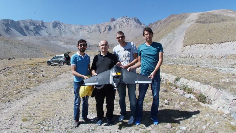
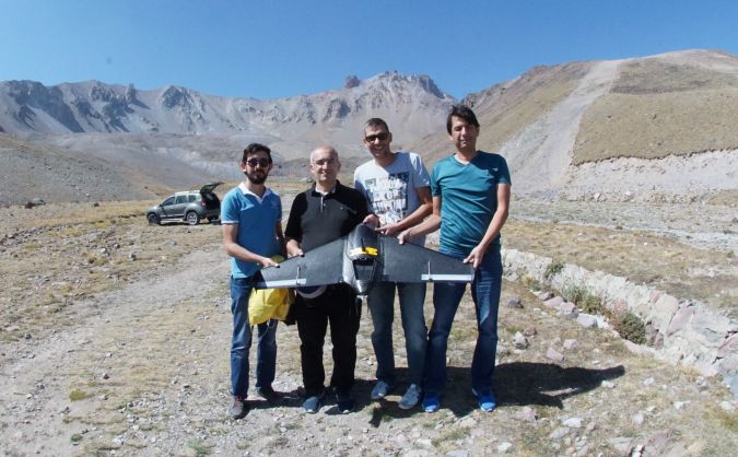
The survey aimed to create a DSM and an orthoimage of Mount Erciyes located in Central Turkey, 15km south of Kayseri. At the foot of the mountain, at a height of 2,150 metres, is a winter sports resort. At its peak, the summit of Mount Erciyes is 3,917 metres above sea level. The survey team was accompanied by a professional mountaineer and Prof Dr Erkan Beşdok, head of the Geomatics Engineering department of Erciyes University. After inspecting the map, Çoban İni, a camp area located at the north east of the summit at a height of 2,858 metres (Figure 1), was chosen as a suitable launch and landing site for the UAS. Built by the Turkish firm ATLAS Unmanned Systems, the fixed-wing aircraft has a span width of 1.2m and a weight of 2.3kg, and it can stay in the air for 70 minutes.
Constraints
To demonstrate the feasibility of the use of a UAS for mountain mapping, several constraints were set for the aerial survey. To test the efficiency of UAS technology under heavy time constraints, the area had to be captured within one flight only. Repeated launching and landing would take up too much time if a casualty had occurred and a rescue team were preparing for their life-saving operations under critical time constraints. The launch site was also selected because of time constraints; the winter sports resort is just a 30-minute car ride from the launch site.
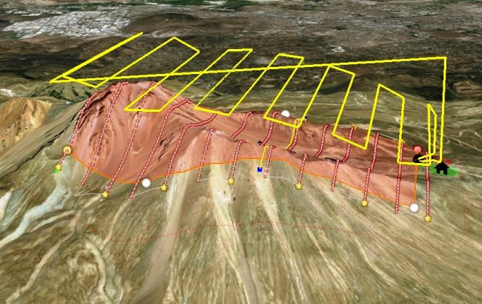
The region has very steep slopes and the height ranges from 2,858m at the launch site to 3,917m at the peak of Mount Erciyes. The flying altitude of the UAS varied from 3,337m to 4,231m. To obtain a constant ground sampling distance (GSD) of 7cm, the flight trajectory was defined in 3D enabling the aircraft to maintain a fixed height above the ground. After launch, the UAS first climbed to the peak height of the survey and then descended gradually. The flight time was nearly 50 minutes, the average speed was 88km/h and the distance flown was 64.5km.
Survey and Products
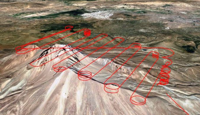
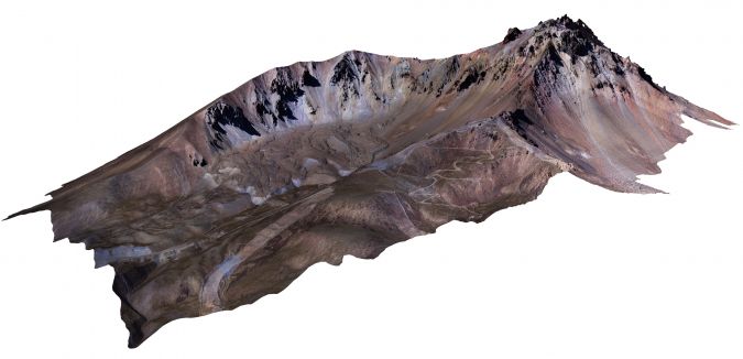
The survey was conducted in mid-September 2017. The UAS was fitted with a Sony α6000 camera. Equipped with a Sony E 20mm f/2.8 lens, the image size of the camera is 23.50 x 15.60mm and its effective resolution is 6,000 x 4,000 pixels. To obtain the GSD of 7cm, the average flying height was set to 350 metres. 13 north-south parallel lines with a mean length of 3km were flown, with along-track and across-track overlaps of 80% and 30%, respectively. Capturing images at predefined positions instead of using time intervals guarantees the minimum number of images when there is a headwind or aft wind, and also reduces the processing time. The images were therefore taken at coordinates which were determined by the ATLAS Mission Planner (Figure 2). Figure 3 shows the trajectory. The area covered was approximately 1,359 hectares, resulting in 569 images. The images tagged with exterior orientation parameters, consisting of the three angles defining image plane pose and the 3D position of the projection centre during exposure, were processed with Pix4DMapper software running on a PC with an Intel i5 processor and 12GB RAM. The software generated a DSM and orthoimage (Figure 4). This 3D mapping exercise was executed within 24 hours including travel times, flight planning, carrying out the flight and creation of the DSM/orthoimage.
Concluding Remarks
This pilot project has shown that UAS photogrammetry is a feasible alternative for high-altitude mapping with the advantages of low cost, short mission time, high resolution and flexibility. The low cost and modest time requirements for surveying and processing pave the way for regular UAS surveys of high-altitude areas. Such UAS surveys make it possible to track the surface changes and to keep the 3D maps of the region up to date, which is important for hikers and mountaineers as well as for first responders in case of a rescue mission. The UAS used in this pilot can also be deployed to survey snowfall/glaciers to track climate change, and to make inventories of avalanches, landslides and debris flows.

Value staying current with geomatics?
Stay on the map with our expertly curated newsletters.
We provide educational insights, industry updates, and inspiring stories to help you learn, grow, and reach your full potential in your field. Don't miss out - subscribe today and ensure you're always informed, educated, and inspired.
Choose your newsletter(s)


