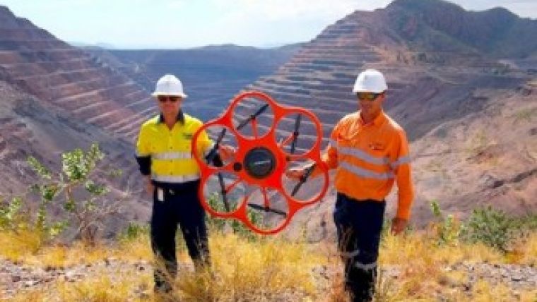
UAV Surveys Diamond Mine in Australia
CADS Survey, an Australian supplier of marine, pipeline and civil surveying services, together with C.R.Kennedy & Co, a national importer and distributor of surveying equipment in Australia, and the German drone manufacturer Aibotix have surveyed one of the world’s largest diamond mines using the Aibot X6 UAV (unmanned aerial vehicle). Hereby they successfully executed a so-called negative waypoint flight, 100 metres below the pilot’s position.
The aerial survey of the Argyle Diamond Mine in Western Australia meant an interesting challenge: equipped with a high-resolution digital camera, the Aibot X6 did not only have to vertically photograph the flight from an angle, but had to execute a negative waypoint flight as well. This means that it had to follow a route previously planned on a computer, running 100 metres below the pilot’s position.
The UAV covered almost 100 hectares of the 300 metres deep mine and captured high-resolution pictures in eight flights. Each of them with a flight duration of 10 to 15 minutes. The hereby collected data were further processed into an orthophoto, a point cloud and a 3D model, all with a Ground Sample Distance (GSD) of 2 to 6cm.
Sam Van Eldik, survey division manager for Civil and Aerial at CADS Survey, said he was impressed by the accuracy of the generated data. Using the Aibot X6, his company was able to generate data of the open pit mine with an accuracy which would not have been reached with a common airplane.
CADS Survey will continue to work with the senior surveyor from the owner Rio Tinto Limited at their Argyle Diamond Mine, using the Aibot X6 UAV to monitor the mine for subsidence on a monthly basis
Argyle Diamond Mine
The Argyle Diamond Mine is located in Western Australia in the rugged East Kimberley region. It is owned and managed by Rio Tinto Limited and supplies the largest volume of diamonds, approximately a fifth of the world's production. The mine consists of an above ground and an underground area. Since the open pit mine cannot be entered below a level of 50 metres, aerial surveying is the only possibility to detect subsidence or other potential dangers to the workers underground at an early stage.
Technical Details
- Camera: Nikon Coolpix A
- Sensor resolution: 16.2 Megapixel
- Flight height: -100 m to +150 m
- Image overlap: about 60% - 90%
- Ground Sample Distance (GSD): 2 cm - 6 cm
Data Processing
- Synchronisation of the GPS information with the images shot by Aerial Image Manager for a fast post-processing
- Further processing with photogrammetry software Agisoft PhotoScan
Learn more on the Aibot X6 at Geo-matching.com.

Value staying current with geomatics?
Stay on the map with our expertly curated newsletters.
We provide educational insights, industry updates, and inspiring stories to help you learn, grow, and reach your full potential in your field. Don't miss out - subscribe today and ensure you're always informed, educated, and inspired.
Choose your newsletter(s)


