UAVs Revolutionise Land Administration
In 2014, a joint publication by the World Bank and FIG noted that 75 percent of the world’s population do not have access to formal systems to register and safeguard their land rights. Therefore, there is an urgent need to build affordable and sustainable systems to identify the way land is occupied and used. The emergence of smaller and more affordable UAS technology, combined with recent advances in highly automated mapping techniques, offers a new tool and methodology for producing faster and cheaper spatial data. In turn, this can benefit land administration agencies and help to secure property rights for millions of people around the world.
A World Bank team tested the use of UAS as a way to accelerate the production of fit-for-purpose spatial data, thereby allowing local and national governments and the private sector to use the up-to-date and accurate data for multiple purposes. The tests were conducted in Albania, which was chosen due to the urgent need for new and improved cadastral maps there.
Testing Low-cost Solutions
With the aim to test low-cost solutions, the team used off-the-shelf components and open-source software to the largest extent possible. The following major tests were successfully conducted:
- Rural mapping applications: a rural area was chosen to test whether unmanned aerial vehicles (UAVs) could be used to quickly and reliably deliver high-resolution orthophotos for administering compensation related to expropriations for infrastructure projects. The exercise was also used to test the technology for cadastral surveying with a strong component of citizen engagement. The resulting product, an orthophoto with 2cm accuracy, provided an absolute base against which the accuracy and relevance of existing spatial information could be checked
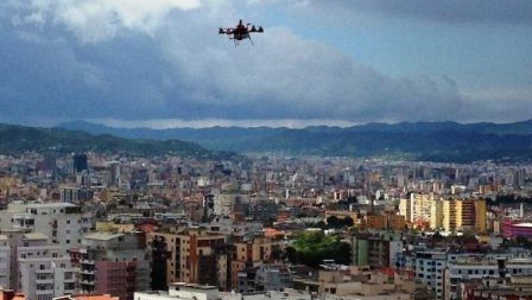
- Urban mapping applications (see Figure 1): an urban area was chosen to test whether UAVs could be used to provide detailed maps of densely developed urban areas with multi-storey buildings. 3D modelling using vertical photography was also tested
- Peri-urban applications: a peri-urban development was chosen to test whether UAVs could be used under production pressure in urban and peri-urban areas, and for legalisation/regularisation initiatives. Oblique photography was also added for enhanced 3D modelling.
Fit-for-purpose Land Administration
The joint World Bank-FIG publication defined the ‘fit-for-purpose’ approach as one that focuses on citizens’ needs rather than top-end technology. It should be flexible, attainable, reliable, inclusive, affordable, upgradeable and allow for stakeholder participation. The tests in Albania demonstrated that UAS technology is indeed fit for purpose as it includes the elements flexibility, inclusivity, participation, affordability, reliability and upgradeability.
Flexibility
Given the small form factor, low take-off weight, open source-driven flight planning, low acquisition cost and field reparability, UASs are flexible both in terms of ease of mobilisation and the specific purpose. The vertical take-off and landing (VTOL) capacity of the specific platform chosen for the Albania context allowed for engagements in rural as well as congested urban environments. Compared to conventional aerial photography methods, UAS technology is more adaptable to weather conditions, including dark cloud cover and winds of up to 8m/s.
Continue reading in the online edition of GIM International.

Value staying current with geomatics?
Stay on the map with our expertly curated newsletters.
We provide educational insights, industry updates, and inspiring stories to help you learn, grow, and reach your full potential in your field. Don't miss out - subscribe today and ensure you're always informed, educated, and inspired.
Choose your newsletter(s)


