USAID Development Data Now Contained in ArcGIS Online
The US Agency for International Development (USAID) launched the agency's first-ever crowdsourcing initiative to clean and map development data such as guarantees, loans disbursed, and available financing. Volunteers used a crowdsourcing tool created with Esri technology to find the required location information. This data can now be easily visualised on an Esri Story Map and in ArcGIS Online, thus providing better insights which will help the private sector explore new areas for collaboration with host countries, researchers, development organisations and the public.
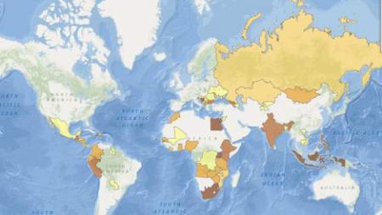
USAID's GeoCenter worked in cooperation with the agency's Development Credit Authority (DCA) to identify a global dataset of approximately 117,000 records to map and make available to the public. The data-cleaning and geocoding process was crowdsourced among volunteer technical communities including the Standby Task Force (SBTF) and GISCorps. All the work was completed in just 16 hours—44 hours earlier than expected.
Visualising the data on a map can change the way USAID's field missions plan for guarantees as well as where they invest development dollars to maximise their impact. By seeing where the loans are concentrated, USAID missions can better analyse whether the guarantees are fully reaching targeted regions.
To view a Story Map application displaying the crowdsourced data and success stories, visit Esri Story Map. To make your own story map with the crowdsourced data and maps, visit Esri Story Map.

Value staying current with geomatics?
Stay on the map with our expertly curated newsletters.
We provide educational insights, industry updates, and inspiring stories to help you learn, grow, and reach your full potential in your field. Don't miss out - subscribe today and ensure you're always informed, educated, and inspired.
Choose your newsletter(s)


