Visiona and Tesera Announce High-resolution Forest Inventories R&D Project
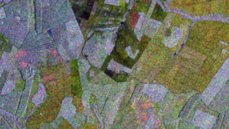
Visiona Tecnologia Espacial, a Brazilian company, and Tesera Systems, a Canadian company, have been approved for a joint R&D project to create high-resolution forest inventories for the Brazilian forest sector with remote sensing solutions from Visiona’s portfolio, including optical and radar imageries. The project is co-financed by the Brazilian São Paulo Research Foundation (FAPESP) and the Government of Canada through the National Research Council of Canada Industrial Research Assistance Program (NRC IRAP).
The usage of the optical and radar imageries is set to contribute to expanding Tesera’s expertise in creating high-resolution forest inventories which, up to now, is based on a combination of airborne Lidar and colour infrared imagery for the Canadian market. The predictive performance resulting from combinations of different satellite sensors is an expected outcome of this project. Visiona and Tesera intend to build the means to optimally combine different imagery and generate high-resolution inventory data and analytics according to customer specifications. The participation of some customers in the R&D project is aimed to contribute to designing a product that effectively meets their needs.
Visiona is a joint venture between the Embraer and Telebras groups devoted to the integration of spatial systems. Created in May of 2012 as a result of a Brazilian government initiative to meet the National Program of Spatial Activities’ (PNAE) goals, the company spearheaded the Brazilian Government's Geostationary Defense and Strategic Communications (SGDC) satellite system and is leader in the Brazilian satellite remote sensing market.
Founded in 1997, Tesera Systems, is an employee-owned company that specialises in systems integration and application development, utilising open-source platforms, cloud, machine learning techniques applied to remote sensing and ground plot data to predict variables of forestry interest, which are used to create operational high-resolution forest inventories for use by the forest sector.

Value staying current with geomatics?
Stay on the map with our expertly curated newsletters.
We provide educational insights, industry updates, and inspiring stories to help you learn, grow, and reach your full potential in your field. Don't miss out - subscribe today and ensure you're always informed, educated, and inspired.
Choose your newsletter(s)


