Singapore: Towards a Smart Nation
Underpinned by a 3D National Map
Since the inception of its Smart Nation programme in 2014, Singapore has emerged as a world leader in smart city initiatives. One of the centrepieces of Singapore’s strategy has been the development of a highly accurate, 3D digital map of the country to support key functions such as urban planning, flood control and civil aviation. The creation of this national 3D map has involved the use, adoption and development of world-leading surveying, mapping and GIS technologies. Read on for an article explaining the various challenges in creating and maintaining the required data, and how it will be used to its fullest potential.
The city state of Singapore covers an area of just 718km². With the current population of 5.5 million expected to increase by 10% to 6 million in 2020, Singapore’s government has proactively launched its Smart Nation agenda to ensure that the quality of life for residents is not only improved, but also maintained in the future. While other countries may not face the same limitations as Singapore in terms of land availability – for example, the USA is over 13,000 times larger than Singapore by area – other cities around the world are presented with similar challenges in terms of managing populations of increasing size and density. In Singapore, a technology-driven approach has been adopted to tackle these issues, as geospatial technologies help to maximize the use of land resources in a region with only limited space. Therefore, as part of the Smart Nation programme, the Singapore Land Authority (SLA) has been tasked with leading the development of a high-resolution 3D national topographic map.
A Challenging Environment
The first phase for creation of the 3D national map involved undertaking an airborne Lidar and imagery survey. With its equatorial climate, volatile weather, low cloud conditions, military restrictions on civil aviation and close proximity to neighbouring Malaysia and Indonesia, Singapore presents a very challenging environment for aerial surveying. In addition, one of the world’s busiest airports, Changi, further complicates aerial survey access in and around Singapore. AAM Group, which was awarded the competitive contract in 2014 to capture and deliver the first phase of the national 3D map project, utilized a two-aircraft approach to make the most of the limited availability of survey windows. One aircraft was focused on imagery capture while the other was dedicated to Lidar, which could also be conducted at night.
Security Restrictions
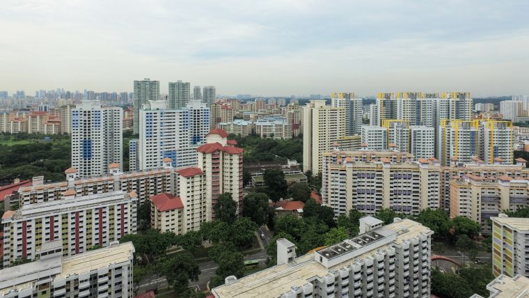
Due to strict data security requirements, all processing must be undertaken in secure government facilities within Singapore. This required a dedicated one-off computer set-up coupled with security clearances for key personnel. Once established during the first phase, AAM teams began the task of generating 3D models for the approximately 160,000 buildings that make up Singapore’s urban landscape (Figures 1 and 2). Since completion in January 2016, this part of the project has won a number of awards in the geospatial industry, largely due to its unprecedented achievement of mapping an entire country using established open standards – such as CityGML – to ensure the model is interoperable and future-proof.
Street-level Surveys
Singapore’s attractive tree-lined streets and dense built environment restrict the features that are visible from the air. To overcome this, SLA issued a tender to capture mobile mapping data of the whole of Singapore’s 5,500km public road network. The mobile mapping survey included simultaneous mobile laser scanning (at a capture rate of over one million points per second) integrated with high-resolution spherical imagery (Figures 3 and 4). The data was then further processed to extract details of both natural and man-made features at street level. AAM Group was once again awarded the tender to undertake this work, which involved being reacquainted with some of the survey challenges from phase one, along with being introduced to a few new ones.
Smoke Haze
Once again, weather conditions created significant challenges for the ten-month long campaign to map Singapore’s streetscape. Acquisition began in September 2015 and was completed in June 2016. In addition to monsoonal rain periods, Singapore also encountered a severe spell of smoke haze in October 2016. This condition occurs periodically due to forest fires in neighbouring countries resulting from the common practice of open burning to clear land for agricultural use. The intensity of the smoke haze varies from year to year, depending on various conditions including wind direction and rainfall. At peak levels, visibility was severely reduced and image quality compromised, affecting the ability to utilize the imagery in downstream tasks such as modelling and feature identification.
Flexibility
As with any vehicle-based survey in a built-up urban environment, there is also traffic to contend with. Adaptive planning and scheduling was required to survey areas at the most suitable times. A seven-day roster was implemented, with weekends being used predominantly for the central business district (CBD) and industrial areas and leaving largely residential areas for weekday operations. Mobile mapping surveys in urban networks also add new degrees of complexity compared with open highway environments. Significant additional capture and processing techniques needed to be put in place to ensure complete coverage, especially around complex intersections and flyover sections. A combination of both fundamental and leading-edge land survey techniques was also employed to ensure a suitable level of accuracy, especially in Singapore’s tunnels and seemingly endless urban canyon environments.
Detailed Integration
With the initial data acquisition now completed, work is currently underway to produce 3D models from the data. Phase two will see models created for the transportation network and city furniture, including objects such as bus stops, street lights, traffic lights and overhead bridges. These models are being integrated with the terrain and building models produced from the first phase of the national 3D map project. One of the key components of this integration is adoption of the CityGML standard, which is an open data model and XML-based format for the storage and exchange of virtual 3D city models, developed by the Open Geospatial Consortium. A CityGML schema has been developed for models from both projects, allowing the data to be seamlessly combined, analysed and shared across various departments. Guy Perry, former executive director of Asia-Pacific at AECOM, describes the detail and resolution of the 3D national map as being “at a level of integration and scale that no one else has done yet”.
Virtual Singapore
One project that is showcasing the scale and detail of the 3D national map is Virtual Singapore, which is a collaborative 3D planning tool currently being developed by the National Research Foundation (NRF) in collaboration with Dassault Systemes (Figure 5). The platform – which is scheduled to be ready in 2018 – will contain both static and real-time data, allowing users to simulate present and future scenarios alike. 3D models generated from both phases of the SLA projects will make up a large proportion of the static data to be fed into the system. With the vast amount of sensor data to be incorporated into the static model, Virtual Singapore will form a digital to-scale model of a living, breathing city. Some of the key topics to be initially tackled in Virtual Singapore are renewable energy, waste management and neighbourhood walkability. Other potential applications include prediction of disease propagation and detailed analysis of both new and existing public transport routes.
Living Laboratory
The Virtual Singapore platform has been described as a ‘living laboratory’ in which a range of smart city initiatives can be trialled and perfected. Through its capabilities as a collaborative platform, Virtual Singapore will also facilitate communication between stakeholders from government, industry and the general public. Another key example is the space management application (named GISD) that AAM has developed for JTC Corporation, which is Singapore’s principal developer and manager of industrial estates and their related facilities. GISD is a browser-based platform focusing on facility management. Functions include the ability to analyse available office space in a building and to build linkages with other JTC systems, such as property tax. This system incorporates 3D models from the SLA project for surrounding context, along with detailed models of the individual buildings, including internal features converted from existing BIM models. For JTC, this application is hosted on-premise and accessed through the intranet. In other regions of the world, such as Australia and New Zealand, there is a large movement towards (internet-based) cloud platforms to support and embrace collaboration to aid in making informed decisions. AAM’s GEOCIRRUS is an example of such a collaboration platform, in which technology is a key component in disseminating geospatial data to the appropriate stakeholders for action.
Build It and They Will Come
Use cases such as Virtual Singapore and GISD are only the beginning. An article in The Wall Street Journal last year stated that “when such huge volumes of data are collected and cross-referenced, experts say, applications emerge that are difficult to imagine until the material is available in the first place”. So, we have a Field of Dreams-type scenario: “Build it and they will come.” Data from phase two of the mobile mapping survey is currently being used by various organizations conducting trials at the One-North autonomous vehicle test site. In 2016, NRF released a grant call allowing government, private and research organizations to pitch ideas of what additional applications could benefit from accessing the 3D national map data. Singapore represents a unique environment of geographic and political stability which allows forward-thinking initiatives such as this to flourish. In this sense, Singapore truly is a living laboratory and test bed where technology is and will continue to be used to improve the lives of all citizens.
Defining ‘Somewhere’
Singapore has long served as a beacon for South East Asia in progress and innovation. With its advances and developments in smart city solutions, the city state can now set examples for the rest of the world to follow. Everything that occurs in this world has one thing in common – it occurs ‘somewhere’. Accurate, detailed and up-to-date geospatial information connected with sophisticated access platforms allow that ‘somewhere’ to be defined, leading to a myriad of applications and benefits. In this sense, geospatial information – or, in Singapore’s case, the 3D national map – provides the framework or backbone for the Smart Nation initiative.
Further Reading
Virtual Singapore: https://www.nrf.gov.sg/programmes/virtual-singapore
Aerial 3D mapping of Singapore: http://www.aamgroup.com/resources/pdf/Geocoxion-smart-vision-for-cities.pdf
About the Authors
Brian Nicholls is an executive director of AAM Group, based in Sydney, Australia. Brian leads AAM’s international team focusing on the development and provision of smart city and smart mapping solutions to government and private sector clients across Africa, the Middle East, India and the Asia-Pacific region.
b.nicholls@aamgroup.com
Daniel Kruimel is a business development manager for AAM in Singapore where he uses his previous survey experience to provide 3D mapping and smart city solutions to clients in the South East Asian region.
d.kruimel@aamgroup.com

Value staying current with geomatics?
Stay on the map with our expertly curated newsletters.
We provide educational insights, industry updates, and inspiring stories to help you learn, grow, and reach your full potential in your field. Don't miss out - subscribe today and ensure you're always informed, educated, and inspired.
Choose your newsletter(s)


