Still Work to do - RICS BIM 2015
This article was originally published in Geomatics World.
It seems that our QS colleagues are waking up to the potential that BIM has to offer, as Professor Ian Dowman discovered at the RICS’s 2015 BIM Conference. But data validation and standardization are key areas for development.
The theme of this year’s RICS BIM Conference was ‘Delivering efficiencies and cost savings throughout the project’s lifecycle’. There was a very strong emphasis on quantity surveying (QS). At the 2014 RICS BIM Conference there was an interest in data collection with a forward look to the use of BIM models for QS, facilities management (FM) and integration of design, build and management. It was clear from the 2015 conference that QS’s are becoming engaged in using BIM, although it was noted that there is slow development, and practitioners are not yet working fully in 3D.
Key issues which came out in the conference were validation, handing large amounts of data, standardisation, visualisation and collaboration. There was also an emphasis on using the design model for quantities and although facilities management was discussed it seemed less of an issue than twelve months ago. Your reporter was left looking for nuggets of interest for the geomatics professional and these come in the area of the need for data quality, visualisation, infrastructure projects and update.
Data ‘Obesity’ Can Be a Problem
The opening keynote was given by Terry Stocks, deputy head of the estates department, Ministry of Justice, on ‘Delivery of Level 2 BIM: Where are we now?’ His message was that there is still work to do, but there is good momentum behind BIM; the benefits are clear and the UK is a leading player. Government departments are moving towards 80% use of BIM by 2016 and there are proven savings in cost by using BIM of 20%. Stocks introduced the term ‘data obesity’ and stressed that users need to know in advance what data they want, in order not to collect too much. He noted that data is being provided to FM, but work is needed on the data exchange between the construction and operation stages which involves standardisation.
Trevor Woods from the DPW Group made the point that BIM models are used for a range of applications. He also noted that there is not enough collaboration between users and software designers. But his most important point was on the importance of validation. Although the software will import quantities in 10 seconds, validation of this information takes four hours. This point was also emphasisied by Gary Ross from Excitech who presented ‘Strategic business planning and the business case for BIM’. He stated that a big issue is the quality of models and data for handover (construction to FM) and that validation is very important. Several speakers discussed the Common Data Environment (CDE), linking project data and task data, and maybe there is a role for geomatics in data handling. Ross also mentioned resurvey, but although facility managers cannot always rely on design data, if the design model is good and generated with FM in mind, then as-built survey should not be necessary. This emphasizes the need for geomatics companies to be involved at all stages of a project to ensure that the survey data is of high quality and suitable for all stages of the work, and to advise when resurvey is necessary.
As-built survey was also discussed in a panel discussion and Alex Bywaters from the Highway Agency and Will Hackney from Transport for London & London Underground both stressed the importance of as-built survey, especially in FM. A delegate from HS2 suggested that it would be useful to resurvey stations at regular intervals during construction for monitoring and costing purposes.
Checking is Essential
James Fiske, director of product delivery and operations, Information Product Group, RICS BIM presented results from the Vendor Showcase Part 2. The results from part 1 had revealed an overall range of 3474m2 – 4781 m2 in the floor area of the RICS building measured from the BIM model compared to 4736 m2 from the measured quantity, a breakdown of individual items showed a range ±50%. This was put down to a number of reasons, including errors in the model, which emphasized the need to use professionals who understand the terminology, problems caused by lack of standardisation and the essential need for checking. Part 2 of the showcase, using only one floor of the building, showed less error: 221 m2 measured compared to range of 200 m2 - 221 m2 from the model.
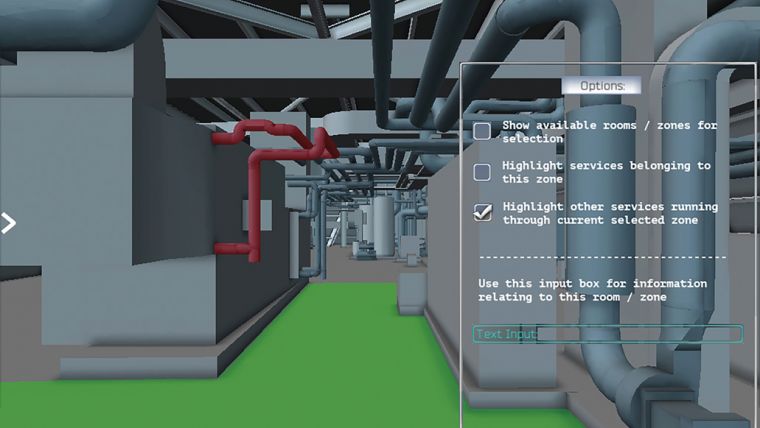
The topic of visualisation came up at several points in the conference and speakers emphasized that this is very important in complex constructions, for example stations for Crossrail, where access to plant is crucial, and in the design of a new prison. 3D visualization helps to understand what is needed and what data is required. One of the breakout sessions in the afternoon was about BIM evolution. A presentation from nomitech discussed ‘The use of immersive visualisations and virtual reality’ showing how gaming technology could be used to visualise BIM models for the QS and used the Riyadh Metro project as an example. It was demonstrated that visualisation encourages collaboration between professionals, particularly in showing changes so that QS’s, architects and engineers can assess the impact of change. 4D simulation aids construction and individual elements such as material type, progress etc. can be linked to the 3D model.
Deconstructing BIM
A more relevant presentation for geomatics came from Steve Jones of the Severn Partnership, who showed how Seeable, also based on gaming software, could be used for many useful applications on a tablet, by reducing ‘big data’ point clouds. The BIM model is deconstructed, but not destroyed, for reuse, only leaving what is needed. This was referred to as bespoke visualisation. A major application was visualising assets for FM in which the point cloud is integrated with panoramic images and assets are tagged and details accessed by pointing on the visualised data. Other applications include health and safety. During the discussion Jones also showed that hidden assets could be identified using visible features such as vents, combined with thermal imagery. Environmental sensors such as pollution monitors can also be integrated into the dataset to control lighting and heating, for example.
There was a small exhibition, mainly from QS software companies but also including laser scanner manufacturers Leica Geosystems and Faro.
The use of laser scanning and photogrammetry has already been established as an essential tool for BIM and has been proven in refurbishment and infrastructure projects. It is clearly in the interests of geomatics professionals to be involved in the whole life cycle of a building or infrastructure project and to ensure that the model is of good quality, is updated as necessary, even to the level of as-built survey, and that standards are maintained. The Severn Partnership has demonstrated that geomatics companies can provide added value to the BIM model through innovative use of the model and development of new software.
This article was published in Geomatics World May/June 2015

Value staying current with geomatics?
Stay on the map with our expertly curated newsletters.
We provide educational insights, industry updates, and inspiring stories to help you learn, grow, and reach your full potential in your field. Don't miss out - subscribe today and ensure you're always informed, educated, and inspired.
Choose your newsletter(s)


