SuperGIS Spatial Analyst 3.0
SuperGeo Technologies, Taiwan, is to release SuperGIS Spatial Analyst 3.0, offering a range of spatial modelling and analysis algorithms and a user-friendly interface to help users accomplish massive and complicated spatial analysis tasks. Users can access the functionality of the integration of vector and raster data, analysis of spatial relationship, best location search, analysis of service area, multiple layer query, and statistics of raster data.
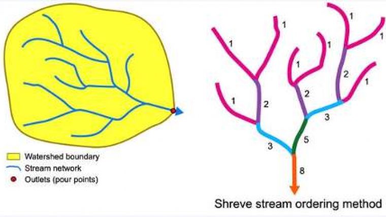
SuperGIS Spatial Analyst 3.0 supports import of point, line, polygon, and raster data for specific functions and carries out hydrologic analysis. Hydrologic analysis contains basin, fill, flow accumulation, flow direction, flow length, sink, snap pour point, stream link, stream order and watershed, which allows users to perform the data in various formats and perform comprehensive spatial analyses.
Integrating Spatial Analyst 3.0 with SuperGIS Desktop 3.1 is required to achieve varied requirements of spatial modelling and analysis. These SuperGIS desktop series products are scheduled to be launched officially by the end of January.

Value staying current with geomatics?
Stay on the map with our expertly curated newsletters.
We provide educational insights, industry updates, and inspiring stories to help you learn, grow, and reach your full potential in your field. Don't miss out - subscribe today and ensure you're always informed, educated, and inspired.
Choose your newsletter(s)


