Surveying in the Mining Sector
An Overview of Geospatial Methods in Mining Engineering
What is the current status of surveying in the mining industry, and which types of survey equipment and technologies are being used today?
Geospatial data forms the foundation of mining. The rapidly evolving innovations in the geomatics sector are bringing previously unforeseen opportunities that will provide a major boost, both to mining surveyors and the mining industry as a whole. Read on for an article which starts with some history – after all, we should never forget where we came from. It then goes on to present a general outline of surveying in the mining industry, with a focus on the survey equipment and the technologies that are being used today.
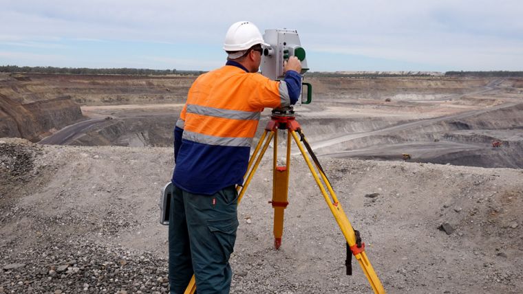
Surveyors in the mining industry fulfil an essential function since they provide indispensable information to all the other mining disciplines. Mining surveyors are responsible for the accurate measurement of areas and volumes mined, plus the precise representation of the surface and underground situation on mining plans.
History of Mine Surveying
The disciplines of surveying and mining both date back to ancient times. The ancient Greeks not only developed the science of geometry, but they also developed the first surveying tool: the diopter, an astronomical and surveying instrument dating from the third century BCE. The diopter can be regarded as the ancient predecessor of the theodolite. The first land surveys can be traced back even further in time, to approximately 3,000 years ago when Egyptian surveyors divided up the fertile land around the mighty River Nile. Likewise, mining engineering is a field with a long history. Archaeological studies have revealed that mining played an important role in prehistoric times, as evidenced by the flint mines in the countries we today call England and France.
The Romans were renowned for their innovations in mining engineering. The copper mines in Rio Tinto in Spain – the best-known ancient mining complex in the world – are a striking example of this. While surface mining was the most common approach, the Romans also used more advanced methods and techniques. Tunnels were dug in order to extract valuable minerals such as gold and silver; this required great planning and advanced knowledge of surveying, mathematics and geometry. However, it was not until the 18th century, when the industrial revolution in the UK was well underway, that the role of the mining surveyor became a widespread and recognised profession.
One of the instruments used back then was the dial: a compass made especially for underground purposes. This method was often inaccurate; iron tools or iron ore deposits in the mine tended to interfere with the needle of the compass. But by the middle of the 19th century more sophisticated devices were being produced. These theodolites were equipped with telescopes, spirit levels and vertical quadrants, enabling the measurement of vertical angles. Theodolites made surveying more accurate by traversing, i.e. measuring fixed points in the mine, so it was no longer necessary to rely on the compass. A short time later, the theodolite had replaced the dial as the main tool of the mine surveyor.
Today, mine surveying is an exact science. Modern theodolites (which in fact are incorporated in total stations, the state-of-the-art surveying instrument that integrates an electronic theodolite with an electronic distance meter) – using laser sighting and electronic data storage – coupled with a global navigation satellite system (GNSS) offer an accuracy that is probably beyond the wildest dreams of the early surveyor armed only with his simple dial and measuring chain.
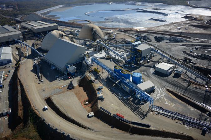
Mine Surveying Today
Mining surveying can be summarised as ‘the digging of mine shafts and galleries and the calculation of volume of rock’, although it entails much more than this in practice. Geometric constraints – e.g. vertical shafts and narrow passages – demand the use of specific survey techniques. While the basic principles of surveying may have remained largely unchanged throughout the ages, the instruments used have not. Common technologies in mine surveying today include terrestrial laser scanning, airborne laser scanning (further referred to as ‘Lidar’), airborne photogrammetry, unmanned aerial systems (UASs), satellite imagery. Besides this, software forms an essential part of the mining surveying profession nowadays. After all, the captured data needs to be processed in order for it to be of any use.
Terrestrial Laser Scanning in the Mining Industry
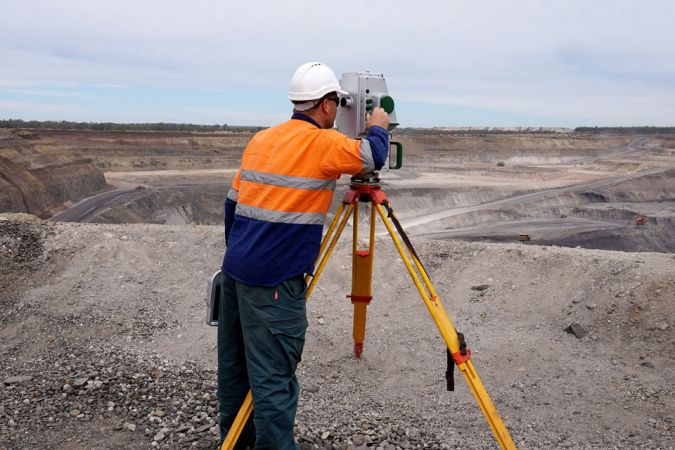
Surveying in the mining industry, both in open-pit and underground mines, often goes hand in hand with terrestrial laser scanning (TLS), which is deployed to verify the spatial changes of mining works. Thanks to its high point density and high accuracy, TLS is a very suitable surveying technique for monitoring movements and deformations.
By obtaining a highly detailed set or ‘point cloud’ of three-dimensional vectors to target points relative to the scanner location, TLS technology collects a large amount of valuable geospatial information in an automated manner. By combining Lidar with GNSS, it is possible to obtain a fully geospatially referenced dataset, which opens up opportunities for changes to be directly measured and monitored over time. In mining specifically, TLS has the potential to be used for a wide range of applications: monitoring and documenting the progress of underground mining works, assessing the stability and hence worker health & safety at mining sites, monitoring deformation and convergence, calculating volumes, providing supplementary evidence (e.g. in the case of accidents or damage), aiding security and protection of mining sites, etc. Hence, laser scanning in the mining industry represents a significant growth market. The technology is already used for the documentation of corridors and infrastructure by room-and-pillar mining methods, although it has not yet gained a substantial foothold in the case of long-wall mining, for example: a form of underground coal mining whereby a long wall of coal is mined in a single ‘slice’. Manufacturers of laser scanners – such as RIEGL and Maptek – often not only produce the hardware, but also offer a software solution with a streamlined survey workflow. With the purchase price of the device and the corresponding software amounting to roughly EUR100,000, the required level of investment is a key factor affecting the adoption of this technology in the mining industry.
Airborne Laser Scanning and Mining
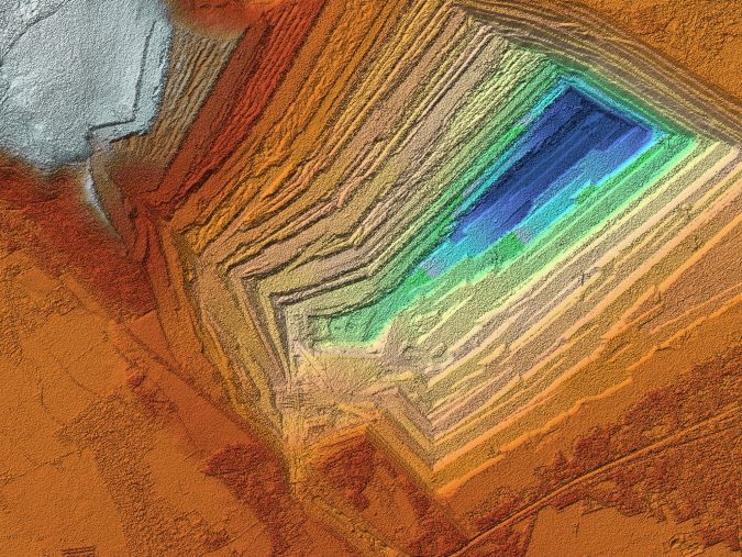
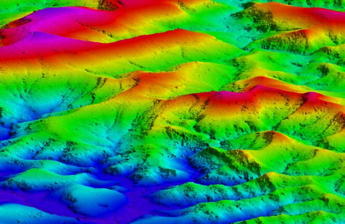
Another method of capturing the mining environment is airborne laser scanning, also known as ‘airborne Lidar’. Utilising high-end manned or unmanned airborne platforms makes it possible to obtain data in challenging circumstances. Airborne Lidar offers great opportunities for the mining sector, as it is able to acquire millions of points per square kilometre. This density creates a robust dataset in the form of a digital terrain model (DTM) or digital elevation model (DEM) that can be used for mining applications such as volume calculations, geomorphology and structural geology, slope analysis and surface run-off modelling for feasibility studies and environmental impact studies. Volumetric mapping or time-sequenced topographic modelling to facilitate subsidence monitoring is also a service that can be provided when using airborne Lidar.
Portable Laser Scanning in the Mining Environment
A more recent trend is the use of portable laser scanners, which are particularly suitable for the challenging mining environment. Handheld laser scanning is an ideal solution thanks to its ease of use, and some lightweight and compact scanners can also be mounted on mobile platforms. Portable scanners are an excellent tool for surveying mining tunnels as well as tasks such as stockpile volume measurements or advanced tracking and change management.
Apart from the favourable mobility aspect, some portable scanner systems utilise simultaneous localisation and mapping (SLAM) algorithms – a robotic technology which enables them to accurately register the scanned data by using the surrounding geometry.
The ever-growing number of portable laser scanning solutions offer an effective alternative to the more traditional GNSS-based survey technologies which do not perform well in underground and covered areas. It seems safe to say that laser scanning will be the preferred method for capturing survey data in the mining industry for the coming years, and handheld or portable scanners add a new dimension to the opportunities for geospatial data acquisition. One important advantage in terms of the application of portable laser scanners is their reasonable price range.
Aerial Photogrammetry and Mining Operations
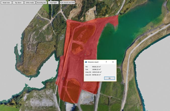
Over the past few decades, aerial surveying has changed the overall face of mining operations and has revolutionised exploration. The application of aerial photogrammetry is a proven method of pit mapping and stockpile volume measurement, with a particular emphasis on 3D modelling and monitoring. The spatial data acquired in this way is used, for example, to create digital terrain models, orthorectified georeferenced imagery and topographic maps. The imagery derived from an aerial survey can also be used in automated processing for the production of DEMs.
Nowadays, aerial photogrammetry is often combined with Lidar technology and is increasingly being obtained using UAVs. The successful use of aerial photogrammetry is dependent on factors such as the expertise and delivery speed of the aerial survey company, the level of ground support from mine site survey staff and, not unimportantly, favourable weather conditions.
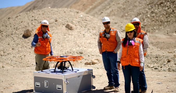
Unmanned Aerial Vehicles in Mining Industry
Reflecting the trend in the entire geospatial profession over the past five years, a growing number of mining companies are working with UAVs. These are equipped with digital cameras to provide high-resolution aerial imagery, which is then further processed to produce highly precise orthophotos, point clouds and 3D models. This data can be used for forecasting the development of the mine, monitoring changes and calculating volumes. UAVs can also play a role in improving the safety of workers underground by providing information about the above-ground situation.
A new disruptive technology in the broader geospatial industry that can bring benefits for the mining sector too is the combination of UAV and Lidar. This may have the potential to replace many existing options. Several companies, such as YellowScan, have launched ultra-compact and lightweight unmanned Lidar systems. The demanding environmental circumstances and sometimes dangerous conditions make UAV surveying the ideal solution in terms of producing GIS data for DEMs and DTMs.
Satellite Imagery for Mining Projects
A lot of powerful information for the mining industry is obtained from space. Satellite imagery is an essential tool in support of mineral exploration projects, for example. Thanks to the detail-rich satellite imagery, the presence and patterns of pathfinding minerals can be mapped, providing valuable insights for mining companies before they decide whether to invest in field deployments. Due to its global coverage, satellite-derived imagery is a safe and cost-effective method for obtaining information regardless of local constraints, even in remote regions. Satellite imagery also makes it possible to monitor elevation changes in an open-pit mine. Image processing, orthorectification, georeferencing, feature extraction, and mosaicking are all techniques that guarantee tailor-made image data for numerous different mining and geological applications. One technique especially worth mentioning is short-wave infrared (SWIR) wavelength bands which offer unique remote sensing capabilities, such as material detection, which are often impossible with other technologies. The SPOT satellites (SPOT 4 and 5) are equipped with SWIR, for example, while DigitalGlobe is an experienced provider of high-resolution SWIR imagery.
Processing Software in the Mining Industry
Over recent years a broad variety of innovative software solutions for mine planning and surveying have emerged. Bentley’s mine surveying solution brings together mine site survey data, surface terrain models, digital images and point clouds. The solution enables mining engineers to develop a comprehensive 3D model of the mining site compliant with company standards. One company that offers the whole geospatial workflow associated with mining is Maptek. This Australian-based company bridges the gaps between the geological, spatial design, execution and measurement details of a mining operation.
Other renowned companies in the geomatics industry such as Leica Geosystems (integrated with Hexagon Mining), Topcon, 3Dsurvey and Trimble (Trimble Connected Mine) also offer a complete product suite for mining engineers. Their solutions include aerial, terrestrial and underground scanning and imaging, positioning infrastructure, planning software, visualisation software, GIS and more. In fact, they comprise all the tools a mining surveyor needs.
The Future of Mine Surveying
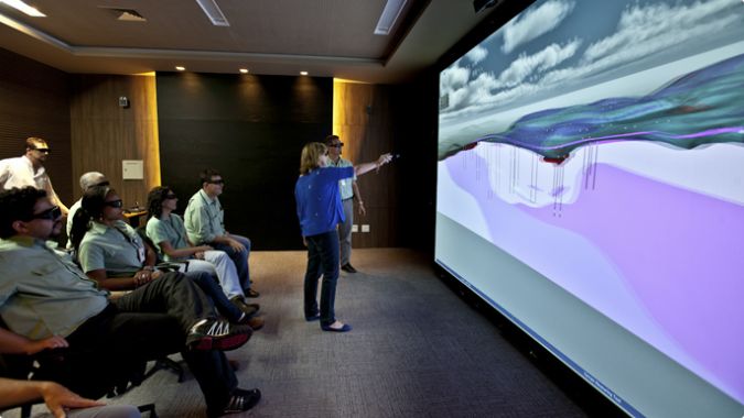
In view of such completeness of the surveying solutions for mining professionals that are now available, one could be inclined to rest on one’s laurels. What else is left to wish for, when so many state-of-the-art solutions are making surveying relatively easy? Nevertheless, a couple of exciting broader technological developments deserve a mention here as being set to make mining even more productive: virtual reality (VR) and augmented reality (AR).
In fact, the global mining industry has been an early adopter of both of these technologies. One of the industry’s pioneers when it comes to VR is Brazil-based Vale, the world’s largest producer of iron ore and nickel. Since 2000, Vale has been assembling geographic databases of its fields, by investing in very-high-resolution images. The company conducts 3D aerial surveys with laser geotechnology and assembles 3D digital models. In 2013, Vale entered into a partnership with the British Geological Survey, which has played a major role in the use of virtual reality in mining. Vale now uses VR to aid decision-making in several aspects of its operations and projects: from defining the mining area to environmental licensing scenarios and even closure of a mining site. Geological, geotechnical and environmental studies are carried out with VR.
Likewise AR – which superimposes a layer of interactive digital information over images of the physical world – offers significant opportunities for the mining industry in terms of improved productivity, reduced equipment maintenance costs and employee safety. Microsoft’s HoloLens AR headset is already transforming businesses in architecture, the automotive industry, engineering and education, to name but a few, and the potential of ‘mixed-reality’ technology to revolutionise the mining industry is already being widely recognised.
So ‘complete’ solutions are already being supplied by the leading companies in the field, but the definition of ‘complete’ seems likely to expand further in the near future. If our own minds sometimes boggle at these science-fiction-like advancements, just what would a Roman surveyor of the ancient Rio Tinto mine make of such innovations?

Value staying current with geomatics?
Stay on the map with our expertly curated newsletters.
We provide educational insights, industry updates, and inspiring stories to help you learn, grow, and reach your full potential in your field. Don't miss out - subscribe today and ensure you're always informed, educated, and inspired.
Choose your newsletter(s)


