Taking Advantage of the Changing Marketplace of Geomatics
GIM International interviews Ron Bisio, Trimble Geospatial
The changing landscape of the mapping and surveying profession brings new challenges, even for a renowned manufacturer of geospatial instruments like Trimble. In view of the growing role of BIM, the rising demand for complete workflow solutions and the challenge of extracting meaningful information out of the immense volumes of point clouds derived from Lidar data acquisition, it is clear that geomatics is in transition. 'GIM International' touched base with Ron Bisio, vice president of Trimble Geospatial, to discuss how his company is approaching the new geospatial reality.
Data capture and analysis solutions are increasingly based on software that can also be used by generalists rather than geospatial specialists only. How are you responding to this evolution?
Innovation can fail if it doesn’t clearly benefit workflow and take into account all stakeholders. Trimble is always thinking about getting the workflows right and developing solutions with more automation and data processing capabilities that can be easily adopted by customers of all kinds, including non-geospatial professionals. Geospatial software providers play a role in making sure the data is shareable through a cloud solution and uses automation to bring understanding to the desks and devices of the professional, who then delivers it to the customer. For instance, Trimble Clarity, a cloud-based solution, allows anyone to use, analyse and annotate imaging data without specialised software. We really want to make sure technology brings customers into their domain, not the opposite.
Now that software is increasingly bridging the gap between sensor-captured data and the answers organisations are looking for, does this mean that Trimble will focus more on software development and less on hardware development?
Because Trimble has a footprint in both hardware and software, we are uniquely positioned to facilitate the two-way exchange between the physical and digital worlds. We continue to develop hardware to meet market needs for advanced data collection and stakeout, but software is also a key element of most of our solutions. In fact, across Trimble, we have more software developers than hardware ones. Over time, we have redefined our technological focus from hardware-driven point solutions to fully-integrated work process solutions. We haven’t lost our passion for hardware innovation, though. As evidenced by the Trimble SX10, our scanning total station that blends traditional point collection with laser scanning and image capture, we continue to focus on meaningful innovation in hardware and software.
Today’s customers not only want new solutions, but they also want them in ever-shorter time spans. How do you keep pace with this trend?
We are moving from a phased approach to geospatial data towards more integrated, real-time collection and analysis of the data. With more processing power available in the field, it becomes easier to bring quality control to the data. The expectation of real-time data is growing, so we need sophisticated geospatial solutions that immediately process the data and do more for the user, without them even knowing it. The cloud gives us further power to process data, so data-intensive processes can be conducted in the background, while geospatial professionals can focus on high-value analysis. We anticipate an elevated role for artificial intelligence to extract and interpret information. We also imagine that Lidar data will eventually be extracted from autonomous vehicles to track maintenance of street lamps and road damage and to notify crews of the need for repairs before safety issues occur.
Providing solutions requires close communication with customers. How do you organise feedback to understand their needs and workflows?
To stay relevant, we need to work the way workforces work. We keep in close contact with customers with the goal of anticipating their needs and developing solutions that help them operate more efficiently, expand their offerings and grow their businesses. To understand our customer needs, we use a variety of touchpoints, including trusted customer input sessions and intensive beta cycles to help us refine our solutions to best fit the needs of a changing marketplace.
The planning, design, construction and management of buildings is increasingly done through BIM. How do you keep pace with this trend?
Building information management (BIM) is, of course, an information-centric process – not a process that begins and ends with the creation of a model. Position accuracy is of crucial importance over the entire construction process, whether that’s placing anchor bolts or installing mechanical, electrical and plumbing systems. Survey experts can expand their business by mastering the positioning requirements of various models. But importantly, they can use BIM to understand the end game. The process of construction is increasingly driven by data, which is why our strategy is centred on the concept of ‘constructible data’. Over the last several years, Trimble has assembled the most comprehensive set of solutions covering the entire lifecycle of a building project, from feasibility to design and engineering, through construction and ongoing operation. We see many opportunities to improve efficiency and productivity with more thorough utilisation of constructible BIM and a wide range of technologies for building projects.
GNSS technology is a major branch within the geospatial industry. Which major developments do you foresee in GNSS technology and services, and which implications will these developments have on the surveying profession?
Professional surveying engineers want tools at their disposal that provide them with flexibility and control so they can perform their work efficiently. For surveying engineers, we not only offer first-class equipment such as our integrated GNSS R10 system with the Trimble Access field software, but we also serve a broader market with solutions such as Trimble Catalyst, our software-defined GNSS receiver for Android devices. With Catalyst, positioning-as-a service provides a flexible option. Not only can you turn the service on only when it’s needed, but a variety of service levels also allow users to choose the accuracy that makes the most sense for their application. We think GNSS is a resource that more people need to get their hands on, so we are trying to democratise it by making it easier for more people to use.
Smart cities and smart sensors are attracting considerable attention among policymakers and urban managers. How will these trends affect the geospatial industry?
A city is only as smart as the sum of its parts, so how well those parts work – and work together – is the key. Accurate geospatial data will remain a key element of smart city optimisation. Trimble views its role in smart cities as providing solutions that help build, monitor and measure city functions, whether intelligent transportation systems, smart water or other utilities. Our technology also helps cities understand what improvements are needed and how those improvements are working and making a difference in citizens’ lives.
In the last decade, one major revolution has been the rapid rise of unmanned airborne systems (UASs). Which are your expectations about the UAS market worldwide and where do you see synergy with your other products and services?
UAS data capture is valid in certain situations, but it must be employed properly and doesn’t replace traditional tasks that require a surveyor. Although Trimble isn’t involved in the vehicle market for this sector, we’ve continued our focus in converting UAS data into reliable, trustworthy information for making business decisions. Primarily targeting the construction sector at this time, Trimble Stratus provides powerful tools for tracking progress against plans, calculating volumes and topographic studies. For geospatial professionals, the Trimble Inpho UASMaster photogrammetric workstation provides a complete photogrammetric workflow. We’re also partnering with multiple UAS vehicle vendors to provide users with optimal workflows.
Mobile laser scanning has also advanced rapidly. A major bottleneck, from the user’s side, is the extraction of meaningful information from the billions and trillions of points in reasonable time spans. Are you working on software to automate the extraction of objects from point clouds?
We see a future with mobile mapping solutions that merge multiple sensor types into unified data collection and analysis tools. Trimble’s innovation will focus on collaborative environments such as Trimble Connect, which unifies data from different hardware and software solutions so multiple stakeholders can work together with disparate tools. Processing those massive datasets does require automation. For this, we continue to incorporate the concept of ‘deep learning’ into our software, such as eCognition which empowers customers with highly sophisticated pattern recognition and correlation tools. Deep learning employs artificial intelligence to teach the software to automatically identify objects of interest in a scene.
What is behind Trimble Geospatial’s 11% revenue growth in Q4 2017?
Our geospatial business continues to benefit from new product introductions, including our recently launched mechanical station product line for emerging markets and continued strong demand for the SX10 scanning total station, as well as increased activity in end markets including oil and gas. We also experienced strong sales of our inertial-based technologies to automotive companies for development of their autonomous technology programmes.
Trimble is involved in many verticals, including agriculture. What kind of geospatial technologies do you expect to be involved in farming over the coming years?
We’ve seen widespread technological adoption in agriculture, and we anticipate continued growth in this area. Trimble is highly focused on vertical markets and has, for years, developed dedicated franchises to meet emerging market opportunities. In agriculture, we continue to develop ‘connected farm’ solutions to optimise operations across the agriculture workflow. Our agricultural customers also give us high marks for offering a full spectrum of support for our Trimble Ag Software.
What about the future of the land surveyor? What kind of young professionals is the geospatial business looking for?
The geospatial profession is changing and, not surprisingly, so too is the geospatial professional. Changes in the global workforce require new approaches for surveying organisations to stay nimble. Technology will be a key factor in business continuity. The introduction of younger workers requires improved standardisation and more intuitive workflows. Surveying businesses need to prepare for the shift from data provider to intelligence provider, and they need to migrate to current methods of data extraction and analysis to stay competitive. Luckily, this fits perfectly with the profile of the generation arriving into the workforce now.
Trimble is well known for its acquisition of successful start-ups. Do you have any such plans within Trimble’s geospatial division?
Trimble is focused primarily on organic growth, but acquisitions serve to enhance our market position. When we acquire businesses, we do so to gain domain expertise, technology, products or distribution capabilities. The goal is to augment our portfolio and deepen our presence in existing markets or establish a new market. We find success with our acquisitions by effectively integrating them.
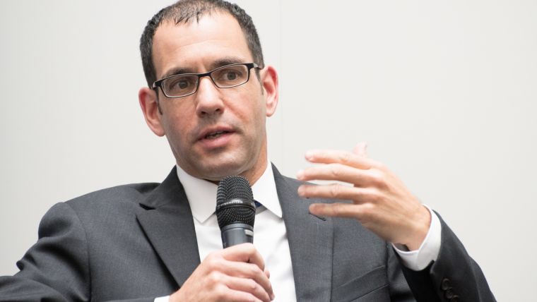
About Ron Bisio
Ron Bisio is vice president of Trimble Geospatial and has 25 years of experience in the geospatial technology industry. Bisio joined Trimble in 1996 and held several marketing, sales and general management positions prior to taking over worldwide responsibility for Trimble’s Geospatial division. He holds a master of business administration from the University of Denver, a master of regional planning from the University of Massachusetts, and an undergraduate degree in geographic information systems & cartography from Salem State University in Salem, Massachusetts, USA. ron_bisio@trimble.com

Value staying current with geomatics?
Stay on the map with our expertly curated newsletters.
We provide educational insights, industry updates, and inspiring stories to help you learn, grow, and reach your full potential in your field. Don't miss out - subscribe today and ensure you're always informed, educated, and inspired.
Choose your newsletter(s)


