The bright side of mapping
Reviewing the YellowScan Lidar for Drone 2022 Conference
Attendees of YellowScan's recent Lidar for Drone 2022 Conference headed home with a backpack full of inspiration, according to Wim van Wegen.
A relaxed vibe, sunny weather with summer temperatures, smiley faces, a charming wine estate as venue and very approachable members of the organizing hosts of the Lidar for Drone 2022 Conference: YellowScan celebrated its tenth anniversary in style. Despite the festive atmosphere, the backbone of the event was formed by the highly informative conference programme, with speakers from all over the world – resulting in a backpack full of Lidar-fuelled inspiration for the trip back home.
Connecting to prepare the industry and exchanging knowledge to pave the road to the Lidar technology of the future: this would be a sound description of the objectives of the YellowScan Lidar for Drone 2022 Conference. The venue of the Domaine de Verchant chateau, a wine domain dating back to the 16th century that is situated just outside the city of Montpellier, proved to be an excellent location to accommodate this gathering of attendees from over 30 countries.
Hedgerows and penguins
YellowScan is renowned for its large portfolio of Lidar solutions for a multitude of applications, offering a full ecosystem for its users. The company has built a distribution network across many parts of the world, which was reflected in the variety in the speakers’ countries of origin. Overall, the conference programme presented the versatility of UAV-Lidar mapping, which became visible after just the first couple of presentations. Edward Vainu from Estonia took the audience on a journey across his country, where the entire power line network is being monitored with drones, while Fearghus Foyle taught the attendants by video connection about monitoring hedgerows for biomass measuring purposes – a brilliant UAV-Lidar mapping application in Ireland, a country with no less than 689,000 linear kilometres of hedgerows.
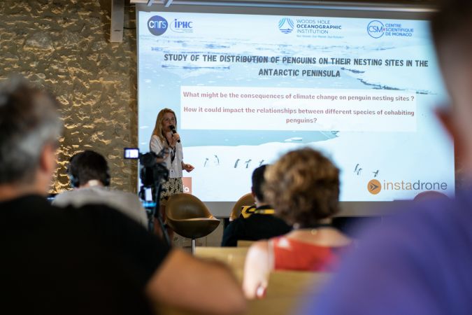
Surveying under challenging circumstances should be no limitation for Lidar solutions, and this was emphasized by several presentations dished up during the two-day conference programme. Lana Lenourry even took the participants to Antarctica, where she recently conducted a penguin mapping project with the YellowScan Mapper mounted on a DJI Matrice 300. This adventure showed how important it is to trust the equipment. Lenourry was able to map more than ten different sites, each of several dozen hectares, while flying in demanding conditions: wind, snow and cold. In a completely different climate zone, the combination of drones and Lidar technology proved to be key in the discovery of hidden Maya structures in the Guatemalan jungle. The discoveries were made possible by mapping the area with a Qube 240 payload, a high-end Lidar scanner designed for the Trinity F90+ eVTOL fixed-wing mapping drone from Quantum-Systems. Imagine what other discoveries may be just around the corner, bearing in mind the strong suspicion that countless buildings from earlier civilizations are still hidden under the rainforest. The advancing Lidar technology offers new possibilities to uncover these, as the project presented by Martin Herkommer of the German drone manufacturer showcased.
Also worth mentioning is the contribution delivered by Bálint Vanek on creating a digital twin of the famous Budapest chain bridge. Capturing and modelling the bridge was done using ground surveys, aerial scans and even a boat. The combined survey methods enabled the project team to create a digital twin from 1cm-resolution digital images and Lidar point clouds with a high scale accuracy, enabling precise distance, area and volume measurements.
Aerial Lidar return on investment
One session was dedicated to the question how Lidar compares with traditional mapping technologies. Traditional survey methods are often much more time-consuming than aerial Lidar, and relative costs are also an important factor to be taken into consideration. Traditional survey methods not seldomly turn out to be more expensive than aerial Lidar. With YellowScan’s solutions getting lighter and more compact over the past couple of years, they offer improved versatility because survey professionals can quickly deploy them at a lower economic cost relative to traditional surveying methods.
Day one of the conference programme ended with a slideshow of photos with a lot of self-mockery, including some unborn concepts, a drone crash and some crazy photos that nicely reflect the atmosphere in the company. The evening was reserved for celebrating ten years of YellowScan, with a cocktail dinner and a cake in the shape of YellowScan survey equipment, enabling the attendants to literally get their teeth into Lidar solutions!
The second day of the Lidar for Drone conference started with a presentation on how UAV-Lidar proved to be a very good solution for avalanche risk detection. UAVs equipped with various sensors, including Lidar of course, were used in an evaluation of new technologies for avalanche risk detection in order to keep the roads open in Norway in winter. The mission took place in the area surrounding the iconic Trollstigen road, one of Norway’s most famous scenic routes that is renowned for its hairpin bends around high mountain peaks. It was certainly a challenging survey project, due to the vertical cliff face, high elevation differences, challenging winds and GNSS shadow.
The impact of a Lidar investment on a small company was painted in a very colourful way by the incredibly inspiring presentation of Arnaud Denisot. “Lidar saved my business,” this self-made UAV-Lidar specialist informed his audience. Originally an aerial video/photography specialist, he saw his revenue melt like snow in the sun when Covid-19 hit the world, as most of his clients were in the tourist industry. With a background as an IT engineer, he re-established himself with a drone services company headquartered in Bali, Indonesia. The new company, Bali Drone Production, gathered steam as a result of its drone and photogrammetry services, but when Arnaud bought his first Lidar scanner – the YellowScan Vx15 high-precision and long-range UAV-Lidar solution – this turned out to be total game changer, marked with the launch of a new specialized mapping branch of the company, called MSDI.
While demand for video and photography vanished, the need for Lidar mapping remained: power line inspection, road development projects, monument conservation and mining – applications that provided Arnaud with a massive amount of work: “We can now be a major player in UAV-Lidar survey services in Indonesia, provide accurate data in correlation with the environmental constraints we encounter here, and intervene quickly on urgent projects.” His company was even selected to digitize the Mandalika Circuit, to integrate it into the newest version of the MotoGP 22 video game.
Pirates and mountain castles
Elsewhere in Asia, the SVAMITVA project sparks the imagination. With no less than 664,369 Indian villages to map, this is truly a survey project at a mind-blowing scale. Sajid Mukhtar of ROTER, a company that has been a pioneer in providing surveying and mapping technology in India, informed the audience of India’s prestigious project to realize clear ownership of property in rural inhabited areas. This huge-scale mission is performed by mapping land parcels using drone technology – UAVs equipped with optical, infrared and Lidar sensors – and providing a ‘Record of Rights’ to village household owners and issuing legal ownership cards to the property owners.
Isabelle Le Tellier, a loyal participant of the YellowScan conferences, immersed the audience in various examples of UAV-Lidar for archaeological projects in different places, ranging from the Alps to the famous tidal island of Mont-Saint-Michel and its surrounding bay, to Madagascar. The study of pirate occupations of the bay of Ambodifotatra brought archaeologists to work in a geographical area never before investigated. The project encompasses the study of the defence systems using old and current cartography, the inventory and study of batteries still in place, the capturing of the remains of pirate camps on the coast using Lidar and the study of the state of underwater remains in the bay such as pirate shipwrecks.
Other applications that were covered at this festive edition of the conference were the mapping of Carcassonne and its mountain castles in France for obtaining UNESCO world heritage certification, the mapping of slopes and landslides for disaster management purposes in Malaysia and the monitoring of the condition of forests using multispectral data and Lidar, making it possible to evaluate the tree canopy and create indices to help monitor vegetation health.
Growing dnowledge
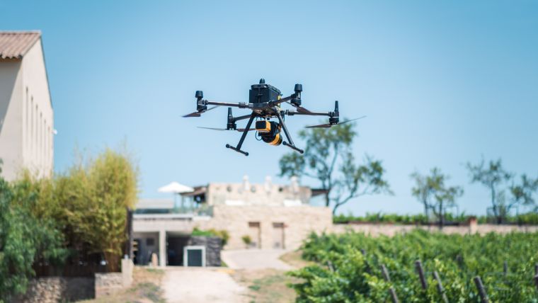
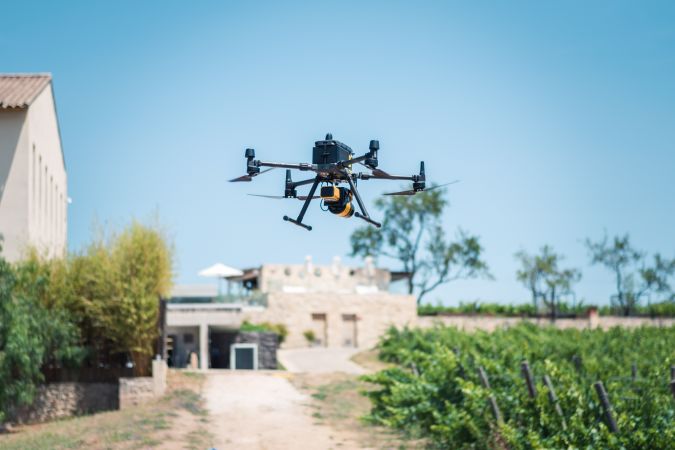
Excited mapping professionals exchanging knowledge and advocating the strength of Lidar technology, this probably summarizes the two-day event on the outskirts of Montpellier. As well as providing many intriguing case studies, the programme also included sessions in which business cases – for instance by RIEGL – were put in the limelight. The demo mapping of the vineyard that surrounded the venue and the demo of colourizing point clouds were also a prominent part of the event, while the same goes for the hands-on exercises – jointly powered by Terrasolid – that were held in parallel with the conference sessions.
The YellowScan Lidar for Drone 2022 conference showed what Lidar can bring to the business by demonstrating the rewards of investing in this innovative technology. Morgane Selve, one of YellowScan’s event organizers, was very happy with the outcome of the two Lidar-packed days. “The passion of our customers makes us really feel good. We received so much great feedback, which is an important source for improving our products. All the comments we heard are added to something you best can describe as a wish list or to-do list, inspiring the YellowScan experts to further advance our Lidar solutions.”
YellowScan is a company with a very open character, where craftmanship is core. The company has steadily built a strong reputation in the market with its very own identity. What safely can be regarded as one of the building blocks of their success story is the ability of all the employees to speak English (which is not self-evident in French companies), making it a lot easier to be a “partner in crime of businesses that want to do Lidar,” as Morgane Selve said. While happy clients and positive feedback alone are already icing on the cake, the product launch of the YellowScan Voyager was the real party piece of the event. The Voyager is the highest range system in YellowScan’s portfolio and is developed to be used onboard either UAVs or crewed aircraft. The laser scanner’s specs can be personalized to fit all sorts of different project and platform needs, and its launch will certainly contribute to the massive 20% market increase that YellowScan has enjoyed over the past couple of years.

Value staying current with geomatics?
Stay on the map with our expertly curated newsletters.
We provide educational insights, industry updates, and inspiring stories to help you learn, grow, and reach your full potential in your field. Don't miss out - subscribe today and ensure you're always informed, educated, and inspired.
Choose your newsletter(s)


