The Geospatial Industry Embraces Digitalisation at Intergeo 2018
A highly successful Intergeo 2018 drew to a close last week in Frankfurt. The trade fair and conference reinforced its credentials as the world’s number one communications and networking forum for the geo-IT sector. “The industry is embracing digitalisation in all its fascinating facets,” sums up DVW President Hansjörg Kutterer. With more than 19,000 enthusiastic visitors from over 100 countries, 640 exhibitors and a conference with more than 1,400 participants, Intergeo once again showed that it is the most important international communication and networking platform for the geospatial industry.
Prof Hansjörg Kutterer, president of Intergeo host the DVW (German Society for Geodesy, Geoinformation and Land Management), pinpoints spatial information as the key to shaping and anchoring the digital transformation. “And that makes our industry a key player in a process of massive change,” he says. Digitalisation, he adds, is rewriting the rule book – and that also applies to the geoindustry. “We’re in the midst of the digital transformation, which is turning things completely on their head,” Kutterer continues, citing the examples of overhauled job descriptions and the desperate search for specialists faced by employers in both the public and private sectors.
The geoindustry goes digital
What does digitalisation really mean for the geoindustry? At the international press conference accompanying the event, Dr. Jürgen Dold, president of Hexagon Geosystems, described digitalisation as taking place in stages. The first step involves converting analogue data to digital, after which stand-alone solutions to specific problems are turned into a network of heterogeneous data. At the third stage, which is happening now, algorithms are used to “distil” this data into services that deliver added value for increasingly customised applications. Ronald Bisio, vice president geospatial at Trimble, used his keynote speech to highlight the role of the surveying profession in digital planning, building and operation – under the acronym BIM (building information modelling). “The entire BIM process – from design and construction to building management and infrastructure – would be impossible without surveyors,” he pointed out, adding that geodata will play an even more vital role in the future.
Intergeo, an invaluable magnet for the industry
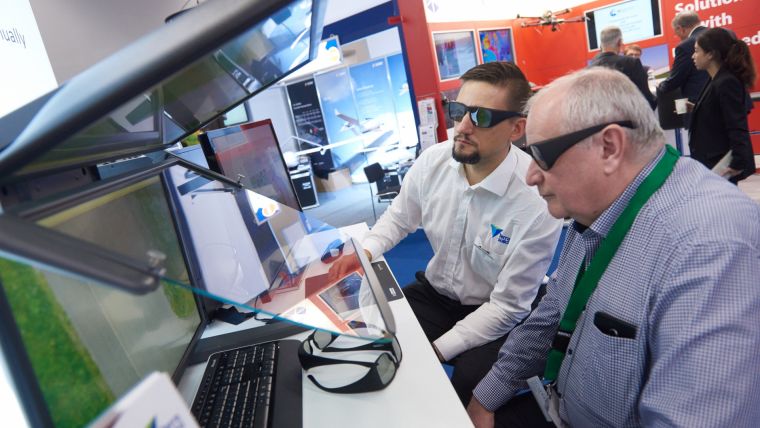
Once again this year, the three days of Intergeo provided an ideal platform for animated discussions between geo-IT, GIS, BIM and smart city specialists. In the thrilling and magnetic context of digitalisation, Intergeo again underlined its world-leading role as a conference and trade fair for geodesy, geoinformation and land management. After three days of conference and forums packed with information, interaction and networking, the event has drawn to a close with top marks. Some 640 exhibitors from 40 different countries and over 1,400 delegates at the international conference all played their part in this tremendous success. Frankfurt proved the ideal international hub to attract more than 19,000 visitors from over 100 countries to this year’s trade fair and conference. But even more important in Kutterer’s eyes was this unrivalled chance for the industry to fully immerse itself in digitalisation for three whole days. The conference and trade fair have, he says, become even more vibrant, diverse and comprehensive, and have once again brought together a global community for intensive networking. “The added value is immeasurable for exhibitors and visitors alike,” Kutterer points out.
Smart city and drones
The two themed platforms Interaerial Solutions (IASEXPO) and Smart City Solutions were key components of Intergeo in Frankfurt. IASEXPO is Europe’s leading platform for unmanned aerial vehicles (UAVs). It shows how wide-ranging the applications are and looks to the markets of the future. The European Drone Summit made a highly successful debut in Frankfurt. UAV DACH e.V. – the Association for Unmanned Aircraft Systems – is the ideal sponsor for this event. This year’s Drone Pioneer Award was won by Wingcopter GmbH with its Deliver Future project for getting medical supplies to areas that are hard to access. Intergeo provided numerous opportunities for exhibitors and visitors to plan and discuss the future of our cities. This topic had high priority during the Intergeo conference and forums, with Smart City Solutions (SCSEXPO) providing a meeting place for the key players involved.
Intergeo 2019 in Stuttgart – 25 years of continuous further development
According to Kutterer, digitalisation in the geo-IT sector is still in its infancy despite the fact that upheavals are already in evidence everywhere you look. He is confident that Intergeo will continue to actively reflect this in Stuttgart in 2019 and stick to its chosen path for what will be its 25th anniversary. “We’re committed to continuity and evolution. It’s what our customers expect of us and the benchmark by which we measure ourselves,” he concludes.
Intergeo 2019 will take place in Stuttgart from 17 to 19 September 2019. Once again, the importance of the geoindustry for smart cities, digital building, drones and much more besides will take centre stage – interactively, visually, virtually and in actual fact.

Value staying current with geomatics?
Stay on the map with our expertly curated newsletters.
We provide educational insights, industry updates, and inspiring stories to help you learn, grow, and reach your full potential in your field. Don't miss out - subscribe today and ensure you're always informed, educated, and inspired.
Choose your newsletter(s)


