Thriving Bucharest Presents Mapping Challenges
Romanian Geoportal to Serve Multiple Users
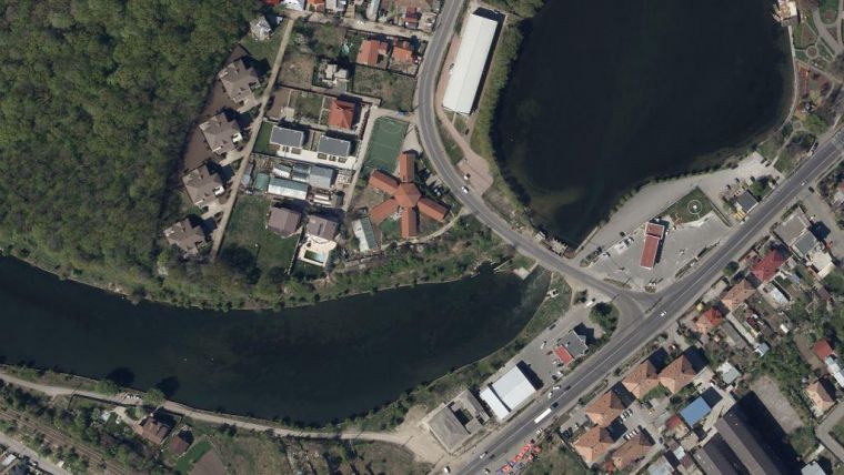
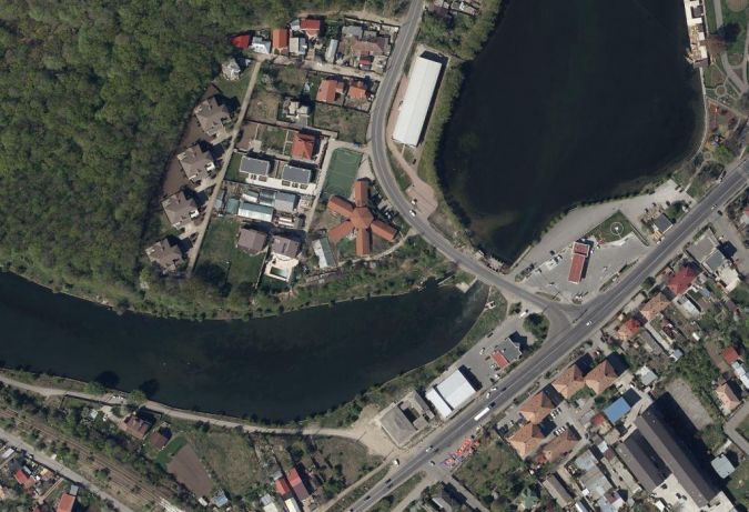
The applications for up-to-date digital orthophotos and digital surface models (DSMs) over areas with rapid change are numerous. However, logistics for collecting aerial imagery over a major city like Bucharest can present challenges due to military and altitude restrictions on overflights. As Romania continues to experience high economic growth and development, the boundaries of the Bucharest Metropolitan Area and its environs are being reviewed and expanded, generating a demand for high-resolution mapping, 3D modelling and detailed GIS data for the entire area.
Bucharest is Romania’s capital city and commercial centre. The city proper has a current size of 228 sq km, however, revised boundaries have been proposed that include Ilfov County in a new metropolitan zone that brings the size to 1,800 sq km. Eventually the zone could include over 5,000 sq km and six other cities. These planned changes require up-to-date geospatial information to support informed decision making.
Metropolitan Areas Drive Growth
Coordinated urban planning is the motivation behind redefining the boundaries of Romania’s primary cities. A variety of issues, such as inadequate public transportation and roadways, are hindering growth and development in individual municipalities and reducing quality of life for the population. Supporters of the initiative believe that creating a unified metropolitan zone run by a council of representatives from across the region will reduce the occurrence of duplication and inefficiency, resulting in sustainable growth and improved infrastructure for everyone.
Romanian Mapping Firm Supports Planning
Primul Meridian provides professional services including photogrammetric surveying, cadastral mapping, topographical mapping, Lidar scanning, bathymetry and geodesy. With headquarters in Slatina, Romania, and offices in Bucharest, Caracal, and Craiova, Romania, its 100 employees complete projects for public and private customers.
To meet anticipated demand for high-resolution aerial imagery and other derived products, Primul Meridian started collecting data over Bucharest and Ilfov County (total 2,276 sq km) at 11cm GSD with 60% / 30% overlap. The resulting deliverables include high-quality digital orthophotos, digital surface models (DSM) and infrared imagery. The NIR channel facilitates the classification of vegetation and water surface in derived products, which will be useful for updating local greenspace registers. Field crews are also collecting feature data, such as addresses, to offer complete GIS/imagery packages.
All potential customers will have access to the data via a geoportal, similar to the Republic of Moldova’s geoportal that features a 30,000 sq km orthophoto map produced by Primul Meridian. Derived products will be available as custom orders, and 3D vectoring will be completed in the future as needed.
Flying over Bucharest
Restrictions on overflights over densely populated areas or facilities that are sensitive from a military perspective are typical, however, it does complicate efforts to map the areas. Unless digital aerial data can be collected from a high altitude, high-resolution geospatial information might be unobtainable.
To successfully collect the Bucharest/Ilfov County area, Primul Meridian needed permission to fly over the city and required equipment that could quickly gather the necessary data at a high resolution. The mapping company operates two digital aerial systems — an UltraCamLp digital camera suitable for small to mid-size projects, and an UltraCam Eagle Mark 2 ultra-large format camera ideal for high-resolution mapping with a footprint of 23,010 x 14,790 pixels. The UltraCam Eagle is the only photogrammetric digital aerial sensor that features a user-exchangeable lens system along with R, G, B, and NIR channels.
Primul Meridian was granted permission to fly over the city but had to schedule the image capture for two days when there was a gap in another project. On 10 and 11 April 2017, 2,423 images were collected at 2,500m altitude in 7 ½ hours of flying time with the UltraCam Eagle Mark 2. The extra-wide footprint and powerful 100mm lens allowed the operators to easily meet the time and image quality requirements.
The UltraMap processing suite provides full end-to-end workflow software with automated processing capabilities that require just a few employees to manage the production process. All that is needed are powerful central processing units (CPU), graphics processing units (GPU) and adequate storage space. Vexcel Imaging is continuing to expand the software capabilities based on individual client requests. Using UltraMap, Primul Meridian processed the Bucharest/Ilfov County area in about two weeks.
Competing on Large Projects
Due to its large footprint, the UltraCam Eagle Mark 2 is highly efficient for large-scale photogrammetric projects, high-resolution (true) orthophoto production, DSM production, ortho mapping and 3D technical vector mapping. The system may be operated with four different focal lengths — 80mm, 100mm, 120mm, and 210mm. The 210mm lens is effective up to 7,000m in altitude, while the 100mm lens collects imagery at up to 5,000m.
The UltraCam Eagle Mark 2 allows Primul Meridian to successfully compete on very large area projects. The firm is currently collecting 50,000 sq km — about 25% of Romania — for the Romanian National Agency for Cadastre and Land Registration. This project includes processing DTMOrthos, Lidar scanning and 3D vectoring. The flight planning software indicates 60 hours of collection time will be needed with the UltraCam Eagle compared to 116 hours with the UltraCamLp, a 48% time savings. The UltraCam Eagle also produces fewer images over the same area, so processing goes faster. Faster collection and processing reduces project costs and timelines for Primul Meridian.
Geospatial Information Supports Economic Growth
As the capabilities of digital aerial sensors continue to improve, it becomes more feasible to successfully complete complex and challenging mapping projects at a high level of accuracy and quality. The new high-resolution dataset for Bucharest and Ilfov County, collected in just 7 ½ hours with an UltraCam Eagle Mark 2, is useful for multiple applications, including urban development, transportation network planning and utility management. Achieving an effective long-term strategy for economic growth throughout the region relies on up-to-date geospatial information.

Value staying current with geomatics?
Stay on the map with our expertly curated newsletters.
We provide educational insights, industry updates, and inspiring stories to help you learn, grow, and reach your full potential in your field. Don't miss out - subscribe today and ensure you're always informed, educated, and inspired.
Choose your newsletter(s)


