
Training the future geospatial workforce
The coming years look promising for the geomatics sector, but the new generation of professionals must be prepared to face the challenges ahead. In view of the looming labour shortage in the surveying industry, is it time to take a fresh approach to training the future geospatial workforce?
The surveying profession dates back to ancient times and has played a transcendental role in the development of different civilizations. Early evidence of surveying practices and techniques can already be found in many historical documents in places such as Egypt, Greece or Rome. The evolution of the practice was relatively slow during the Middle Ages, until the arrival of the Italian Renaissance. This period of huge scientific and technological advancement laid the foundations for the surveying profession as we know it today. Since then, surveyors have been carving out a niche for themselves and creating new opportunities in the employment market by meeting the rising demands of construction and industry. After very little change for hundreds of years, the new tools and technologies that were introduced from the mid-20th century onwards enabled surveyors to work even more quickly and accurately. Yet while the equipment has evolved over time, the fundamentals have not actually changed that much throughout history.
In today’s internet era, however, the surveying profession is changing much faster than ever before due to the explosion of various global technologies (smartphones, IoT, big data, etc.) and the current accentuated value of location-based data. The profession has been rebranded as ‘geomatics’ as the skills offered by these specialists have diversified and moved ever further away from the classic concept of surveying. Geomatics practitioners are still able to generate geospatial information from measurements, as they always have done, but there is now a much wider range of measurement methods and data capture techniques. Therefore, they need to be constantly adapting their skills in this rapidly changing environment.
Encouraging youngsters for a future in geomatics
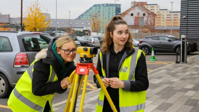
There is unprecedented demand for skilled manpower in geomatics, since geospatial information now plays a more essential role in society than ever. There are multiple and varied applications for geospatial skills and knowledge, with wide integration in urban and regional planning, natural resource monitoring, infrastructure management and precision agriculture, among others. In spite of this, there is currently considerable concern among businesses and academics involved in the geospatial field about the fact that job opportunities in the industry far outweigh the supply of qualified personnel.
Traditionally, due to the specificity and the relative complexity of the instrumentation used, the education and training in all geomatics-related fields would normally take place at universities. Perhaps surprisingly in view of the existing labour demand and the future prospects, an insufficient number of students are enrolling for geospatial-related university degrees almost everywhere. In fact, the lack of enthusiasm for land surveying, geodesy, GIS or geomatics programmes in some countries means that it is no longer feasible for university departments to continue offering them, which is creating a vicious circle. In that sense, perhaps it is time for the industry to increase its efforts to encourage youngsters to develop the knowledge and skills necessary for a future in geomatics at secondary school level, or maybe even earlier. Previous science, technology, engineering and mathematics (STEM) experiences promoted by universities have demonstrated that students who are exposed to field-specific activities at an early age are more interested in pursuing the subject later on.
Towards a sufficient supply of skilled geospatial professionals
Paradoxically, given what seems to be happening within geomatics education itself, there is a clear increase in demand for geospatial courses and training activities from experts in other fields and even from a non-specialist audience. We are witnessing the democratization of many geospatial techniques, such as GIS and photogrammetry which are enjoying great popularity these days. The boom in high-tech devices such as drones and 3D printers is contributing to this and stirring up more fervour for mapping and recording geospatial data among the general public. In this context, many students and professionals from a wide range of fields are also considering strategies to enhance their portfolios and boost their credentials by acquiring new geospatial knowledge and skills.
This growing external interest in the geospatial field should be seen as a good sign of its appeal. To take advantage of this opportunity to attract new talent from other fields, perhaps it is time to modernize geospatial training programmes and to provide relevant instruments and resources for new learners. One way to do this would be to develop training activities with different degrees of complexity, specifically targeted at each type of audience. This could be the solution for ensuring a sufficient supply of skilled and qualified geospatial professionals to meet the industry’s future needs.

Value staying current with geomatics?
Stay on the map with our expertly curated newsletters.
We provide educational insights, industry updates, and inspiring stories to help you learn, grow, and reach your full potential in your field. Don't miss out - subscribe today and ensure you're always informed, educated, and inspired.
Choose your newsletter(s)


