Trimble Introduces High-accuracy Field Solution for GIS Applications
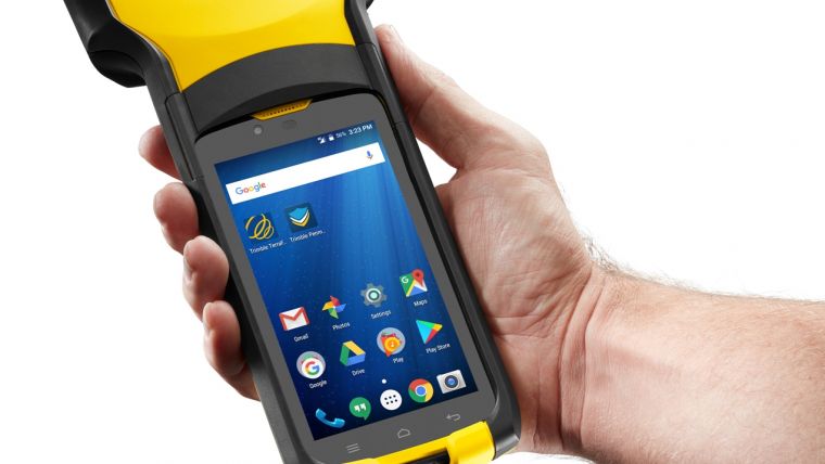
Trimble has announced a new high-performance field computer for its Mapping and Geographic Information Systems (GIS) portfolio – the Trimble TDC150 handheld. Designed for GIS data collection, inspection and management activities, the TDC150 provides users a rugged solution that has the flexibility of a handheld, a modern interface with open Android operating system, and scalable high-accuracy positioning for professional field workflows.
The TDC150 provides advanced Global Navigation Satellite System (GNSS) capabilities in a durable, ergonomic and lightweight form factor. With a built-in GNSS antenna, the TDC150 is a scalable solution that allows customers to choose their desired accuracy. Easy-to-use and carry in the field, it features a bright 5.3-inch sunlight-readable touch screen and an all-day battery for continuous work on the jobsite.
TerraFlex software
The handheld comes with Google Mobile Services certification to run Google core applications and access thousands of apps on the Google Play Store. Professional GIS field applications, including Trimble TerraFlex software – a cloud-based solution that enables users to easily collect, manage and edit their geospatial feature data – are supported, as well as Trimble Penmap for Android software and Esri’s Collector for ArcGIS mobile app. A new innovative TerraFlex workflow uses the TDC150’s onboard rear-facing camera to capture features. This visual aid shows users when the camera and receiver are aligned over features, enabling horizontal centimeter accuracy when holding the device.
“The mapping and GIS industry, including utility companies, local government, and environmental management agencies, look to Trimble for continued innovation,” said Rachel Blair-Winkler, business area manager for Trimble Mapping & GIS solutions. “Adding the ability to get the level of horizontal accuracy required in a handheld configuration without the need for an external pole and antenna, and the new camera-based data logging workflow, gives our customers the flexibility to accomplish more while out in the field.”

Value staying current with geomatics?
Stay on the map with our expertly curated newsletters.
We provide educational insights, industry updates, and inspiring stories to help you learn, grow, and reach your full potential in your field. Don't miss out - subscribe today and ensure you're always informed, educated, and inspired.
Choose your newsletter(s)


