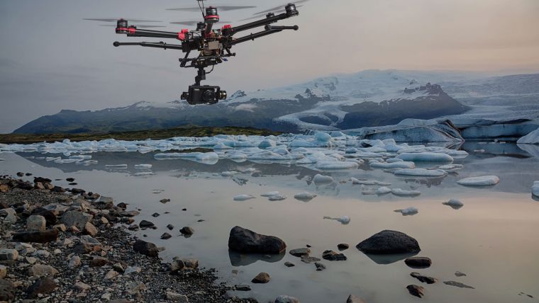
UAS Applications Are Ubiquitous
Unmanned aerial systems (UASs) include imaging systems and/or airborne Lidar systems on an ever-increasing number of variously sized, remotely piloted fixed-wing or multi-propeller systems – the latter being able to hover and take-off vertically – as well as hybrid systems. In 'GIM International' and other surveying and mapping literature, there have been many articles describing the use of UASs, new developments and precautions that need to be taken to achieve satisfactory results. This article explores how UAS applications have become ubiquitous.
(By John Trinder and Yincai Zhou, The University of New South Wales, Australia)
In many countries, small UAS operations must satisfy specific regulatory conditions. These limit the airspace for UASs to below 400 feet (approximately 120 metres) and only allow them to operate while the UAS is within the operator’s visual line of sight (VLOS). The operator typically must also have the appropriate UAS certificate to apply for operations above 400ft or beyond visual line of sight (BVLOS). The limitation of the maximum flying height to 400ft above the take-off location restricts the ground sampling distance (GSD) of images for geomatics applications to approximately 5cm. This is an advantage for many applications, however, since the purpose of many UAS flights is to monitor objects, vegetation and other features at close range.
Due to limited battery capacity, the area that can be covered in a single flight is typically of the order of 1 square kilometre. For larger areas UAS use may be uneconomic for surveying and mapping tasks in comparison to manned aerial photography. Research has shown that adding a solar capability to the UAS can increase flight time significantly, to up to four hours for a single flight.
Applications
UAS technologies have not been specifically designed for the geomatics fields, leading to many new civilian and commercial applications of UASs. Some typical applications described in the literature are: storm/hurricane monitoring; parcel delivery; emergency services; wildfire monitoring; wildlife protection; a range of agriculture tasks; asset and infrastructure inspections, especially in remote areas; security; exploration; environmental assessment; mass media; real estate; transport and traffic monitoring; international peacekeeping and monitoring vulnerable populations for human rights abuses; the visual arts; and many more. Some researchers claim that up to 30,000 civilian and commercial UASs could be flying in the skies over US cities within the next decade.
Many UAS applications described above are limited by the current civil aviation conditions. It could be argued that, without sophisticated collision avoidance, UAS development is still at a primitive stage. Research is being undertaken into collision avoidance systems. This should improve the applications of UASs and could allow them to fly within civilian airspace as well as avoid collisions with objects outside of civilian airspace, particularly when multiple UASs are being used. Furthermore, NASA in the USA is researching prototype technologies for a UAS Traffic Management (UTM) system, which includes airspace design, dynamic definition of boundaries for safe operations of UASs, congestion management and terrain avoidance that could lead to integration of airspace requirements for safe, efficient, low-altitude operations.
How much does positional accuracy matter?
In many applications of UASs, the most important information is the spectral characteristics of the terrain cover derived by multispectral or thermal cameras. In this case, since the exterior orientation parameters derived from the global navigation satellite system (GNSS) receivers and the inertial measurement unit (IMU) are usually inadequate to determine reliable positioning, commercial bundle solutions using ground control points or transformations based on auto-tie points are required.
High positional accuracy for mapping applications is a product of the entire UAS system including the sensors, e.g. spectral cameras and airborne Lidar, exterior orientation parameters derived from the GNSS receivers and the IMU, operations and software, flight planning especially in difficult terrain or dense vegetation cover, as well as accurately surveyed ground control points. The cameras are usually calibrated by in-flight procedures based on an adequate number of auto-tie points or ground control points. If the images are acquired with overlaps of typically 80% along the flight direction and at least 70% between flights, the accuracy of densified point clouds derived from UAS images will be of the order of 1 to 1.5 GSD in position and 1.5 to 2 GSD for heights measured as a root mean square error (RMSE). Rich ground surface texture enables more auto-tie points and hence a higher-accuracy point cloud. Lower accuracies are likely to be achieved if the overlaps are reduced.
UAS Lidar
UAS Lidar mapping is available in the geospatial market but it is not as mature as UAS photogrammetry due to the high price tag for high-accuracy, low-weight Lidar scanners, as well as the need for a precise GNSS/IMU. UASLlidar mapping does not require large overlapped scans, and a single flight can cover a much larger area than UAS photogrammetry. However, the flight time is usually much shorter due to the heavy payload (typically 2kg) compared with a compact camera (typically 200g). UAS Lidar mapping usually uses onboard RTK GNSS for heading and IMU for pitch and roll. Heading accuracy still needs to be improved to achieve comparable point cloud accuracy at the same flight height as UAS photography.
Thanks to the availability of software for processing UAS images, it is possible for individuals without any knowledge of photogrammetric processes such as bundle adjustment to acquire and process UAS images without appreciating the capabilities of the software and/or their shortcomings. These can include aspects of flight planning, flight speed, imaging angle, imaging time of the day and control point distribution in the surveyed area. Image quality is also a factor to consider for mapping accuracy. Geospatial professionals have the know-how to achieve the proposed accuracy by considering flight parameters, camera set-up, image quality, terrain surface and control point distribution, coordinate systems, software processing set-up and parameter configurations. Therefore, it is strongly advisable to engage a qualified professional for the acquisition and processing of the UAS images.

Value staying current with geomatics?
Stay on the map with our expertly curated newsletters.
We provide educational insights, industry updates, and inspiring stories to help you learn, grow, and reach your full potential in your field. Don't miss out - subscribe today and ensure you're always informed, educated, and inspired.
Choose your newsletter(s)


