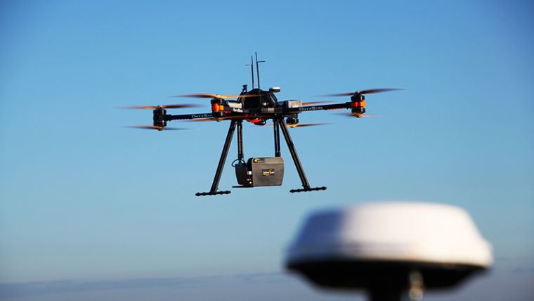
UAS-based Lidar: A Market Update
One of the most eye-catching developments in the surveying profession is the integration of unmanned aerial systems (UASs) and Lidar. Airborne laser mapping is no longer restricted to traditional aircraft only, but is now also available for unmanned aerial vehicles. UAS-based Lidar is particularly interesting for surveys carried out over relatively small areas. The quality of the captured data – i.e. point clouds – depends on the sensor performance and the flight-path accuracy. 'GIM International' has selected some examples of available solutions for UASs and Lidar.
3D Target
3D Target, an Italian manufacturer of measurement instruments, launched a new Scanfly product at Intergeo 2016. Scanfly is a turnkey solution for 3D Lidar mapping, specifically designed for unmanned aerial systems (UASs). Besides on UASs, the Scanfly can also be installed on any other type of vehicle (aerial, terrestrial and marine). The optional panoramic camera allows the photographic documentation of the surroundings. The Scanfly backpack option will be available in early 2017. The SLAM algorithms aid the integrated IMU (INS+GNSS) to achieve the best accuracy even with satellite outage. The point cloud is available in the most common formats or for smart processing, 3DT proprietary software. Read more
Hypack
Hypack, USA, has partnered with Infinite Jib, Velodyne and SBG to provide a mapping solution that represents a next step in the unmanned aerial vehicle (UAV) market: NEXUS 800 UAV. This solution, powered by Hypack, represents a full end-to-end solution, seamlessly harmonising Lidar data with photogrammetry. The NEXUS 800 is a turnkey system that integrates hardware and software to provide an advanced and seamless solution for Lidar survey planning, data acquisition, post processing and analysis and product creation. Read more
RIEGL
RIEGL traditionally uses the Intergeo platform to give an insight into and an overview of its comprehensive Lidar sensors and systems product range. At Intergeo 2016, on the first day, RIEGL introduced current developments and unveiled latest products to the Intergeo audience at its booth. They included the entry-level miniVUX-1UAV Lidar Sensor, a very compact miniaturised 360-degree field of view Lidar sensor with only 1.6kg and especially developed for the implementation of emerging survey solutions by small UAS/UAV/RPAS. The sensor offers multi-target capability and accuracy using echo digitisation and online waveform processing for data acquisition. The sensor is capable of 100,000 measurements per second and offers an operating altitude of 100+ metres. This device allows UAV-based acquisition of survey-grade measurement data from agriculture & forestry, archaeology and cultural heritage documentation, to glacier and snowfield mapping and landslide monitoring. Read more
Routescene
The Routescene proposition to transform the approach to surveys across the world is taking hold. Collaborating with Hanseatic Aviation Solutions, Mapix Technologies – the company behind Routescene – has jointly developed an integrated fixed-wing UAV and LidarPod solution, which is one of the first such products to become commercially available in the world. Following in-depth customer research, the companies identified a gap in the market for an unmanned aerial 3D mapping solution capable of flying long-distances, particularly for use in large countries with great expanses of remote land such as Australia, USA, Canada and Eastern Europe. The applications of this integrated solution are diverse from long distance surveys such as powerline inspections in the utilities sector, biomass mapping of forests to geophysical surveys. Read more
Siteco
Siteco Informatica has launched its new high-performance Sky-Scanner Lidar and image data collection system for unmanned aerial vehicles (UAVs). In development since early 2015, the Sky-Scanner has already exceeded all performance expectations on the DJI-S1000 and DJI Matrice-600 airborne platforms. The development project was spearheaded in collaboration with LTS, a high-tech survey Company headquartered in Treviso, shareholder of UNISKY (spinoff of the Venice University), and ASCO-DAITO, a Japanese leader of surveying, inspection and environmental engineering. Read more
YellowScan
In February 2016 YellowScan announced the launch of its new Lidar UAS surveying solution with highest accuracy and most dense georeferenced point cloud data. Weighing only 1.5kg, the YellowScan Surveyor has a 3cm accuracy and the capability to capture 300,000 shots per second.According to the French company, R&D development for the YellowScan Surveyor solution started in early 2015 with the same philosophy and technology foundation that has made the YellowScan Mapper so successful. With a robust and fully integrated system designed to meet the needs of most demanding survey professionals and terrain, YellowScan Surveyor is quickly and easily adapted to any UAV. Read more
Is your solution missing? Please let us know and send a message to our editorial manager, wim.van.wegen@geomares.nl.
Also worth reading to learn more on the developments on Lidar and UAS are the following two articles:
Lidar’s Next Geospatial Frontier
Over the past two decades, airborne Lidar has evolved from a developmental technology into a well-established mapping solution, and in the process has revolutionised the surveying and mapping industry. Today, unmanned aerial systems (UASs) represent the next geospatial frontier. With recent advancements in sensor technology, the adoption of Lidar for UASs is rapidly expanding, leading to new industry horizons. Read on for insights into the current state of UAS-based Lidar technology and emerging trends.
The Current State of the Art in UAS-based Laser Scanning
Airborne laser scanning (ALS) offers a range of opportunities for mapping and change detection. However, due to the large costs typically associated with traditional ALS, multi-temporal laser surveys are still rarely studied and applied. Unmanned aerial systems (UASs) offer new ways to perform laser scanning surveys in a more cost-effective way, which opens doors to many new change-detection applications. What are the differences in suitability between the two main types of UAS platforms – fixed-wing systems and rotorcraft – and what is the current state of the art in UAS-compatible laser scanning systems? Read on to find out.

Value staying current with geomatics?
Stay on the map with our expertly curated newsletters.
We provide educational insights, industry updates, and inspiring stories to help you learn, grow, and reach your full potential in your field. Don't miss out - subscribe today and ensure you're always informed, educated, and inspired.
Choose your newsletter(s)


