UAS Potential in Archaeology
Archaeology entails the recording of the physical remains left by past generations. Traditionally, archaeological exploration has been by excavation. Other survey techniques have recently gained importance in recording remains that are visible above the ground. Examples include prehistoric fields, settlements and burial remains in upland areas, or industrial landscapes, buildings and standing monuments such as stone circles in other areas. It is more than worthwhile to explore the application of unmanned airborne systems (UASs) in archaeology.
In the past most recording was done with tape and a 1m planning frame, while a theodolite was a luxury. More recently total stations, GNSS receivers, terrestrial laser scanning (TLS) and airborne Lidar have become available. While TLS can be an effective means of recording buildings, it is not suitable for recording landscapes (whether large upland field systems or open-area excavations). Airborne Lidar is useful but, at least in the UK, it cannot provide adequate resolution for the detailed capture of landscapes; typically, only 1m resolution Lidar tiles can be purchased and many areas are not covered. Hence, the need emerged for a technique that is flexible, accurate, economical, fast and can provide 3D models. The latter is gaining weight as archaeologists are responsible to ‘preserve by record’ those archaeological sites which have to be destroyed in advance of developments. Those records have to be maintained for the benefit of future generations and must be as comprehensive and as detailed as possible – increasingly, this means as detailed 3D models. The ‘holy grail’ of archaeological 3D modelling has come in the form of photogrammetry, using unmanned aerial systems (UASs). The discipline of photogrammetry has existed for over 150 years, but recent software innovations have allowed it to become a practical and efficient tool which is within the economic grasp of archaeologists.
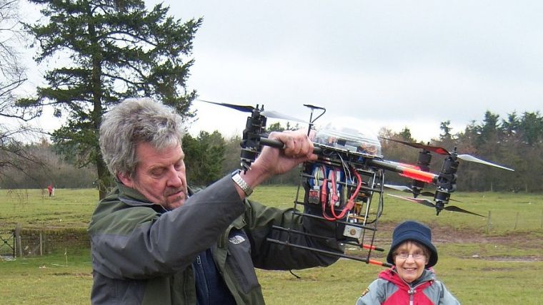
Multi-rotor UAS
In 2010 photogrammetry was used to record parts of a large prehistoric excavation, near Carlisle in the north of England, utilising a camera mounted on a 5m-high mast. Photogrammetry was found to be very rapid, and could provide more detail than robotic total stations as well as better accuracy, since deviations from the vertical of the pole of the total station introduced significant errors. Comparison with survey points revealed a standard deviation of 20mm. The experiment showed that photogrammetry could revolutionise site recording. However, the limited height of masts impeded its true potential. After experimenting with balloons and kites, a UAS appeared to be the most flexible and effective solution. With GNSS-controlled automation, coupled with effective gimbals, UASs form a stable platform capable of capturing images with pebble-sized resolution. They can also be positioned precisely where the surveyor wants them, which is not possible with balloons and kites. A UAS capable of lifting a Sony NEX5 camera can be purchased for under GBP1,000 (USD1,500), making it affordable. Since they are capable of recording open landscapes and also record structures and excavations, multi-rotor UASs are better suited to archaeological recording than fixed-wing UASs. However, multi-rotor UASs are impractical for covering areas larger than 1km2 because their flying time is limited and speed is slow. Nevertheless, sites and landscapes can be recorded 10 to 20 times faster than by conventional means and in greater detail. Cobbled streets, for example, of which only the outlines could previously be mapped economically using total stations, now incorporate the detail of all the individual cobbles. Detailed contours of sites provide a precise and objective record of the landscape, highlighting and revealing subtle features that are virtually invisible in the field. Irregular objects such as standing stones are difficult to record in 2D, resulting in errors and unrepresentative depictions. Photogrammetry, however, enables such objects to be recorded as 3D models.
Limitations
Dense woodland, individual trees and even clumps of grass will obscure the sites to UASs. Unfortunately, not all archaeological sites have carefully manicured, bowling-green-type ground surfaces, whereas aerial Lidar can provide a record of the underlying ground surfaces. Secondly, successful operation of UASs depends on the weather, so it may sometimes be necessary to wait days or even weeks for the right conditions. Thirdly, there are the legal and health & safety restrictions on the use of UASs. In the UK, all commercial operations need to be undertaken by licensed pilots who follow strict guidelines to ensure safety. There are also restrictions defined by the Civil Aviation Authority (CAA) exemption for aerial work, which includes the provision that flying cannot be implemented “over or within 50m of any vessel, vehicle or structure that is not under the control of the person in charge of the said aircraft”. Being compliant with these guidelines can entail considerable preparation to ensure control of structures and vehicles and may even prevent the survey being performed,
By Jamie Quartermaine, Oxford Archaeology, UK
This article was published in GIM International's 2015 UAS Special.

Value staying current with geomatics?
Stay on the map with our expertly curated newsletters.
We provide educational insights, industry updates, and inspiring stories to help you learn, grow, and reach your full potential in your field. Don't miss out - subscribe today and ensure you're always informed, educated, and inspired.
Choose your newsletter(s)


