UASs for Cadastral Applications
Testing Suitability for Boundary Identification in Urban Areas
When ownership of one or more parts of a parcel changes, seller(s) and buyer(s) are legally obliged to identify the new boundaries. Stakeholders are often unable to attend the on-site identification session. Could high-resolution images captured by UAS bring relief? Would it be possible to use a high-quality orthomosaic as substitute? The crux is that precision and spatial resolution must be high enough. Having conducted tests in an urbanised area in The Netherlands, the authors conclude that the precision of 3cm is similar to conventional land surveying and enables seller(s) and buyer(s) to perform boundary identification.
Identification of the location of new legal boundaries is presently done on site in the presence of a cadastral officer. Even when an appointment has been made, and sometimes when the cadastral officer is already on site, seller and/or buyer frequently cancel the arrangement – an undesirable and costly phenomenon. To improve the efficiency of boundary identification, the simultaneous presence of stakeholders on site should be substituted by other means. High-resolution aerial imagery discloses the topographical situation and thus offers a potential alternative, provided that the precision is 6cm or better, since that is the precision of conventional land surveying.
Concept
High-resolution images enable the creation of orthomosaics of uniform scale and hence the boundaries outlined are free of distortion. However, orthomosaics created from conventional aerial images are unsuitable because their current precision and resolution are too low. Improving this to the required level would be very costly. Images captured by Unmanned Aerial Systems (UAS) seem to have appropriate characteristics: flying at a relatively low altitude (40m) results in better resolutions while the precision is 6 to10cm, as Swiss tests show. A slight improvement to these figures would be enough to make UAS imagery suitable for boundary identification. These images would eliminate the necessity for all stakeholders – seller(s), buyer(s) and cadastral officer – to be present on site simultaneously. Instead, the seller(s) and buyer(s) would be able to identify the new boundaries on the image, possibly at the moment of transaction in the notary office. The cadastral officer would then be able to sketch the boundary on a soft or hard copy of the aerial image.
Test Set-up
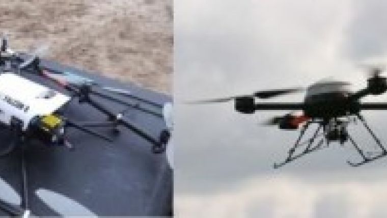
During the winter and spring of 2012, Kadaster started tests on the suitability of aerial images captured by UASs for the identification of property boundaries. The tests were conducted in co-operation with KLPD (Dutch national police force), National Aerospace Laboratory of the Netherlands (NLR) and, in a later stage, the firm OrbitGIS. Three experiments were conducted at two locations: Austerlitz and the city of Nunspeet. The first experiment carried out in Austerlitz concerned a learning phase aimed at getting acquainted with the technology. The second experiment concerned a practical case. The third experiment – also a practical case – was necessary due to some failures during the second experiment.
The full article is online at http://member.gim-international.com. Please subscribe for free using the Subscribe button in the left hand column.

Value staying current with geomatics?
Stay on the map with our expertly curated newsletters.
We provide educational insights, industry updates, and inspiring stories to help you learn, grow, and reach your full potential in your field. Don't miss out - subscribe today and ensure you're always informed, educated, and inspired.
Choose your newsletter(s)


