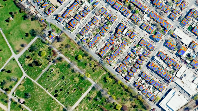
Uncovering the competitive advantages of aerial surveying
How airborne geospatial data has become a powerful tool for understanding the world
What are the primary technical differences between crewed and uncrewed aerial vehicles and satellites when it comes to capturing images of Earth? Where do they overlap, and where do they diverge? By comparing and contrasting the various aerial surveying platforms, this article helps readers to gain a better understanding of the distinctive advantages and limitations of each tool, and how they can be utilized in various situations.
Geospatial technology has transformed our understanding of the world over the last few decades. Aerial surveying, which has been in existence for a century, has progressed in tandem with aviation to become a crucial tool for capturing high-quality data. In addition to the conventional methods of aerial surveying, such as photography, Lidar, thermal, hyperspectral and radar, uncrewed aerial vehicles (UAVs or ‘drones’) and satellites have become ubiquitous tools for capturing images of the Earth’s surface.
Showing us the world from above
In the 1920s, Heinrich Wild invented the first photogrammetric aerial camera, the C2. Over the next 80 years, the industry progressed from analogical to digital cameras, giving photogrammetrists the ability to create detailed maps faster than ever before. With the objective to streamline the process and handle a larger amount of data, allowing users to receive more detailed and accurate datasets faster, the aerial surveying industry was an early adopter of digitalization. As a consequence, the first digital cameras and Lidar sensors appeared around the year 2000.
Subsequently, advances in cloud computing have meant that more accurate data than ever can be obtained quickly. The digitalization of processing, in combination with an increase in demand by the digitalizing of societies, has accelerated adoption of the aerial survey as a business model in the private sector. Nowadays, there are around 60 aerial surveying companies in Europe, according to the European Association of Aerial Surveying Industries (EAASI).
On the other hand, satellites have been used for Earth observation (EO) since the launch of Vanguard 2 (USA, 1959). In 2021, over 950 EO satellites were in orbit, recording data with both passive and active sensors and acquiring more than ten terabits of data daily. Satellite images are used nowadays for mapping, environmental monitoring, agriculture, disaster response, climate research, urban planning, defence and security, and natural resource management. Meanwhile, drones have evolved rapidly since the 1990s, with advances in technology enabling them to perform a wide range of tasks.
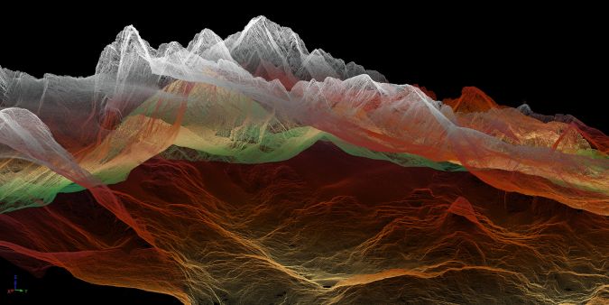
Image resolution: where do we stand?
In terms of resolution, despite the significant technical developments, satellites offer the lowest resolution. Commercial satellite operators are currently able to provide imagery with a ground sample distance (GSD) of a maximum of 30cm, which in some cases is resampled. On the other hand, drones can capture images with much higher resolution than satellites. The resolution of drone images depends on the above ground level (AGL) flying height of the drone, with lower heights resulting in higher-resolution images. For example, a drone flying at the height of 100m can capture images with a GSD of around 2cm. But does this mean that drones are more efficient?
Crewed airborne platforms, such as aeroplanes and helicopters, can capture images with similar resolution to drones, but can do so by flying at a higher AGL due to the utilization of higher-quality optics. Image sizes are larger due to higher-resolution cameras, resulting in footprints on average six times bigger. Nowadays, photogrammetric cameras carried by aeroplanes provide an average of 300Mpx arrays, while drones provide 50Mpx on average. The combination of bigger sensors with higher speeds (180 knots for aeroplanes versus 44 knots for drones) and prolonged flying time (five hours for aeroplanes versus 40 minutes for drones) allows aeroplanes to capture more extensive areas in a single mission, which leads to higher productivity and efficiency. In addition, the smaller size of sensor arrays of drone-mounted sensors results in a much higher number of images. In cases of corridor mapping (e.g. highway planning, powerlines), data capture with an aeroplane may be resolved with one flight line, whereas it may require several lines when using drones.
The quality of the optics plays a significant role in the sharpness of images captured by aeroplanes. Aerial images faithfully represent terrain and objects and are used as input for cartographic processes. Camera optics and sensors (CCD or CMOS) are never perfect. Optical projections are not uniform across the image (focal plane), so the sensors must be calibrated to correct existing distortions. Large-format cameras are ‘metric’, meaning that they have been calibrated in the manufacturer’s laboratory. They are built to keep distortion very low and stable over time, guaranteeing that images can be processed with high accuracy. Smaller cameras used on drones are in most cases ‘non-metric’ or ‘semi-metric’, meaning that they use self-calibration software. Their distortions are more prominent and change dramatically due to environmental conditions like temperature. These variations cannot be corrected completely, and measurements lack the accuracy of large-format aircraft-mounted cameras.
Sensor integration
In the case of crewed airborne surveys, the aircraft can carry a range of complex and multiple sensors, making it a highly versatile tool for mapping large areas. Lidar is a highly accurate and efficient technology that can create detailed 3D maps of terrain, vegetation and other features. It can be used as a single sensor or in combination with photogrammetric sensors (oblique/nadir RGBI imagery), providing a more comprehensive view of the surveyed area. Aerial survey companies are using a Lidar technology that allows data capture while flying at from a few hundred metres up to 6,000m AGL, providing more accurate results than those provided by solid-state Lidars which are used in many drones.
Furthermore, piloted aircraft can capture a range of non-visible data such as infrared, thermal, synthetic-aperture radar (SAR) and multispectral imagery, using them alone or combined. Sensors used in aircraft not only have higher resolution and are metrically calibrated, but they use better-performing inertial navigation systems (IMUs) that allow direct georeferencing of the sensors with three to four times better precision than the smaller solid-state IMUs used on drones. Crewed aircraft have enough room to mount sensors on gyro-stabilized platforms that keep the camera axis vertical (within certain limits) against deviations caused by wind and turbulence more precisely than the gimbal stabilizers used on drones. Considering that crewed aircraft are much less sensitive to wind and turbulence than drones, this results in less motion blur, improved image quality and more uniform flight lines.
As for Lidar, whose dependence on direct orientation is much greater than in photography, the difference in IMU precision is particularly relevant, as well as the difference in power, pulse frequency, laser range precision, number of returns and other features. Therefore, Lidar for aircraft outperforms drone systems by factors of from two to ten. Additionally, aircraft can be used for bathymetric Lidar surveys, which are conducted solely by aeroplanes due to their ability to carry the necessary equipment and power supply. This combination of features and functions is essential for applications such as environmental monitoring, where non-visible data can provide critical insights into the health and well-being of ecosystems. For instance, a piloted aircraft equipped with a thermal imaging camera can identify areas of heat loss in buildings and monitor wildlife populations that may be invisible to the naked eye. Projects of this kind are sensitive to changes in ambient temperature, so the thermal imagery needs to be obtained quickly. The more homogeneous the temperature is during the shot, the better. It is almost impossible to execute this type of project with a drone in relatively large urban areas.
The weight factor also plays an important role. Sensors, together with the stabilized platform and control equipment, amount to between 90 and 120kg as a complete system. Currently, there is no civilian drone that can handle that weight – and even if there were, it would be extremely expensive considering that a drone capable of carrying a payload of 40kg can cost half a million euros.
Fast supply of data
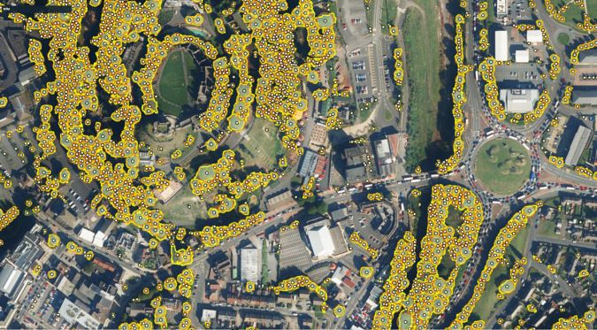
Another advantage of crewed aerial surveying is the time needed to obtain the data. When covering smaller areas (e.g. a few hundred square kilometres) or flying specific corridors, aircraft offer greater efficiency and speed, even when flying in overcast conditions below the clouds. This is because satellites cannot easily change their scheduled orbit or capture clear images in bad weather conditions. And while drones could offer more flexibility, they cannot access urban environments easily due to current flight restrictions. Furthermore, drones are susceptible to adverse climatology.
The human element: security and flexibility
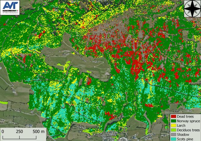
The human element is one of the key factors in crewed aerial surveying. A human operator can provide more nuanced decision-making in complex scenarios. At the same time, the pilot can respond to real-time changes in the environment. For example, changing weather conditions, air traffic, snow on the ground and leaves on trees can all affect the quality of aerial data. The crew can adjust the flight path or altitude immediately to ensure the data collected is of the highest quality. Airborne data offers technical advantages in addition to the differentiating factor of flexibility. Furthermore, human decision-making is important for ensuring data quality by identifying and correcting errors in real time and for managing risks and challenges that may arise during data collection. Excellent examples of the relevance of human judgment are those projects in which external factors determine the mission, such as tidal changes when working on coastal projects for instance.
Key advantages of each platform
We are witnessing a complex panorama in continuous evolution. Technological advances and ambiguous marketing statements lead us to a scenario where the differences between images obtained by satellite, drone and aerial mapping are quickly blurred. Key advantages of drones include their relative affordability, ease of operation and their capability to fly at a lower altitude and closer to structures than crewed aircraft. This makes them particularly useful for applications such as building inspections, transmission tower surveys and small network surveys.
Satellites offer the advantage of being able to collect data on a global scale and over large areas, as well as a high revisiting rate and not being affected by air traffic limitations. This makes them particularly useful for applications such as climate monitoring and land use mapping, where frequent, large coverage is prioritized over high resolution and accuracy.
It is important to consider the legal reality, especially regarding drones, as they face flight restrictions limiting their use in most countries. In Europe, drones are generally not allowed to fly above 120m in height, beyond the operator’s visual line of sight (BVLOS) or more than 500m horizontal distance. Moreover, drones are not allowed to fly in restricted areas such as airports, emergency areas, densely populated urban areas and other areas as determined by local authorities. Therefore, their general use for urban mapping is not allowed currently.
Conclusion
In conclusion, crewed aerial surveying offers a unique set of advantages for collecting high-resolution, timely and accurate data in a wide range of conditions. While drones and satellites have their own advantages, crewed aerial surveying remains a valuable tool for a variety of geospatial applications. The human element is also a critical competitive advantage since it allows greater flexibility in obtaining data and rapid adaptation to real changes.
However, all types of platforms (UAV, aerial and satellite) will provide crucial and useful data at various levels of quality and scale. It has been proven that using data from combined sources leads to better results in many projects. It is vital that clients and end users know and understand in detail the differences between the data sources, which allows them to choose the platform that will best fit their technical requirements.
What the manufacturers say
A number of partners of EAASI were asked for their views on the current competitive advantages of crewed airborne systems and the future of the aerial survey industry.
Layton Hobbs – Product Line Director for Airborne Solutions, Leica Geosystems, part of Hexagon
“We’ve seen that the aerial survey industry has been able to adapt to (and adopt) technology changes since the early days. Today, aerial surveyors use sophisticated digital sensors coupled with highly complex inertial and GPS measuring systems, lasers and time-of-flight sensors capable of measuring the speed of light over only a few metres. In the near future, we see sensor systems continuing to integrate different modalities into a single platform, allowing for new types of remote sensed data to feed artificial intelligence (AI) and machine learning (ML) analysis. We expect sensor performance to continue to increase, but also for sensor capabilities to expand and offer richer 3D data with more information stored for each measurement on the ground.”
Alexander Wiechert – CEO, Vexcel Imaging
“Each technology has a reason to exist, with benefits and downsides. I see more potential threats for crewed aerial surveying coming from drones than from satellites in the near future. However, drone operation is currently heavily limited, and the payload is still small. This is why the current use of drones is a niche to survey points of interest and small-scale areas. The situation may change in the future as we advance in general towards a more automated operation in technologies, but it will take time as the airspace regulations will need to change, and this is usually a slow process.”
Philipp Grimm – CEO, IGI Systems
“I think that disaster response is one particular example of the competitive advantages of aerial surveying versus drones or satellites. For instance, during the German floods two years ago, many of our clients were flying to collect information about the status of the disaster area. Emergency response teams, firefighters and police needed to obtain this information fast to organize assistance on the ground, decide where to place bridges, etc. These specific situations demand a quick flight response and fast image processing that is only possible with crewed aircraft.”
Peter Rieger – Manager, Airborne Laser Scanning Business Division, RIEGL
“The development of drones and other aerial platforms is also likely to expand the applications of aerial surveying beyond traditional industries in the next five to ten years. For example, drones can be used for environmental monitoring, disaster response and search and rescue operations. This could lead to new opportunities for surveying companies and other businesses in the industry.”
Thibaud Capra – Product Manager, YellowScan
“In any Lidar data acquisition for surveying purposes, it’s all about the scale and cost of operations, while meeting the mission requirements and scope of work. Aerial missions are ideal for larger-scale operations, which would be too tedious for UAV flights while keeping a better resolution and level of detail than satellite imagery. It also has a flexibility of data quality as you can fly lower to improve the point density, for instance. Moreover, it is safer as you have no boots on the ground, and you’re able to survey large areas that can be too risky to crawl in or access with the necessary equipment, batteries, etc.”

Value staying current with geomatics?
Stay on the map with our expertly curated newsletters.
We provide educational insights, industry updates, and inspiring stories to help you learn, grow, and reach your full potential in your field. Don't miss out - subscribe today and ensure you're always informed, educated, and inspired.
Choose your newsletter(s)
