Unlocking the Full Potential of UAVs for Advanced Mapping
Ask the Specialist
In this edition of ‘Ask the Specialist’ the question is: how can we unlock the full potential of drones for advanced mapping operations? For our ‘Ask the Specialist’ features, we invite readers to send us their burning questions about geospatial surveying. We pass the questions on to relevant industry experts who provide comprehensive and detailed answers to point geospatial professionals in the right direction.
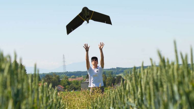
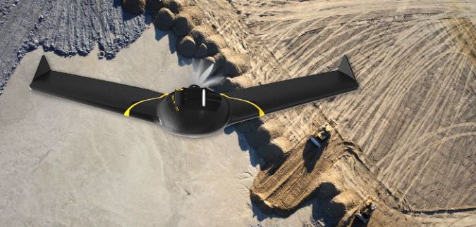
It is no secret that, today, unmanned aerial vehicles (UAVs or ‘drones’) are a viable and mainstream commercial mapping tool that provide a robust return on investment. But technology does not stand still, and the result is the progress of more advanced drone operations which can help to improve safety for people both in the air and on the ground, while also saving long-term costs and increasing data collection efficiencies. From beyond visual line of sight (BVLOS) and operations over people (OOP) to flying at night or in fleets, it is clear that advanced operations present vast opportunities. So the question is: why are they not being utilized by drone operators the world over?
Navigating today’s landscape
These operations are, in name and nature, more advanced than their traditional counterparts – but the answer to this question does not solely lie in the complexity of the operations themselves. Rather, it is the lengthy planning and approval process typically involved in obtaining permissions for advanced flights – combined with the lack of harmonization of drone regulations across the globe – that can elevate the barriers to entry. In 2018, thousands of companies applied to the US Federal Aviation Authority (FAA) for a Part 107 Waiver – an official document that approves certain aircraft operations outside the limitations of regulation – to be allowed to fly BVLOS but, according to AUVSI figures, only 23 were approved. So, what can be done to break down these barriers once and for all?
Testing, testing and more testing
Demonstrating that drones are capable of meeting the safety, regulatory and logistical needs of advanced drone operations is key to unlocking their potential in this space. Safety testing is paramount to achieving this, because testing and regulations are almost inextricably linked. The more data that is available supporting a drone’s durability and reliability, the more evidence there will be that the technology is safe and fit for purpose; fixed-wing drones are backed by thousands of hours of safety testing, which has proven vital in helping to streamline and accelerate the approval of waiver requests and flight permissions. Sufficient safety testing data can also ensure that the operation scope is not restricted, for instance by being limited to flying in remote areas only. Indeed, it is clear that the role that testing can play in both ensuring regulatory compliance and expanding mapping opportunities should not be underestimated.
Onwards and upwards
Proving that a drone is capable of safely carrying out advanced flights is clearly essential to gaining approval. But how do operators know exactly what is required of them, when the rules they must follow vary depending on where in the world they are? The positive news is that important steps have been taken to address this. The FAA and Swiss Federal Office of Civil Aviation (FOCA) recently signed a declaration of intent to strengthen collaboration in the unmanned aircraft systems (UAS) space and cooperate to advance the harmonization of domestic and international UAS safety standards. And the new European rules coming into force in January 2021 are an exciting, welcome step forward in the industry’s efforts to synchronize legislation in countries across the continent.
These new European regulations will also facilitate progress in streamlining approvals for advanced drone flights like BVLOS, by offering a clear and defined written process for operators. Streamlining measures are being implemented across the pond, too; the FAA recently launched its new BEYOND programme, which will support efforts to move towards BVLOS operations being carried out under established rules, rather than waivers. Type certification is also becoming increasingly important in the USA, which may further signal a potential move away from waivers in the future.
Reaping the rewards
In time, the potential benefits for advanced drone operations in commercial settings are significant. Partnering with authorizing bodies or institutions, and maintaining communication throughout approvals, will be integral to enabling operators to collect more data and build on the regulations already in place. With the right connections, advanced operations can be carried out easily and efficiently, and I’m confident that commercial companies can reap the rewards. With access to more data and increasingly accommodating regulations, I look forward to advanced drone operations becoming more and more accessible for the modern drone operator. It’s closer than we think.

Value staying current with geomatics?
Stay on the map with our expertly curated newsletters.
We provide educational insights, industry updates, and inspiring stories to help you learn, grow, and reach your full potential in your field. Don't miss out - subscribe today and ensure you're always informed, educated, and inspired.
Choose your newsletter(s)


