Urban Planning of Stockholm in 3D
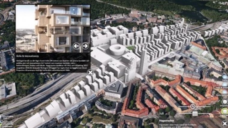
Stockholm Municipality has set up an appealing way of communicating its future urban projects. In the Culture House of Stockholm City, a large touchscreen is available allowing citizens to 'fly' through a photo-realistic 3D model and explore the various urban projects planned in Stockholm. This impressive virtual mock-up of the Swedish capital was created by Blom Sweden, thanks to the Smart3DCapture solution from Acute3D for the 3D reconstruction and to Agency9’s CityPlanner for the visualisation.
Merging the ultra-accurate 3D model automatically generated by Smart3DCapture (including more than 5 billion triangles) and the GIS data already collected by Stockholm Municipality, this photo-realistic 3D city model is not a mere 3D view of Stockholm, but also an incontestable key tool in the decision-making process and a universal means of communicating with citizens.
The principle of Smart3DCapture is to analyse several photographs of a static subject, taken from different viewpoints, and to automatically detect pixels corresponding to a same physical point. From many such correspondences, relative orientations of photos and accurate 3D shapes of the scene can be inferred.

Value staying current with geomatics?
Stay on the map with our expertly curated newsletters.
We provide educational insights, industry updates, and inspiring stories to help you learn, grow, and reach your full potential in your field. Don't miss out - subscribe today and ensure you're always informed, educated, and inspired.
Choose your newsletter(s)


