UrtheCast and Esri Bring Satellite Imagery to Life in ArcGIS
UrtheCast and its subsidiary, the Earth Observation company Deimos Imaging, have entered a broad partnership with Esri, starting with a new UrtheCast imagery service that is powered by Esri: Kanvas. The service will enable all Esri users to access timely, reliable and quality assured imagery, directly into their apps and desktops. The on-the-fly imagery service curated by Deimos imaging, is a precursor to the upcoming UrtheDaily constellation, which is expected to image the entire Earth daily at 5m resolution, complimenting Sentinel-2 and Landsat applications.
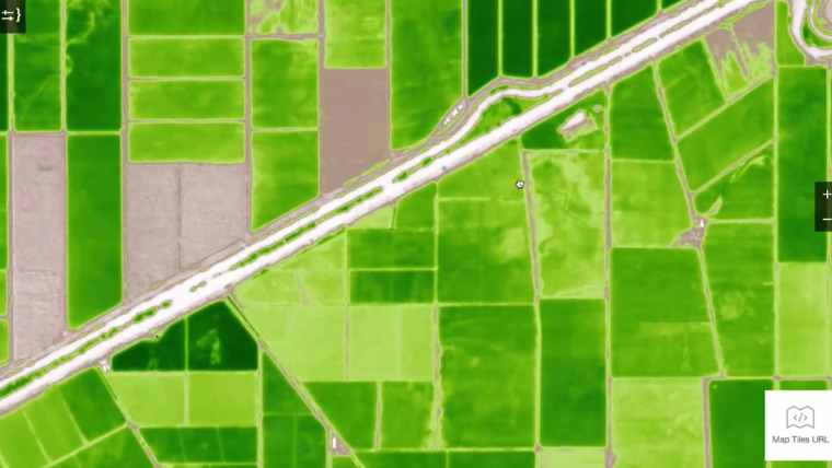
Starting today, anyone with the ArcGIS platform will have free access for three months to the multi-season time series of medium and very-high resolution satellite imagery, over the whole of Spain and California. Hosted in Amazon Web Services using ArcGIS, Esri users can utilise the multi-temporal imagery service and start building valuable apps for monitoring, change detection, precision insights and more.
New GIS solutions
Lawrie Jordan, director of Imagery at Esri, said his company is very excited about the broad partnership with UrtheCast and for their users to explore the potential of Kanvas using ArcGIS. Allowing users to create simple, quick, insightful apps, based on timely and qualified imagery, will inspire new solutions in GIS. Esri fully supports the upcoming UrtheDaily constellation and see significant interest from their users. Delivering daily coverage of the Earth as geo-analytic ready imagery directly into the hands of the users, means that mapping the Earth daily is now a step closer, and the intelligent map a future reality, Jordan added.
Easy-to-use value-added products and services with geo-analytics capabilities are significantly broadening the utility of Earth Observation data. The future is in user-focused, real-time apps, said Jamie Ritchie, business development director at UrtheCast and Deimos imaging. The goal of Kanvas is to bring imagery to life by leveraging machine learning algorithms in an integrated environment. By partnering with Esri, Urthecast and Deimos are delighted to make available their imagery in ArcGIS, to significantly accelerate decision making in a wide range of fields.
Kanvas was introduced at the Esri 2017 User Conference in San Diego.

Value staying current with geomatics?
Stay on the map with our expertly curated newsletters.
We provide educational insights, industry updates, and inspiring stories to help you learn, grow, and reach your full potential in your field. Don't miss out - subscribe today and ensure you're always informed, educated, and inspired.
Choose your newsletter(s)


