Web-based 3D in Urban Planning
Examples and Critical Success Factors
Urban planning has become more complicated due to today’s rate of urbanisation and the rapid expansion of cities. Web-based 3D tools coupled with high-quality 3D city models and digital terrain models offer viable solutions. Although the majority of plans are still produced in 2D, there is a growing trend towards 3D. Read on for examples and discussion of some critical success factors.
(By Håkan Engman, Agency9, Sweden)
The majority of plans are still produced in 2D. One hurdle has traditionally been the high acquisition cost for digital terrain models (DTMs) and 3D city models. This is changing quickly as the technology for the capture and automated processing of detailed 3D geodata is rapidly maturing and eroding the cost barrier. The fact that access to 3D geodata no longer requires specialised software and workstations is also supporting the transition to 3D.
Browser-based City Planning
Advances in 3D support of WebGL and HTML5 internet-based tools have made it possible to establish workflows which incorporate 3D geodata. These tools support easy interaction with massive DTMs and city models. Meanwhile, high-quality 3D geodata is nowadays the proverbial ‘one click away’ for anyone with a web browser. Agency9’s CityPlanner is an example of an easy-to-use web-based planning tool. It is used to stream 3D city models of unlimited size, and the service scales from a single user – such as an architect or planner – to large organisations. As a cloud service, it makes it easy to get started as users are not dependent on IT departments or hardware investments. This new 3D planning paradigm allows municipalities and other organisations, both governmental and non-governmental ones, to explore the possibilities of 3D geodata.
Easy Access and Use
Web-based 3D planning tools such as CityPlanner provide instant access to 3D city models and other geodata in a web browser. This eliminates the need for users to go through lengthy procedures, such as requesting geodata from the GIS Department and scheduling experts to set up and configure workstations (Figure 1). 3D models and data can be accessed and visualised during design sessions at any workplace or in any meeting room, either in the office or externally. Existing 2D geodata, such as zoning, street and utility maps or environmental information, can be draped on the city model. 3D buildings and other objects can be sketched, terrain features modified and existing buildings hidden to simulate demolition, for example. The scene can be visually analysed from different viewpoints by moving the camera to desired positions and angles. Points of interest can be added to share images, attachments, text or other types of information. Real-time sun and shadow analysis provides insight into the effects on solar-energy collection and sun hours in planned residential areas. Gathering feedback is easy, since visualisations can be shared with anyone, anywhere through a web link. The resulting collaborative workflow reduces lead times and helps to avoid misunderstandings. Planners do not need in-depth CAD skills and they are also less dependent on the expertise of visualisation specialists. Changes can be quickly updated and distributed while provisional sketches can be refined by CAD models made by architects, for example.
Participative Planning
Web-based 3D tools support communicative planning by creating short feedback loops and interaction with stakeholders and citizens (Figure 2). Citizens may be affected by the changes resulting from implementation of the plans. With the right communication they can feel like stakeholders during the planning process, which creates awareness, engagement and involvement. Communication with citizens at an early stage can thus reduce frustration, miscommunication and complaints. Feedback can also provide valuable crowd-sourced information which may be incorporated into further planning. Citizen participation currently takes place at physical meetings, which limits participation. Use of the internet can widen the audience to include families, minorities and others who would not normally attend such meetings.
Experience shows that the use of 3D models in communication with citizens not only supports their understanding of the situation and generates inspiring feedback, but also results in users spending more time on studying plans and proposals. As an example, a study carried out by one city revealed that very few stakeholders and citizens visited the public website for urban planning projects, and only 1% of them opened the PDF attachment describing the projects. In contrast, an interactive 3D model was viewed by 30% of the visitors, resulting in a remarkable increase in awareness. A proper strategy, 3D tools which allow for a digital dialogue (see Figure 3) together with high-quality 3D geodata substantially improve public participation.
Choice of Geodata
Background data that represents the existing scene is essential for 3D visualisation. City models are traditionally represented by a DTM combined with separate building layers, which may contain simple building geometries, more refined roof structures or even textured facade imagery.
As an alternative to geometry models, photorealistic 3D city models (mesh models) are now growing rapidly for planning purposes. These reality models can be automatically created from satellite or aerial imagery at affordable costs by using tools such as ContextCapture from Bentley, PhotoScan from Agisoft or Streetfactory from Airbus. Aside from budget, the choice of 3D geodata depends on the purpose of the specific visualisation and the planner’s own preferences. The choices may relate to the following questions:
- Who is the target group for the visualisation (e.g. citizens, stakeholders, planning experts)?
- What level of detail is required? Aim to avoid confusing the situation with street scenery and distracting colours which are not a part of the plan.
- How accurate does the model need to be?
Many organisations may invest in both photorealistic and geometric 3D city models to serve different use cases. Furthermore, the availability of national 3D maps, e.g. from national mapping agencies (Figure 4), is driving national use of 3D in planning. Deployment of such models in Norway, Sweden and Denmark, for example, is giving organisations involved in planning instant access to basic 3D data nationwide.
Critical Success Factors
Traditionally, 3D visualisation has been a one-off project created by a consultant, resulting in a video that is distributed online. Such projects are usually expensive to continue. Leading an organisation towards a 3D-based workflow is complex. Obstacles to overcome may include organisational issues and fear of new technology. Therefore, as a first step, organisations are recommended to carefully select a pilot with high visibility to create awareness and demonstrate value. Management commitment is the key long-term success factor, along with defining feasible targets and allocating proper resources. Without the right publicity, even the best projects can fail. Therefore, communication with the public is key and involvement of the Communication Department is essential. A successful project can open the eyes of management and other stakeholders, which helps drive the implementation forward.
Biography of the author
Håkan Engman, MSc, is CEO of Agency9 and has an international background working with IBM, BMC Software and Ericsson. For the past ten years he has worked with start-ups in the software market.
Email: hakan.engman@agency9.com
Illustrations
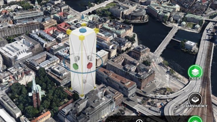
Figure 1, A giant reality 3D model of Stockholm, produced by Blom/Terratec, visualised in a web browser.
Figure 2, Proper planning using web-based tools consists of multiple steps with short feedback loops and interaction with stakeholders and citizens.
Figure 3, Gothenburg’s MinStad 3D portal engages tens of thousands of people.
Figure 4, A national 3D model of Norway provided on the web by Norkart.

Value staying current with geomatics?
Stay on the map with our expertly curated newsletters.
We provide educational insights, industry updates, and inspiring stories to help you learn, grow, and reach your full potential in your field. Don't miss out - subscribe today and ensure you're always informed, educated, and inspired.
Choose your newsletter(s)


