Where would the geospatial world be without circles?
It’s about time, it’s about space!
Do you ever stop to think about the ideas behind today’s geospatial technology? Many of them are thanks to methodologies and breakthroughs by our ancient counterparts, as this article explains.
There is probably no one involved in surveying and geospatial modelling who believes that they could achieve accurate and reliable results without trigonometry and space-correlated time. But how many realize that the models, concepts and equations which drive today’s 3D modelling and problem-solving technology are only possible thanks to methodologies and breakthroughs by our ancient counterparts. A number of key contributions are acknowledged in this article.
There was a great sitcom on TV when I was a young fellow (a very long time ago!) called It’s About Time!. The storyline involved two NASA astronauts being launched on a mission which spiralled into a time warp and cast them back to the prehistoric period. I thought it was brilliant, especially as I was fascinated by space, prehistory and how the world fitted into the vast framework of the cosmos. The first line of the theme song was “It’s about time, it’s about space”. And certainly, what we do as geospatial professionals is all about space and time, as well as how we measure and reshape our environment to cause minimal impact on the planet upon which we exist.
Is there anyone involved in surveying and geospatial modelling who believes that they could achieve accurate and reliable results without trigonometry and space-correlated time? Those of us possessing the gift of mathematical comprehension can send a big ‘thank you’ card back in time to two ancient Greek masters who are both variously attributed to dividing the circle into 360 degrees: Hipparchus and Hypsicles. Seeing as both men lived in about 200-180 BC, there could have possibly been some mutual interaction. This now well-recognized circular division has been modified into spherical 3D applications for all manner of precise figure creation and accurate mapping by surveyors and astronomers. In fact, Hipparchus has been called “The Father of Trigonometry”, having also invented the concept of latitude and longitude in addition to creating tables of chords, inventing a plane astrolabe and manufacturing celestial globes.
Ancient oracles
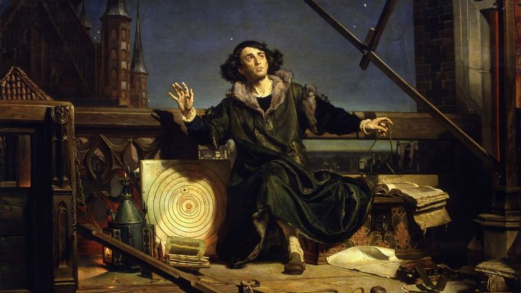
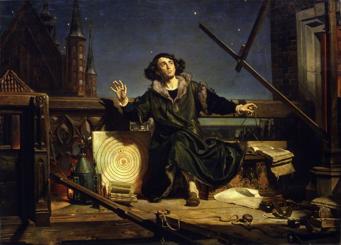
We only need to travel backwards to 310 BC to find the birth of another ancient oracle named Aristarchus of Samos. This guy, who lived until 230 BC, espoused a heliocentric solar system nearly 1,800 years before the later-favoured Copernicus… talk about being well ahead of your time! Not only did he teach that the Sun was at the centre of our galaxy, he also determined the relative distances of the Sun and the Moon from the Earth. So why did it take so long for the God-fearing Catholic scientists to convince their Pope that the Earth was not flat and it actually orbited around the Sun not vice versa? It may have been practically useful for surveyors for the Earth to be planar, but when ships were disappearing over the curvaceous sea horizon, then the flat-Earth hypothesis must have been regarded as a bit of ‘Papal bull’ to all but the ‘true’ believers.
Everything old is new again
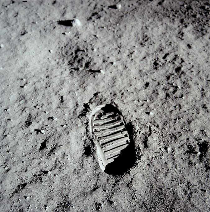
So what lessons can be extracted from these ancient men of learning? There has to be some truth in the saying “Everything old is new again”. Today, we still have paranoic groups obsessed with conspiracy theories about anything that appears to be fantastical or beyond their minute realm of brain activity. The Apollo 11 Moon landing doubters carry echoes of the time during the Industrial Revolution when luddites smashed up machinery and sabotaged factories because they regarded the advent of new technology as dislocating humans from bread-winning employment. The reality is that such technological innovations have invariably resulted in greater opportunities, including more viable careers with reduced physical exertion for those undergoing training and gaining experience in the new techniques and equipment.
Worldwide Standard Time
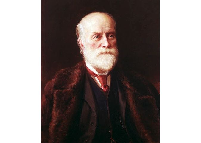
Meanwhile, another remarkable change with worldwide ramifications, without which global travel and interspace activities would not be possible, occurred less than 150 years ago. On 1 January 1885, Scottish-Canadian surveyor Sandford Fleming’s idea of the globe divided into 24 one-hour time zones became reality when World Standard Time (WST) was adopted at a conference in Washington DC, USA. Fleming had proposed the concept of WST after an incident in Ireland in 1876, when he missed a train due to the non-standard relativity of time between different localities. His surveyor brain went straight into action to devise the need for standardizing the relative time all over the globe, together with a 24-hour clock and a zero line of longitude at a Prime Meridian through Greenwich, UK.
It took quite a number of years to realize universal adoption of WST and there were many variations to the original prototype. The island nations near the International Date Line sought some compromises and modifications, and considerations of the local situation between adjoining countries brought about some deviations in the intended straight line. Various countries that were otherwise split into differing time zones chose to distort the symmetrical network of time zones by enlarging or diverting the ‘true time’ longitudinal lines to trace external boundaries or to include the whole nation within one of the final time zones. The overall result can be seen on the current international time zone chart.
The importance of time-related positioning
Clearly, the NASA space programme and all other such efforts to explore the outer regions of our solar system are dependent on time for precise positioning to ensure, as much as possible, that more satellites sent into orbit for the augmentation of Earth communication networks remain operational and reliable. With so much multiplicity of motion – with planets rotating, moons orbiting and satellite constellations competing for space – time-related positioning is critical to preserve the continuance of functionality. It is also essential to maintain a functional communication system to coordinate rescue and relief efforts in the aftermath of disasters. Unfortunately, such precise location pinpointing methods are also utilized by militantly aggressive nations to launch deadly strikes against defending territories. However, equally defensive rocket capabilities can use the same technology in an attempt to counteract such strikes.
Protectors and champions
Surveyors have always been an indispensable ingredient in the evolution and inhabitation of the planet Earth. In Ancient Egypt, the scribe surveyors had the task of reinstating the boundary monuments of land parcels after the Nile floods washed them away. Today, with our fragile planet enduring multiple forms of physical transformation, surveyors and geospatial experts have never been more vital to our survival. They are the protectors and champions of a world facing the effects of pollution, population increase, climate change and natural disasters such as flooding, landslides, earthquakes, volcanic eruptions, fires and wars.
In my view, it is important to acknowledge how the methodologies and breakthroughs handed down to us from our ancient counterparts have provided us with the necessary models, concepts and equations to drive the modern computerized technology which has become the problem-solving 3D modelling equipment of the modern age. Naturally, as a very senior member of the geospatial family, I can never envisage a time when expert surveying knowledge developed over years of hands-on experience will be totally replaced by global positioning systems and robotic artificial intelligence (AI) instrumentation. Despite the great advances in computerization, I believe there will never be an infallibly flawless system with a precise output absent of inherent errors only discernible through an expert overview. Geospatial experts will remain indispensable.

Value staying current with geomatics?
Stay on the map with our expertly curated newsletters.
We provide educational insights, industry updates, and inspiring stories to help you learn, grow, and reach your full potential in your field. Don't miss out - subscribe today and ensure you're always informed, educated, and inspired.
Choose your newsletter(s)


