Yushu Earthquake Relief
Applying Space Technology
Space technology has been widely used for disaster management in China. As the decision-making support agency for Chinese disaster management, the National Disaster Reduction Center of China (NDRCC) has established architecture for the application of space technology. The authors describe how this worked in the case of relief work after the Yushu Earthquake, summarising the experience and lessons learnt.
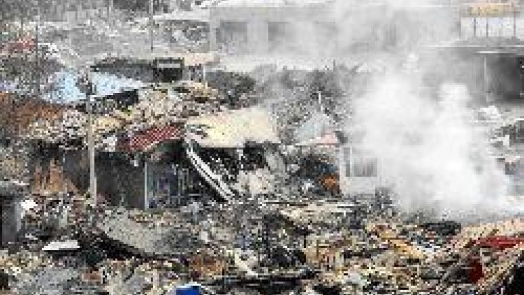
Yushu Earthquake struck on 14th April 2010 at 7:49am local time, with a registered magnitude of seven. The epicentre was the village of Rima in the county of Yushu. More than 2,500 people lost their lives and five times that number were injured. The Chinese government quickly organised relief efforts according to the national contingency plan, with the aim of saving as many lives as possible and minimising material loss. NDRCC immediately set in motion operations for gathering all available geo-data from a wide spectrum of sources; Figure 1 shows a schematic overview of the entire process, from imagery to map products.
Image Acquisition
Within four hours of the earthquake NDRCC had sent requests for Earth Observation (EO) images to International Charter ‘Space and Major Disasters'; CHARTER is the joint initiative that works to provide emergency-response satellite data free of charge to those affected by disaster anywhere in the world and which China National Space Administration joined in 2007. NDRCC sent similar requests to ten institutions and agents owning EO imagery in China. Most of the images acquired, in total 42 pre-event images and 1,135 post-event images recorded by nineteen space-borne and airborne platforms from seven countries (Table 1), focused on Jiegu Township, the area most severely affected. Imagery recorded by aeroplanes and unmanned aerial vehicles (UAV) was delivered by the Chinese Academy of Sciences and the State Bureau of Surveying & Mapping. The NDRCC-operated Small Satellite Constellation for Environment and Disaster Monitoring and Forecasting (SSCEDMF) provided the first post-event image within five hours of the earthquake; HJ-1 A and HJ-1 B, launched in 2008, are the first two SSCEDMF satellites, and presently the only ones.
Image Analysis
Based on previous experience, earthquake specialists rightly believed that bungalows would be badly damaged. The structure of buildings could be extracted from pre-event imagery. Within fifteen hours of the earthquake it was possible to complete pre-assessment of damage to houses, thus providing support for the setting up of emergency response. Earthquakes usually result in secondary disaster, such as landslide. Based on comparison of pre-event and post-event imagery, five landslide bodies could be identified, all located in the southeast of Jiegu Township;
the biggest landslide extended over 4,900m2. Damage to the nearby road could also be assessed. Based on the images, buildings in Jiegu Township were categorised according to a three-level class hierarchy (Figure 2):
- township function: political area, residential area, industry area and special-use area (religious, agricultural, cultural and others)
- land use: districts distinguished according to main activity taking place there; political, educational, health care (hospital), residential, industrial, and special-use; in total 98 districts
- building type: high-rise, bungalow, greenhouse, square and stadium, resulting in subdivision of the area into 685 homogeneous blocks.
According to the above hierarchy a coding system was developed enabling each building to be assigned to three classes. For example, a building might have a government function, be located in a political district, and belong to building type ‘high-rise'. Along with the relief work, ground observations now completed the pre-assessment results.
PDA Fieldwork
Field information on affected people and damaged buildings in all blocks was collected using PDAs equipped with GPS and digital camera. Field workers could record information on templates implemented in the PDAs to facilitate gathering, and all information was managed using custom-built software. After collection data was transmitted to a data server in Beijing via wireless communication and combined with the pre-assessment of damage to property determined from image analysis on HJ1-A/B and Quickbird imagery acquired on 15th April 2010 (Figure 3).
Map making
Once the information was extracted and damage assessed, standardised maps could be rapidly generated by loading data onto a template designed according to pre-specified standards. Over twenty map types were produced and distributed by fax, email, hardcopy, internet or briefing to four types of user: central government emergency management agencies; local government and field teams; the public and international societies in support of awareness raising and assistance; and scientific research institutions.
Experience and lessons
Splitting up the emergency operation into small parts and assigning each to a team of specialists with specific responsibilities proved effective. It is also essential to partition the disaster area into multiple levels to support planning and execution of fieldwork, the results of which need to be integrated with EO imagery to arrive at reliable and accurate information. Information content of diverse EO imagery differs greatly. Aerial imagery, characterised by a high spatial resolution with pinpointing of scene capture, is better suited for detailed assessment than satellite imagery. The latter has the advantage of rapid availability, thus providing early-stage overview pictures of the affected area.
Concluding Remarks
Although space technology combined with aerial imagery and GIS technology proved effective in supporting emergency response management in the case of the Yushu Earthquake, communication and information collection needs to be further improved in the interests of enhancing future disaster relief.

Value staying current with geomatics?
Stay on the map with our expertly curated newsletters.
We provide educational insights, industry updates, and inspiring stories to help you learn, grow, and reach your full potential in your field. Don't miss out - subscribe today and ensure you're always informed, educated, and inspired.
Choose your newsletter(s)


