The Geo4Dev initiative aims to combine research with geospatial data to support global development in line with the 2030 Agenda for Sustainable Development. As part of its goal to end poverty and set the world on a path of peace, prosperity and opportunity for all on a healthy planet, the 2030 Agenda recognizes the importance of space-technology-based data, in situ monitoring and reliable geospatial information for sustainable development, policy-making, programming and project operations. Geo4Dev is a collaboration between academia, public and the private sector that integrates rigorous research with innovative sources of geospatial data, including satellites, sensors and mobile phones, together with artificial intelligence, machine learning and computer vision approaches.
This blog is contributed by Ran Goldblatt, Trevor Monroe, Maria Jones, Douglas Glandon, Samuel Fishman, Daynan Crull, Gabe Levin and Ghermay Araya.
Our world is changing
Our world is rapidly changing in almost every dimension. In 2007, for the first time in history, the global urban population exceeded the global rural population and by 2050 nearly 70% of the world's population will live in urban areas.
While there is no doubt that urbanization has many positive implications for society, economy, welfare and more, this does not come without immense challenges. Rapid urbanization may damage ecosystems, increase emission of gases, increase demand for public services, put pressure on public infrastructure and may increase the gap between rich and poor. Urban areas were also the most vulnerable to the recent COVID-19 pandemic, and the majority of global COVID-19 cases are reported in urban areas.
With slower investments in infrastructure, housing and other basic services, more people are living in slums, and in parallel, poverty and extreme poverty are also rising. In 2018, almost 8 per cent of the world’s workers and their families lived on less than US$1.90 per person per day, and COVID-19 may push between 88 and 115 million people into extreme poverty (Poverty and Shared Prosperity Report 2020).
In parallel, since the 1940`s, there has been an increase in the frequency and severity of global natural disasters. Extreme weather and floods account for the majority of global natural disasters with immense impacts to vulnerable populations in low-income countries.
Food security is another challenge many developing countries face. Shocks related to climate change, conflicts and infectious disease are hurting food production, disrupting supply chains and limiting accessibility to affordable food. According to the FAO, nearly 690 million people – or 8.9 percent of the global population – experience hunger, up by nearly 60 million in five years.
Yet, accurate data on the number of poor people, their living conditions and vulnerability are scarce, especially in developing countries. Census counts and population surveys comprise the primary sources of this type of data, but these are published infrequently, varying in resolution and precision, due in part to limited available resources for data collection. On the other hand, innovative sources of data facilitate the development of new approaches for demographic modeling and measurement of wealth.
Geospatial data for development
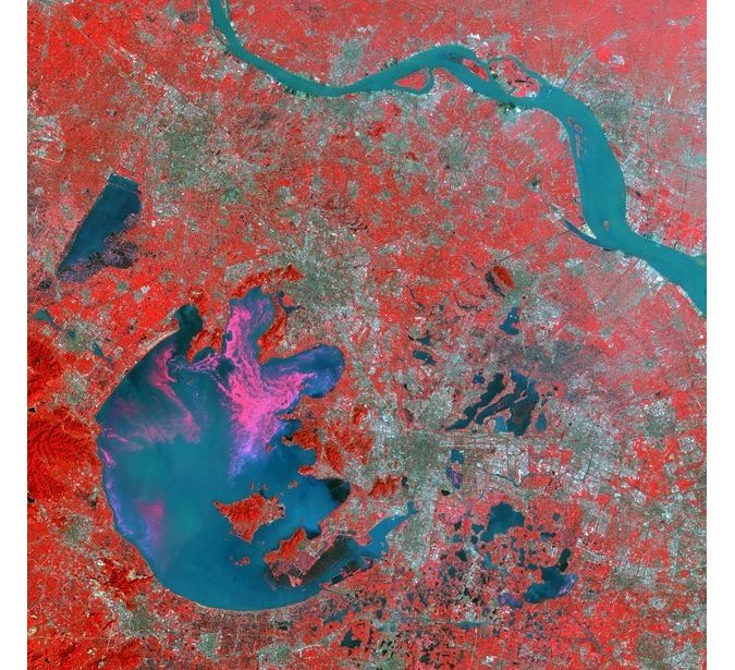
And indeed, everything in our world has a spatial dimension. Poverty and other societal characteristics, social justice disparities, economic trends, food security, changes to ecosystems and aspects related to society well-being or inequality hold physical dimensions.
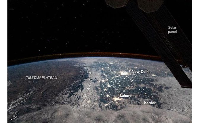
Integrated geospatial measurement capabilities enable an ever-increasing capability for granular measurement development and finer evaluation methods. Ground and remote sensors measure and collect climatological and environmental data, such as the quality of water, air and soil; mobile phones and GPS devices collect data on movement of people; cameras constantly monitor the functionality of critical infrastructure; sensors on board satellites, airborne and UAVs capture almost every location on Earth - monitoring economic activity and agriculture land productivity; stream gauges help track the impacts of floods on vulnerable populations; Volunteered Geographic Information is collected and contributed by volunteers, complementing (or replacing) traditional data sources; while geodata is used to support disaster management operations. Satellite data is being used today to measure the economic and societal impacts of COVID-19, for example, by looking at changes in nighttime light emissions.
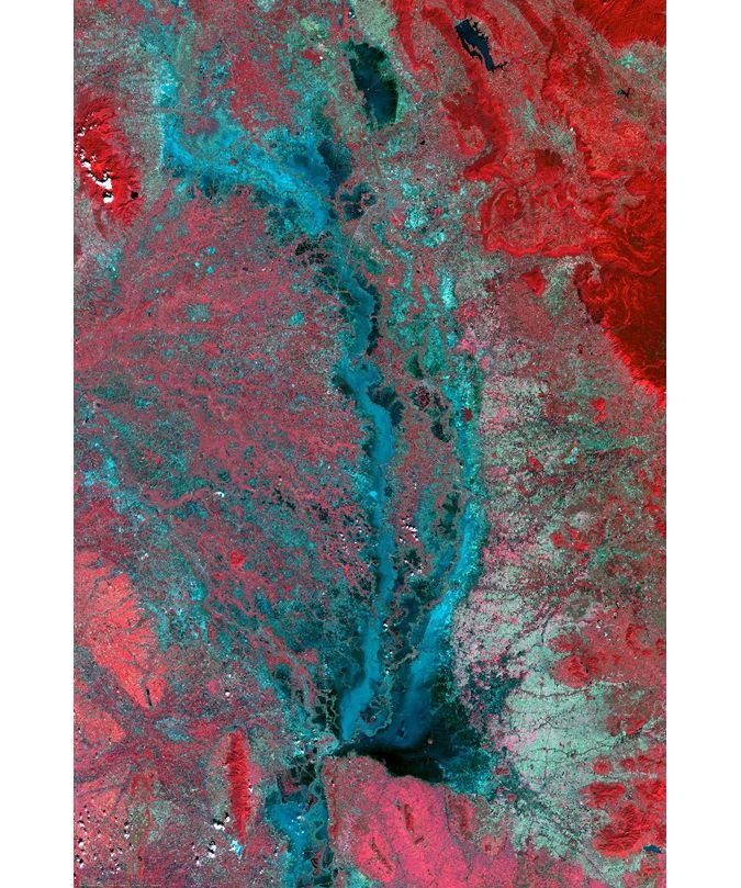
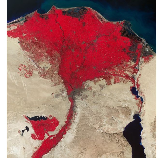
Publicly available remotely sensed data are collected, for example, by sensors on board Landsat or Sentinel satellites at a spatial resolution of up to 10m and used to understand socio-economic dynamic in every location on Earth, while nighttime light data collected since the 1990s are leveraged to map poverty or estimate the distribution of populations and economic activity.
The Geo4Dev Initiative
With the increased availability of so much diverse data, new tools and methodologies are being developed and made available and accessible to sectors who traditionally did not rely or knew how to make sense of geospatial data. In parallel, much effort is put towards capacity building and development of basic training on the use of geospatial data, applications and tools to promote a more sustainable environment and society.
And this is exactly the objective of The Geospatial Analysis for Development (Geo4Dev) Initiative. Geo4Dev aims to drive the development of new data, tools and methods for conducting geospatial analysis across diverse sectors, including agriculture and food security, urbanization, climate change, impact evaluation, humanitarian crisis, and disaster response. It brings together a network of leading researchers, government ministries, NGOs, private enterprises, and funding partners to inspire and support new research collaborations, share knowledge, and build capacity to utilize geospatial data, tools, and approaches.
On 10-11 December 2020, the Geo4Dev Initiative hosted an online symposium and workshop to showcase cutting-edge tools, datasets, and applications of geospatial data for global development research, followed by a hands-on workshop for those interested in building or honing their skills in this space. The convening also formally launched the new Geo4Dev website – an open-access hub for geospatial data and research. Several Nighttime Lights datasets, developed for public use by agencies including the National Oceanic and Atmospheric Administration (NOAA), the World Bank and the Colorado School of Mines, were also featured during the second day.
The event showcased a wide range of applications of nighttime light data in development research and operations, including the use of big geodata for impact evaluation, prediction and inference of wealth, income and population with satellite data, measurement of the economic impacts of COVID-19 with nighttime lights and more. Dr Chris Elvidge, who delivered the keynote, provided an overview of the DMSP and VIIRS low light imaging datasets and the new annual VIIRS nighttime series. The second day of the symposium provided a series of hands-on training on how to interpret, process, visualize and analyze this vast amount of raw nighttime light imagery and convert it into meaningful information that can help answer policy questions.
Other speakers illuminated a range of applications for nighttime light data, in particular in the transport sector. Théo Bougna and Alice Duhaut of the World Bank’s DIME Analytics Group presented on uses of nighttime light data to measure the impacts of road and transport corridor projects that include changes in economic activity, income, and urbanization. Their research demonstrated the possibility of using satellite imagery to develop fast approaches to delivering policy relevant information about impacts in data scarce and conflict-affected regions.
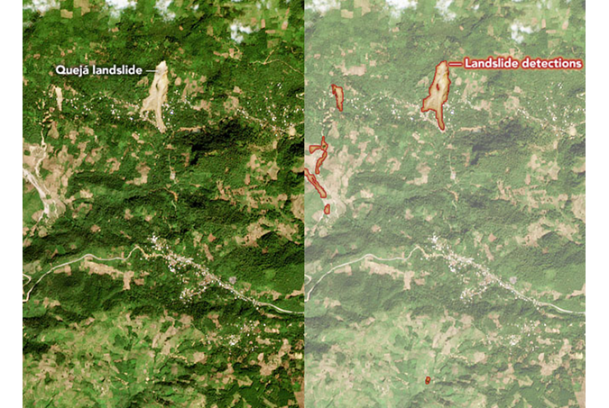
A slate of speakers also presented novel methods for using satellite imagery and predictive modeling to transform approaches to poverty measurement and alleviation. Gordon Hanson, Marshall Burke, and Joshua Blumenstock all discussed machine learning approaches using satellite imagery to predict socio-economic and demographic characteristics and/or changes at disaggregated levels.
And in a world dominated by COVID, Mark Roberts of the World Bank’s Urban, Resilience and Land Global Practice, showed how nighttime lights in Morocco could be used to trace real-time GDP at the national and sub-national level, and in turn track economic impacts of the pandemic.
Also featured in the Geo4Dev symposium and workshop was a forthcoming World Bank data set called “Light Every Night” via the AWS Open Data program, which is the culmination of a several year collaboration between the World Bank, NOAA, and the University of Michigan. The data set comprises the DMSP and VIIRS data catalog published as Analysis Ready Data (ARD) under a World Bank open data license. For the first time in one place, almost 30 years of daily measurements of nighttime lights will serve as the foundation for insights into a wide array of policy and research applications. Open source tutorials and tools from the World Bank and the ARD community will help the development community transform the data into valuable insights for sustainable development.
Video recordings of both the symposium and workshop can be found here. The tutorials presented during the second day of the event can be found here.
Summary
Geo4Dev aims to provide a hub that inspires and supports new research collaborations, share knowledge, and build capacity to utilize geospatial data, tools, and approaches to measure all aspects of developing countries. There is an increasing interest in the use of geospatial data to measure development aspects. Remote Sensing Journal has recently launched two Spatial Issues related to the use of geospatial data for development which are now open for submission of papers and communications: Remote Sensing Measurements for Monitoring Achievement of the Sustainable Development Goals (SDGs) and Remote Sensing of Night-Time Light. Development Engineering journal accepts papers for submission to a Spatial Issue in the field of Geospatial Analysis for Development.
About Geo4Dev
The Geospatial Analysis for Development (Geo4Dev) Initiative is hosted by the Center for Effective Global Action (CEGA), New Light Technologies (NLT), and the International Initiative for Impact Evaluation (3ie), and promotes the use of geospatial data for the targeting, design, and evaluation of social and economic development programs, especially in low- and middle-income countries. The initiative drives the development and adoption of new data, tools and methods for conducting geospatial analysis, while supporting their application across diverse sectors including agriculture and food security, urbanization, climate change, impact evaluation, humanitarian crisis, and disaster response.