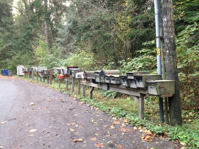
For most of us, it is hard to imagine how we would function without an address, yet many people still do not have this basic identity.
To those of us who live in a place which has a street address, it seems obvious. We use our address every day to receive services, including mail, solid waste removal, electric, water and other utility services, and we expect that all other governmental functions will be delivered to us reliably, in a way that is equitable, orderly and cost-effective. Many of us use our smartphones to navigate to a destination and we expect that a street name and an address number will bring us to the exact place we need. For most of us, it is hard to imagine how we would function without an address.
Yet for many who live in places without this civic fabric, where people still do not have this basic identity, it is difficult for local governments – or even for the provincial, the state or the federal government – to create and manage a system that actually works and provides equitable, efficient and effective services to people. Addressing is so ‘simple’ and yet so difficult. Cost is a factor. It is not easy to identify every dwelling, every shop or business, every public or semi-public facility, and to assign each a unique identifier that will be associated with a person or a business and be used as their official geographical identity.
GIS and relational database tools
In recent years we have seen numerous efforts to create software solutions that can solve the difficulties of designing and implementing working, cost-efficient and reliable address systems. Many of these systems rely on geographical grids or use coordinate locations that must be interpreted by smart devices to provide a location that can be identified on the ground by a person. Many are not so useful when the internet or GPS is not functioning, or for those who do not have such devices.
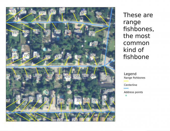
That said, there are tools now available that can make the development and management of an addressing system more efficient. GIS and relational database tools make it possible to create systems that are tailored to the local street network, while aerial and satellite imagery provides guidance about the locations of buildings and other features of the landscape. Mobile data collectors can provide field personnel with photos, geographic coordinates and other basic information for each structure or location. Combined with a robust, standardized data environment, such data can assist in creating and managing the addressing fabric. Maintenance and management tools, designed to work in the graphic environment of GIS and the tabular environment of the linked data repository, create the resources to provide address data to a wide variety of address users ranging from emergency services (police, fire, medical) to permitting, voter management, school districting, tax appraisal and collection, code enforcement, utility services and fee collection, mail and package delivery, and many others.
But cost is not the only issue. There are economic and political hurdles to the creation of an addressing framework. Streets must be named, a well-crafted public education campaign must be conducted, and officials must be convinced of the value of the work. Academic research in the field has identified significant benefits to citizens of a community from the institution of addressing. People who have an address can obtain a bank account, apply for jobs, receive mail and potentially obtain a mortgage on their property that allows them to start a business or continue their education. For those who do not have an address it will be much harder to maintain their very basic civic life.
A more standardized street data repository
So, what’s needed to get started? First, there is a need for a plan that comprises an evaluation of what data is available, what needs to be collected and what are the necessary steps to create an addressing system. Second, a systematic design of an addressing system for the area of interest (this could be a city, a county or an entire island) must be developed, followed by data aggregation and collection, including the development of a robust central data repository, using standards and quality control techniques to ensure that the data is accurate. Third, a public education campaign will be needed to promote the benefits of adoption of the addressing system; this could be through social media, websites, radio and TV broadcasts, press conferences, town hall meetings, etc. Finally, there is a need to review all workflows for address management and maintenance to support the addressing system into the future.
At all levels of government, addresses are the foundation for more efficient and effective governance. They provide a civic identity to citizens, and a reliable means to locate and serve all residents within a jurisdiction. Addresses seem to be so simple and many of us take them for granted, yet they are so difficult. GIS and robust relational databases allow the design and maintenance of a more standardized street data repository from which not only governments benefit, but also the citizens who have a place within the system of addresses.